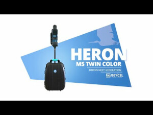


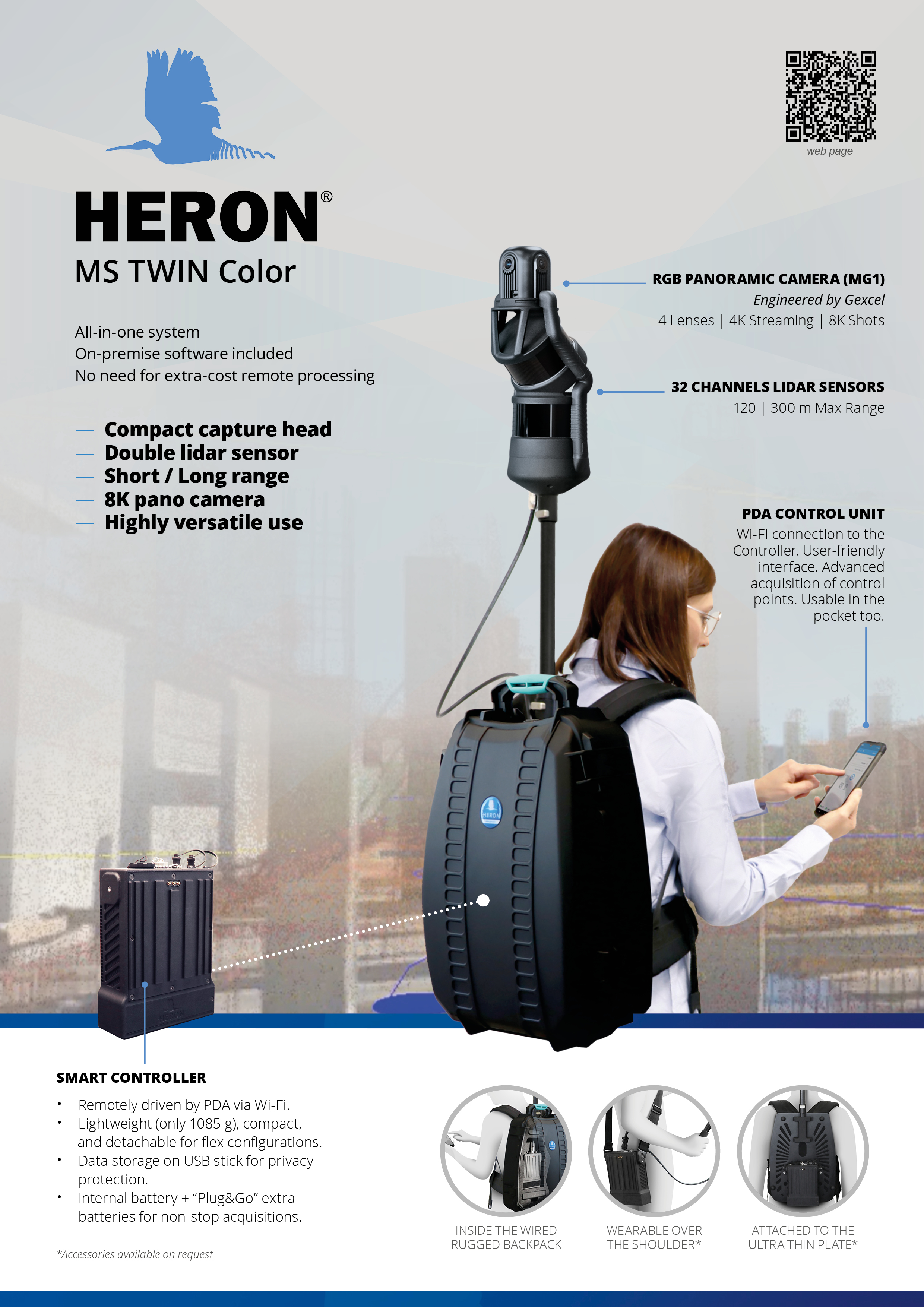
HERON MS TWIN Color
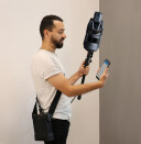
A flex system in your hands!
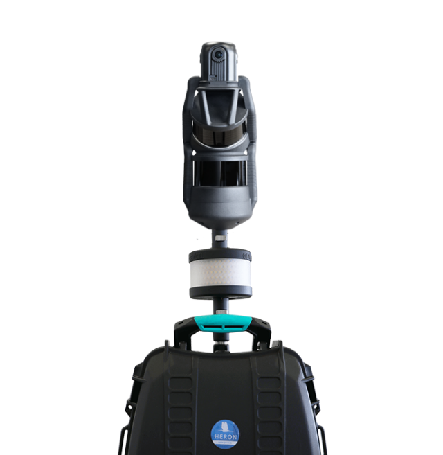
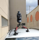
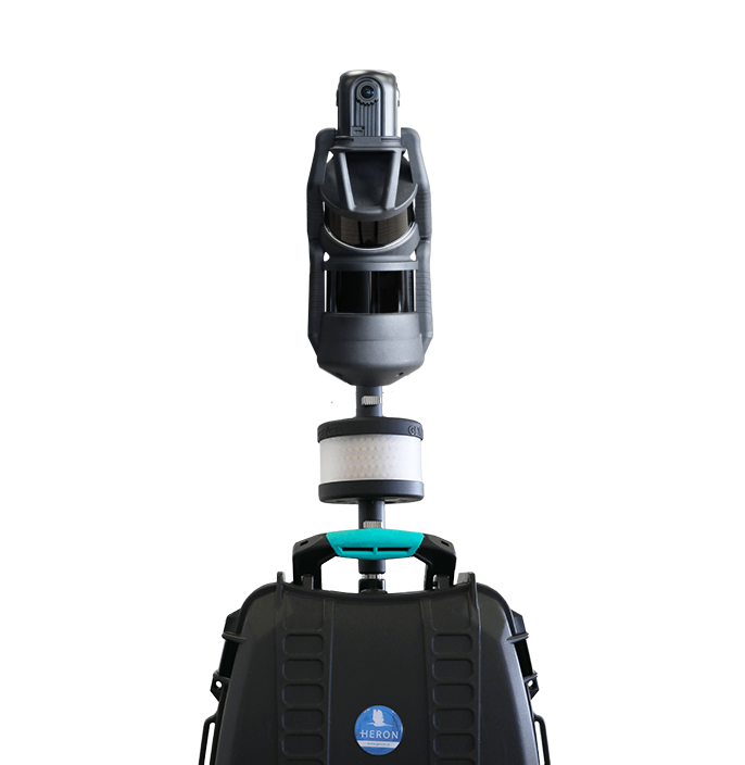
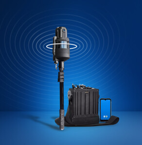
HERON MS TWIN Color is a SLAM-based system with the only capture head on the market featuring double lidar (32 chs - Max range: 120/300 m) and an 8K pano camera in a super compact design! An all-in-one system with on-premise software included for no-limits data processing.

GEXCEL
Brescia, IT
Description
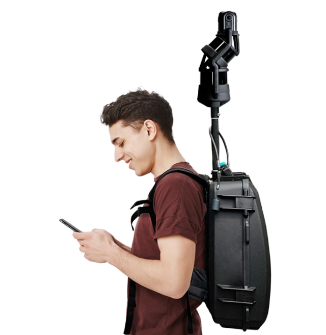
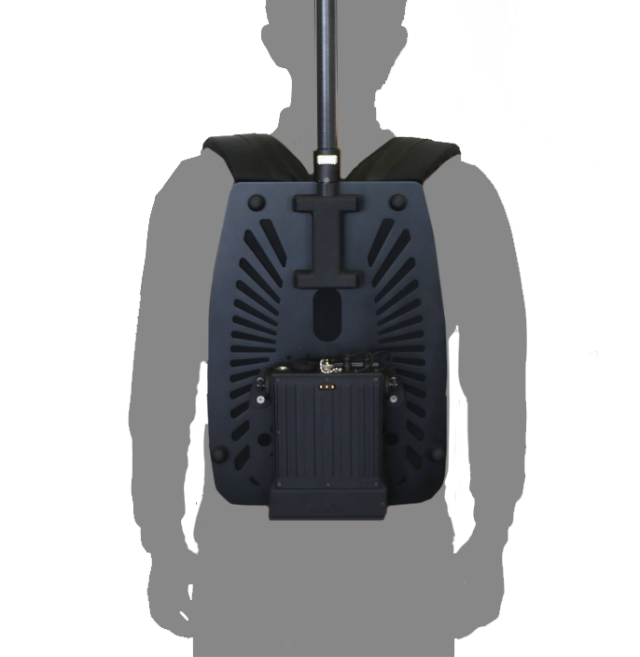
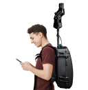
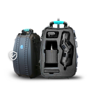
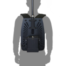
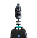
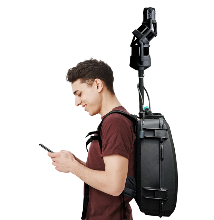
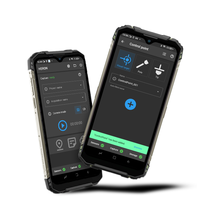
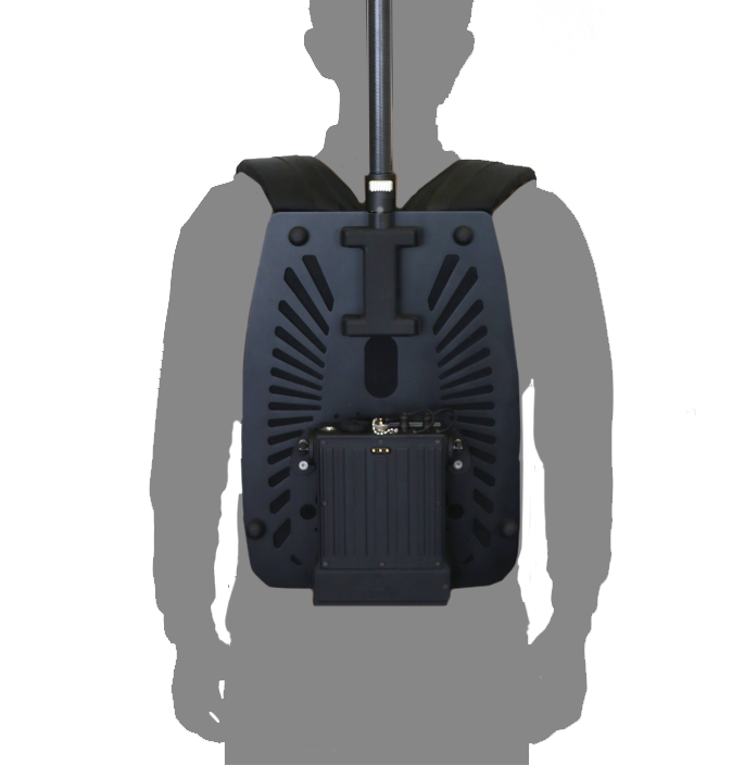
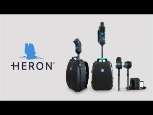
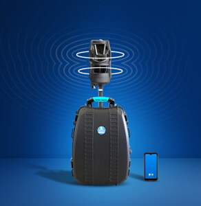
HERON MS TWIN Color is a portable 3D mapping system featuring a double laser sensor (32 chs LiDAR - Max range: 120/300 m), for robust 3D geometry acquisitions, along with the MG1 innovative and proprietary 4-lens RGB panoramic camera for 4K videos and 8K images acquisition. The wired rugged backpack hosts a smart and detachable controller driven by a wireless PDA (Personal Digital Assistant). The flex design makes HERON MS TWIN Color a super versatile SLAM system. HERON MS TWIN Color works in complex, multi-level buildings and supports geospatial and digital twin applications. It is provided with complete on-premise software packages to manage the entire data processing workflow.
INCLUDED ON-PREMISE SOFTWARE:
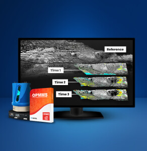
• HERON Desktop: for no limits SLAM processing, with patented algorithms
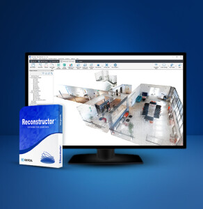
• Reconstructor: for 3D point cloud advanced post-processing
• Reconstructor Viewer: for the visualization and measurement of 3D point clouds and cameras (free software)
• GoBlueprint: for 2D maps/orthophotos visualization, measuring and CAD export (free software)
SYSTEM USABILITY:
• RGB 8K pictures and 4K videos.
• No initialization and calibration procedures.
• Optional use of control points or control scans as constraints.
• Patented algorithm: free mapping path.
• Loop closure not required.
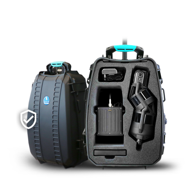
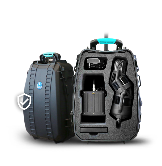
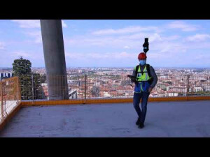
• Wired rugged backpack for acquisition and transport.
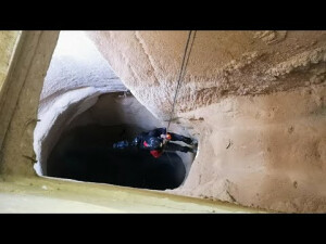
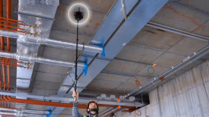
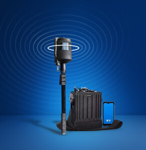
• Compact capture head dockable to:
- telescopic poles to measure cavities and inaccessible areas (also upside down).
- vehicles (cars, bikes, quads, robots, etc.).
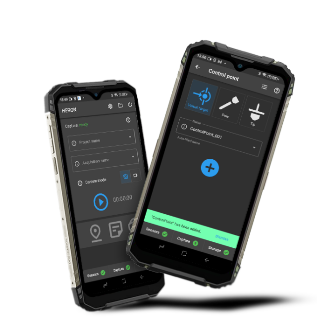
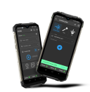
• Rugged and powerful touchscreen control unit.
• Real-time visualization of point clouds generated during the acquisition.
• Designed to work in extreme environments and several accessories to expand applications.
• All-in-one system: on-premise software included and no extra costs for remote data processing services.
DATA PROCESSING:
• Accurate 3D models also in complex environments.
• Automatic color mapping.
• Advanced mode for full professional control of the SLAM algorithm parameters.
• Point cloud editing software.
• Very dense point cloud rendering with multiple colour layers and 3D virtual tours at 8K.
• Direct export of 3D data to ReCap, E57, LAS and the main formats of point clouds.
• Easy data export to third-party software (e.g. 3DM Feature Extraction, EdgeWise, Micromine, Scene, Verity).
• Sharing in E57 on cloud platforms (e.g. 3DM Cloud, Cintoo Cloud, Scene Webshare).
• Advanced point cloud rendering which emphasizes features and details.
• Tracking mode for real-time change detection tasks.
Do you have questions about this product?
- Questions about price, availability, and/or retailers
- Questions about technical specifications and usage
- Questions about suitability for your project or application
Specifications
-
General
-
Applications
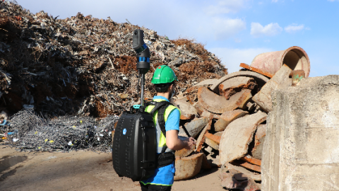
Everywhere (indoors/outdoors), underground and open pit mines, geospatial and digital twin applications, multi-level buildings, tunnels, cultural heritage sites, forensic, forestry, urban areas. Particularly appreciated in harsh and complex areas.
Year of last update
2023
Year of introduction
2020
Height [cm]
124
Width [cm]
24
Length [cm]
37
Operating temperature: min. [°C]
-10
Operating temperature: max. [°C]
45
Weight [kg]
9
-
Camera System
-
Number of cameras
1
FoV per camera [horizontal in deg]
360
Maximum frames/sec. per camera
24
FoV per camera [vertical in deg]
360
Brand and type
Gexcel MG1 | 4-lens
CCD size [.. x .. pixels]
8192 x 4096
Export formats
.jpg
-
Software specifications
-
Software name
HERON Desktop, Reconstructor, Reconstructor Viewer, GoBlueprint
Output data [point cloud, images, mesh, ...]
point clouds, images, meshes, trajectories, orthophotos/x-ray orthophotos (direct export to AutoCAD™), volumes, areas, cross-sections
Output file formats
.e57, .las, .ply, export in ReCap
-
More information
-
Main applications
Volume computation - Excavation progress monitoring - Digital archive - Construction progress monitoring - Floor plans generation for asset management - Logistic/traffic management - Dilapidation monitoring - Scan to BIM - Contours and profiles - 3D virtual experience - Real-time change detection - As-built generation
Training facilities
Yes
Distinguishable features
Mountable on car, bike, boat, quad, trolley, etc. - Usable in every light conditions - Initialization procedure not required - Loop closure not mandatory - SLAM patented algorithms - Control points and control scans as constraints - Automatic self-localization in a reference model, when available - Real-time change detection - Advanced data analysis - Compatibility with AutoCAD, ReCap Pro, EdgeWise, Verity, 3DUsernetVISION and Cintoo Cloud
-
Laser Scanner
-
Number of laser scanners
2
Brand and type
32-Channel 360° Spinning Mid-Range Lidar
Wavelength [nm]
905
Laser safety classification
1
Min. Range [m]
1
Max Range [m]
300
Max. vertical field of view [deg]
360
Max. horizontal field of view [deg]
360
Absolute accuracy [1 sigma in mm]
10
Max. measurement rate [kHz]
20
Range precision [1 sigma in mm]
5
Scans per second
640.000
-
Positioning System
-
SLAM algorithm implemented
Y
GNSS receiver type
Trimble DA2 Powered by the Trimble® Catalyst™ GNSS positioning service
-
Data storage
-
Max. data storage [Internal + External in Gb]
256
Data storage type [120 characters]
USB 3.1 Gen 1
-
Power Supply
-
Battery type [120 characters]
Li-ion 6700 mAh / 80.4 Wh / 12 V
Operating time on single battery [hr]
1
Documents
Brochure
HERON-MS-TWIN-Color_brochure_ENG_web.pdf
Other documents
-
HERON-MS-TWIN-Color_TechSheet (2).pdf2.65 MB


