


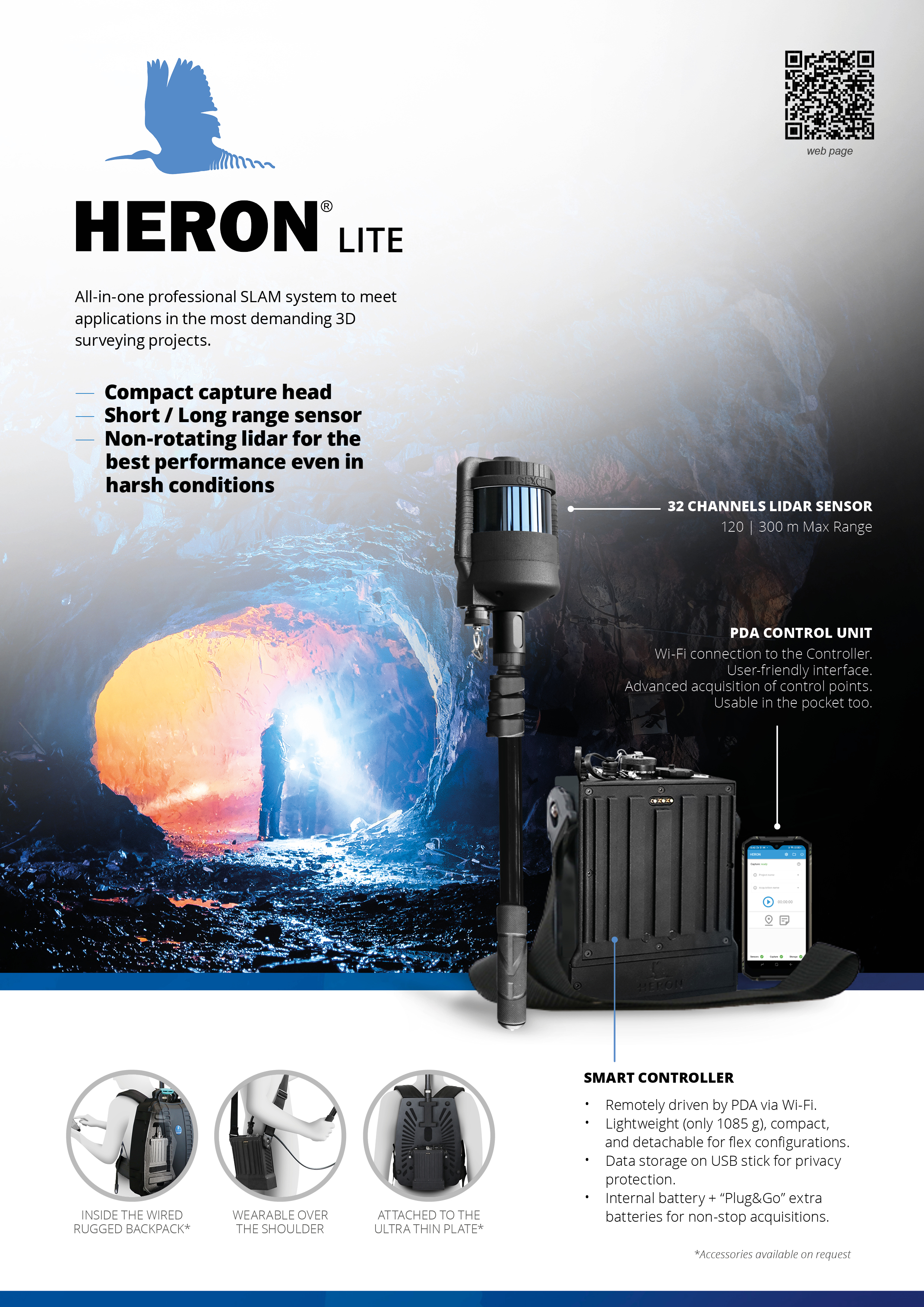
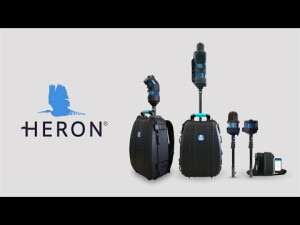
HERON Lite
YOUR LIGHT, HANDHELD, PROFESSIONAL 3D MAPPING SYSTEM!
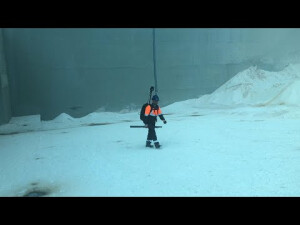
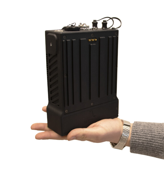
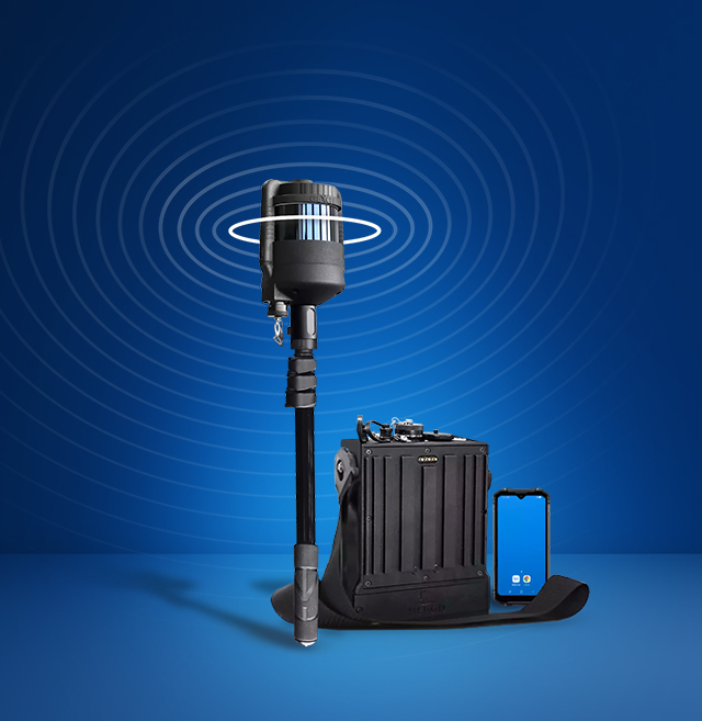
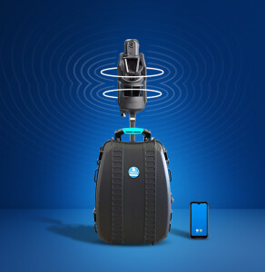
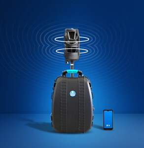
HERON LITE is a handheld 3D mapping system composed of a compact capture head featuring a non-rotating lidar sensor (32 chs - Max range: 120/300 m) for best performance even in harsh conditions. Particularly appreciated in stockpile volumetric computation, underground mines and when RGB information is not required. HERON LITE is provided with a complete software package to manage the entire data processing workflow.

GEXCEL
Brescia, IT
Description
HERON LITE is a handheld 3D mapping system composed of a compact capture head featuring a non-rotating laser sensor (32 chs - Max range: 120/300 m) for best performance even in harsh conditions. Particularly appreciated in stockpile volumetric computation, underground mines and when RGB information is not required. HERON LITE is provided with complete on-premise software packages to manage the entire data processing workflow.
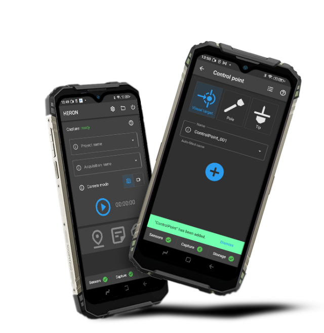
INCLUDED ON-PREMISE SOFTWARE:
• HERON Desktop: for no limits SLAM processing, with patented algorithms
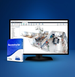
• Reconstructor: for 3D point cloud advanced post-processing
• Reconstructor Viewer: for the visualization and measurement of 3D point clouds (free software)
• GoBlueprint: for 2D maps/orthophotos visualization, measuring and CAD export (free software)
SYSTEM USABILITY:
• No initialization and calibration procedures.
• Optional use of control points or control scans as constraints.
• Patented algorithm: free mapping path.
• Loop closure not required.
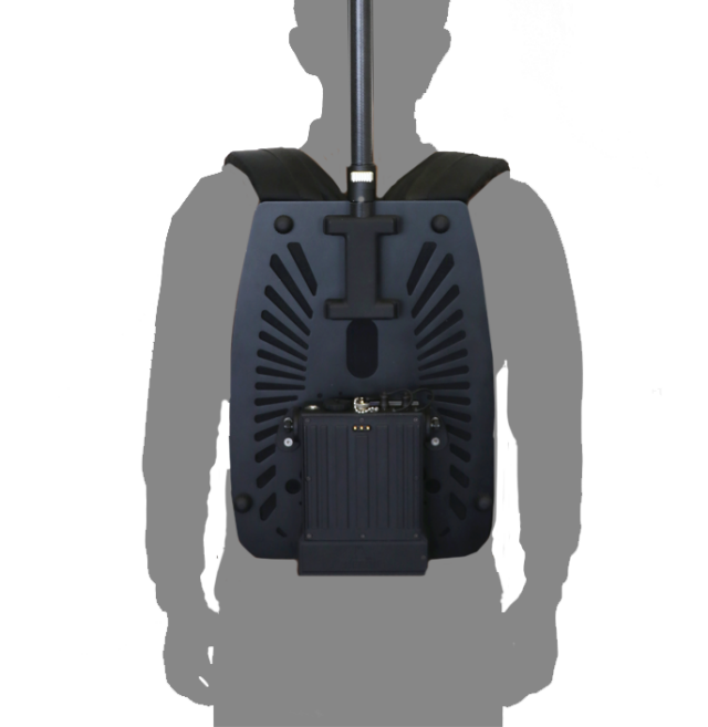
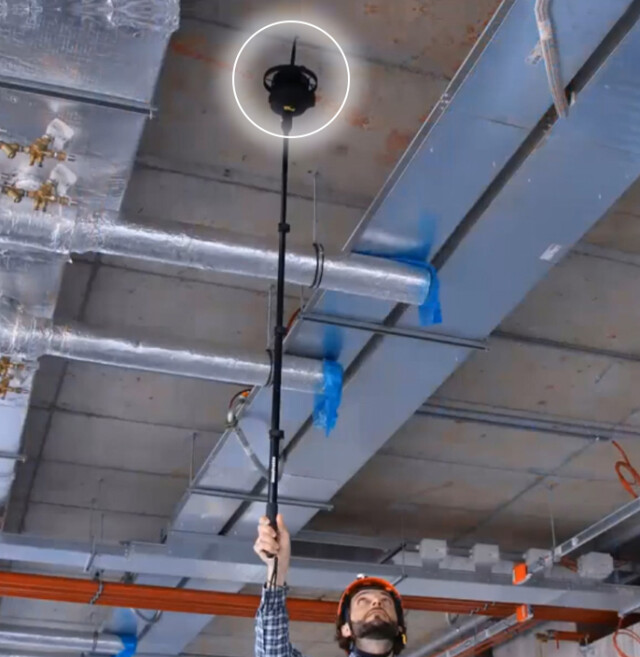
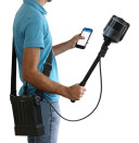
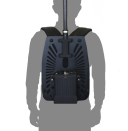
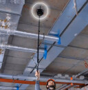
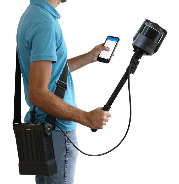
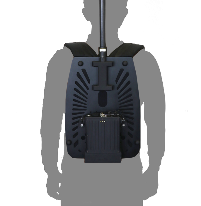
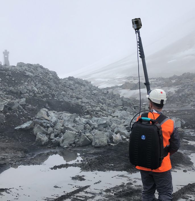
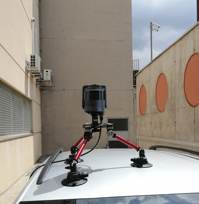
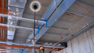
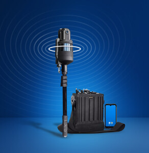
• Compact capture head dockable to:
- ultra slim or wired rugged backpack.
- telescopic poles to measure cavities and inaccessible areas (also upside down).
- vehicles (cars, bikes, quads, robots, etc.).
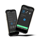
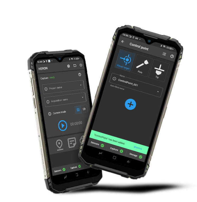
• Rugged and powerful touchscreen control unit.
• Real-time visualization of point clouds generated during the acquisition.
• Designed to work in extreme environments.
• Accessories for a very flexible use.
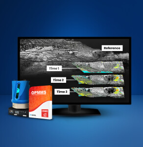
DATA PROCESSING:
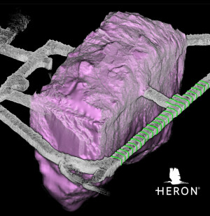
• Accurate 3D models also in complex environments.
• Advanced mode for full professional control of the SLAM algorithm parameters.
• Point cloud editing software.
• Very dense point cloud rendering with multiple colour layers.
• Direct export of 3D data to ReCap, E57, LAS and the main formats of point clouds.
• Easy data export to third-party software (e.g. 3DM Feature Extraction, EdgeWise, Micromine, Scene, Verity).
• Sharing in E57 on cloud platforms (e.g. 3DM Cloud, Cintoo Cloud, Scene Webshare).
• Advanced point cloud rendering which emphasizes features and details.
Do you have questions about this product?
- Questions about price, availability, and/or retailers
- Questions about technical specifications and usage
- Questions about suitability for your project or application
Specifications
-
General
-
Year of introduction
2017
Height [cm]
60
Depth [cm]
12.5
Width [cm]
14.4
Hardware Material
technopolimer, aluminum
Total Weight [kg]
1 kg (handheld) + 1 kg (over the shoulder)
-
Application
-
Main users
Surveyors, Architects, Engineers, Geologists, Quantity Surveyors, Mine Operatives, Security Forces, Forestry Manager
Main applications
Everywhere (indoors/outdoors), especially underground mines, cavities, stockpiles, tunnels, open pit mines, and when RGB information is not requested - Volume computation - Excavation progress monitoring - Digital archive - Scan to BIM - Contours and profiles
-
Scanning Characteristics
-
Light source
Active
wavelength light source [nm]
905
Min. Range [mm]
500
Max. Range [mm]
300.000
Max. vertical field of view [deg]
360
Max. horizontal field of view [deg]
360
3D measurement accuracy [mm]
10
Data aquisition speed (points p/second)
640,000
Color registration
N
Scanning Speed
max 20 Hz
Calibration
not needed
Laser Class
1
Typical Noise
5 mm
-
Operation Characteristics
-
Operating temperature: min. [°C]
-40
Operating temperature: max. [°C]
45
-
Power
-
Battery type
6700 mAh | 80.4 Wh | 12 V
Scan time per battery [h]
2.5
-
More information
-
Distinguishable features
Mountable on car, bike, boat, quad, trolley - Usable in every light conditions - Initialization procedure not required - Loop closure not mandatory - SLAM patented algorithms - Control points and control scans as constraints - Advanced data analysis - Compatibility with AutoCAD, ReCap, EdgeWise, Verity, Cintoo Cloud
-
Functionality
-
Mesh as output
Y
Software name
HERON Desktop, Reconstructor, Reconstructor Viewer, GoBlueprint
Real time visualization during scanning
Y
Other Formats
.e57, .las, .ply, export in ReCap
-
Connectivity and Sensors
-
INS
N
WiFi
Y
Bluetooth
Y
USB Port
Y
Documents
Brochure
HERON-LITE_brochure_ENG_web.pdf
Other documents
-
HERON-LITE_TechSheet (4).pdf508.74 KB


