
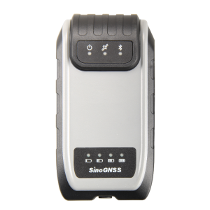
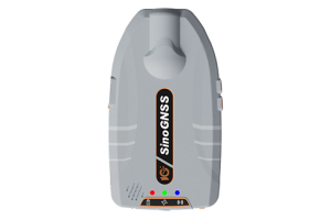
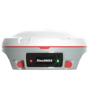
G100 GNSS Receiver
A rugged, compact, wearable GIS receiver that provides professional-level positioning data
According to your working demands, G100 can be mounted on a pole, carried in your pocket, or attached to a belt. The 3400 mAh battery provides up to 9 hour continuous operation, and fast charging design can save much of your time, enhancing efficiency and productivity in the field.

ComNav Technology
Shanghai, CN
Description
Designed for a wide range of GIS applications, such as power patrol, forestry survey, pipeline inspection, water management and other field work requiring a high level of precision, the G100 enables you collect reliable location data for daily GIS workflows.
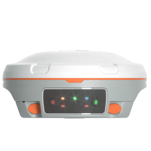
- Designed with internal antenna
- GPS L1, BeiDou B1, GLONASS L1, SBAS
- Sub-meter Positioning Accuracy
- Ideal for GIS Applications
- Compact Rugged Design
- Multiple Data Collection Device Choices via Bluetooth Connection
- Intergrated GNSS Antenna
Do you have questions about this product?
- Questions about price, availability, and/or retailers
- Questions about technical specifications and usage
- Questions about suitability for your project or application
Specifications
-
General
-
Type
Land
Year of initial introduction
2017
Height [m]
0.0504
Depth [m]
0.137
Width [m]
0.072
Total Weight [kg]
< 0.35
-
Performance
-
No. channels
200
Max. simultaneous tracked channels
200
Tracked satellite signals
GPS L1, BeiDou B1, GLONASS L1
SBAS differential signals
WAAS, EGNOS, MSAS, GAGAN
Reacqisition time [s]
1.5
-
Environment
-
Operating temperature: min. [°C]
-20
Operating temperature: max. [°C]
60
Water sand and dust proof
IP65
Shock and vibration proof
1.5m drop
-
Communication: general
-
Communication ports
1 serial port (9 pin Fischer), 1 Fischer connector
Simultaneous links
Y
PPS Out
N
Bluetooth
Y
-
Communication: Protocols
-
NMEA output format
NMEA 0183
Configuration method
PC, survey software
-
Horizontal uncertainty
-
code: DGNSS/RTC (constant part) [m]
0.4
-
Power
-
Operating power: min. [V]
5
Operating power: max. [V]
27
Typical consumption [W]
1.6
Internal power supply
3400 mAh
External power supply
5-27 VDC
Operating time with internal power supply [hr]
9
Certifications
CE
Rechargeable with (auto)battery
Y
-
More information
-
Distinguishable features
Bluetooth, internal antenna

