


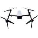
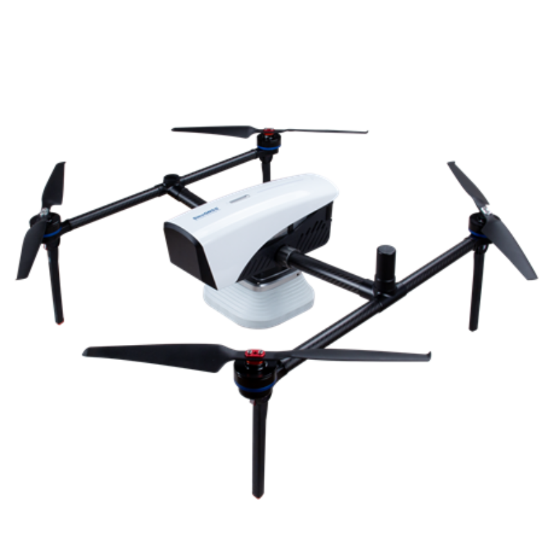
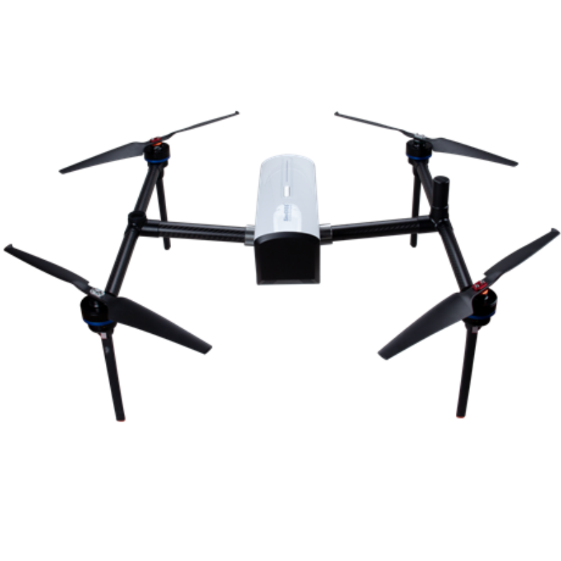
E300 Unmanned Aerial Mapping Solution
Based on K8 platform,the powerful and reliable UAV solution is capable for photo position at centimeter level, providing high-precision results.
The Unmanned Aerial Mapping solution consists of an E300 RTK drone, an optional camera, and flight control software. Featuring high accuracy, strong compatibility, long endurance, high performance, and easy workflow, it can meet the requirements of many different applications, including topographic surveys, urban construction, forestry investigation, emergency rescue, 3D modelling, mining surveying, etc.

ComNav Technology
Shanghai, CN
Description
High Accuracy
E300 RTK drone embedded with high precision K8 GNSS module, supporting GPS L1/L2/L5, BeiDou B1/B2/B3/B1C/B2a, GLONASS L1/L2, Galileo E1/E5-a/E5-b/AltBOC/E6, QZSS L1/L2/L5. With Quantum III Technology, the K8 GNSS module provides reliable and stable RTK positioning results. The professional Post-Processing Kinematic software Compass Solution supports the full-constellation calculation, providing accurate positioning results. RTK/PPK is the dual backup, one as a failsafe for another, to ensure the acquisition of data. The in-built antenna offsets the correction, thus, further increasing the precision of the photo position. What's more, EVENT Synchronization Technology can reduce camera trigger errors, and ensure the high performance of the solution.
Strong Compatibility
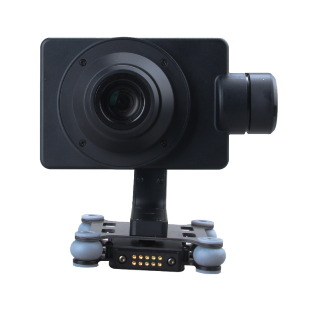
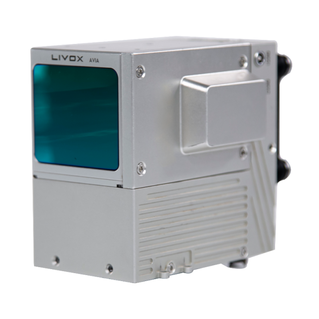
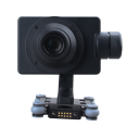
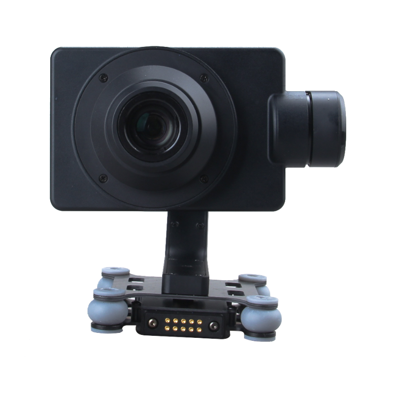
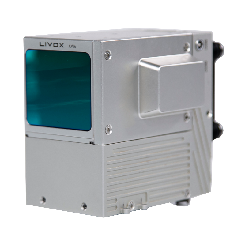
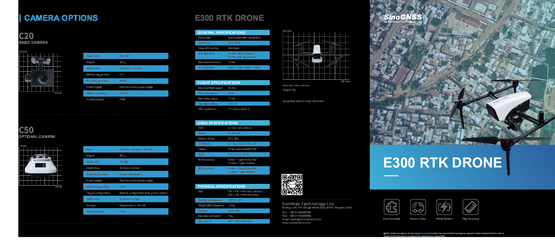
Featuring a carrying capacity of 3 kg, the E300’s payload bay is compatible with a wide range of cameras, including C20, C50, LiAir VH2, and others. Payloads can be quickly and easily swapped in the field for maximum versatility, which can meet the requirements of different applications.
Apart from supporting standard Ntrip protocol, E300 is compatible with all the base stations and CORS systems of different brands.
Long Endurance
The E300 is characterized by an ultra-efficient aerodynamic design and can reach 60 minutes of flight without payload and 50 minutes with basic payload to cover areas with a maximum 10 km radius per flight. In one flight, E300 can map around 0.62km² in1.5cm/px GSD with one battery.
High Performance
Based on intelligent recognition algorithms, E300 is able to capture high-resolution images consistently even in complex environments.
Moreover, E300 adopts a multi-path redundancy design with key modules for safety.
With RTK.PPK, The solution can provide centimetre-level positioning results without ground control points (GCPs), which also saves time during the operation.
Easy workflow
On one side, the E300 RTK drone features a simplified design for easy rapid assembly within 1 minute while still providing excellent stability and vibration resistance.
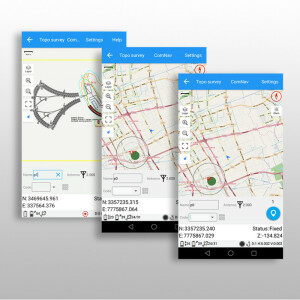
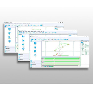
Another side, the solution is supported by ComNav self-developed flight control software with a clear interface, easy workflow, and powerful fight control capability, which can completely satisfy the requirements of high-efficiency, high-quality, and high-precision aerial survey operations.
Do you have questions about this product?
- Questions about price, availability, and/or retailers
- Questions about technical specifications and usage
- Questions about suitability for your project or application
Specifications
-
Environment
-
Min. operation temperature [°C]
-30
Max. operation temperature [°C]
50
Max. wind speed [m/sec]
17.1
-
Battery and Power
-
capacity
16000 mAh
energy
16000 mAh
Battery type
Lithium battery
-
Imaging/scanning devices
-
Onboard imaging/scanning devices
Type of Camera
C20, C50, LiAir VH2 and others
Build-in Stablilsation
Y
Exchangeable
Y
-
Platform
-
Platform
Copter
Brand
ComNav Technology
Max. payload [kg]
3
Max. stay in the air [min]
60
Max. speed [km/h]
72
Max. height above sea level [m]
1000
Weight (with cooling fan)
1.8 kg without payload
Material
carbon fibre
Maximum climbing speed
6 m/s
Maximum descending speed
15 m/s
-
Accessories
-
Included batteries and charger
Yes
Transportation accessories
case
More included products and spare parts
3 Propellers
-
Operation Characteristics and Safety
-
Training provided
Y
Launching method
VLOT
Automatic launch and landing
Y
Autonomous emergency landing
Y
-
Dimensions
-
Height [cm]
24
Width [cm]
52
Length [cm]
52
Weight [kg]
1.8
Number of rotors
4
Transport on human back
Y
Weight of battery [kg]
1.5
-
Base Station
-
Type of Ground computer
Windows
Sensor control
Y
-
Navigation Sensors
-
Type of GNSS receiver and captured signals
GPS L1/L2/L5, BeiDou B1/B2/B3/B1C/B2a, GLONASS L1/L2, Galileo E1/E5a/E5b/AltBOC, QZSS L1/L2/L5
Correction services [PPK, RTK]
PPK, RTK
Other sensors and additional information
accelerometer, gyroscope
Velocity Measurement Accuracy
3cm
Orientation Accuracy
0.2°
Positioning Accuracy
2cm
-
General
-
Year of last update
2022
Typical applications
Topograhic Survey; Urban Construction; Forestry Investigation; Emergency Rescue; 3D Modeling; Mining Surveying
Product Name
Unmanned Aerial Mapping solution / Drone / UAV
Models in series
E300
-
Included software and automatically generated
-
Type of software included
Flight planning
Automatically Generated Products
3D Landscape Models
Flight planning software
CNPilot
Documents
Brochure
sinognss-e300-rtk-drone.pdf
1.86 MB
Other documents
-
SinoGNSS LiAir VH2 High Performance Lidar855.15 KB
-
SinoGNSS E300 Packing List4.5 MB
Videos

