


Advancements In Sensor Fusion Technology
In environments with high multipath interferences or instances of GNSS signal jamming and spoofing, traditional PNT systems encounter challenges in maintaining accurate and uninterrupted operation. It is increasingly evident that modern vehicle navigation systems must integrate supplementary sources that are infrastructure-independent and resilient. These systems should embrace alternative Position, Navigation, and Timing (PNT) solutions to ensure the continuous provision of precise navigational data and time synchronization outputs, particularly during prolonged GPS/GNSS outages. The Inertial Labs aiding data ecosystem provides a range of alternative position, navigation, and timing (alt-PNT) sources and capabilities for ensuring the delivery of highly robust and precise estimation of vehicle navigation data streams in GNSS-challenged or GNSS-denied environments for air, land, and sea-based platforms.
RF Geolocation:
The Inertial Labs’ INS has integrated capabilities to accept RF (Radio Frequency) ranging aiding data inputs from advanced, infrastructure-less, MESH network-based tactical Software Defined Radios (SDR) that are developed by DTC (Domo Tactical Communications).
From an application standpoint, the DTC’s BluSDR-30-B radios serve as base (“beacon”) points within a defined range of up to 30 kilometers from the vehicle’s BluSDR-30 radio, which is mounted on aerial or land systems with the INS. Once powered, the radios automatically establish a secure MESH network configured to send Time of Flight (ToF) packets throughout the MESH (between each radio), supporting up to 144 nodes within the network. Hence, the SDR on board the vehicle shall obtain real-time ToF data from the distant base radios deployed on the ground along with their known, instantaneous 3D position coordinates.
Each ToF and base radio location packet will be provided to the rover radio within the mesh network, which will be processed by the INS’s data-logging processor and fused with a robust, tightly coupled Kalman filter for triangulating the vehicle’s position from the RF ranges that are received by two or more deployed ground radios. Thus, the INS’s unique integration capability with DTC’s SDRs gives it a significant edge over other industry solutions that do not have the fusion filter capabilities to blend aiding data inputs from various alt-PNT (Position Navigation & Timing) sources simultaneously. Note that the ground base SDRs should always have line-of-sight with the vehicle’s SDR to be active within the mesh network formed amongst the radios. The radios can operate in multiple RF frequency UHF spectrum bands with the ability to output signals at 1W (+30dBm) and allow for configurable bandwidths from 1.25-20MHz. Based on the environment in which the radios are deployed with the INS (e.g., Multipath interference patterns), the bandwidth and output power can be configurable to achieve optimal RF ranging performance.
AltNav Receiver:
Inertial Labs supports integrations with Alt-Nav receivers by digitally processing STL (Satellite Time and Location) based signals from the Iridium constellation of satellites in LEO (Low Earth Orbit) for obtaining global position estimates without the need for mGNSS signal availability. STL signals’ travel time is shorter than regular GNSS signals; they operate in a mesh networking architecture and have lower emission power, making them a resilient choice for an alt-Nav PNT source. Furthermore, a degree of added complexity exists when special jamming equipment is used to jam STL-based signals due to their dynamic orbital characteristics as the frequency changes with satellite positions within LEO. While the positioning accuracy from STL signals is lower than that of traditional GNSS signals, the hybrid approach of utilizing both receivers is an added benefit that complements GPS/GNSS outages. Alt-Nav receivers providing STL information from LEO constellations (e.g., Iridium) are 1000 times more potent than traditional GPS signals. Hence, STL signals can be used indoors, underground, or in severely obstructed environments, which makes them an ideal candidate for critical infrastructure environments within commercial enterprises or government entities.
Camera Module:
Machine vision has become an integral part of many sensor fusion platforms that aim to push boundaries to deliver highly accurate and precise PNT data streams for end users that require high resilience to GPS/GNSS systems. It has become a critical alt-PNT source that can operate when no onboard vehicle communication-based systems are available. Inertial Labs’s robust sensor module (camera + AHRS/IMU) is integrated with the INS processing module to compute real-time ground speed updates from observing a stream of concurrent terrain imagery captured by day/IR cameras on an aerial platform. The ground speed computations are fused with other complementary sensor systems to deliver highly accurate PNT information in GNSS-denied outages. Inertial labs also use highly innovative techniques to calibrate the cameras and IMU sub-systems precisely and fully to define extrinsic and intrinsic properties.
Air Data Computer (ADC) / Dual Axis Air Speed Sensor:
As the advent of GNSS jamming and spoofing has become more prevalent, the need for an alternative position, navigation, and timing (APNT) in GNSS-denied environments has grown drastically. A common aiding data source for GNSS-denied UAV navigation is an air data computer (ADC) with a differential and static pressure sensor. True airspeed and barometric pressure estimates during flight allow the navigation filter within an Inertial Labs INS to correct the vehicle’s velocity and MSL (Mean Sea Level) altitude readings and bound the GNSS-denied positional drift. An ADC is only applicable for fixed-wing UAV applications since multi-rotor UAV platforms can simultaneously maneuver in longitudinal and lateral motions. Using simulated and real-time data collection, Inertial Labs’ team tested the feasibility of GNSS-denied navigation using a dual-axis air speed sensor compared to a free inertial/dead reckoning solution. The dual-axis air speed sensor from FT Technologies adopts a digital anemometer-based solution by being able to estimate airspeed incoming from any direction using an innovative acoustic resonance-based technology. The airspeed magnitude and direction allow the INS to estimate horizontal air speed in the longitudinal and lateral axis. In all instances, the GNSS-denied position drift of the device receiving aiding data from the dual-axis airspeed sensor is significantly less than that of a dead reckoning alternative.
Wheel Encoder:
A wheel encoder keeps track of a wheel’s rotational revolutions on a ground vehicle. Wheel rotations can be used to track the distance the ground vehicle covers in GNSS-denied environments. Accumulated distance in millimeters should be sent to the INS as aiding data. The odometer-aiding data type is used to correct the distance in the GNSS-denied environments, significantly reducing the position estimation error of the INS. If the GNSS solution is available, the odometer-aiding data is used to tune the scale factor coefficients and correct misalignment angles between the vehicles and INS axes.
Ground Speed Radar:
The ground speed radar for land-based dynamic vehicles is based on Radar Doppler technology. It consists of a radar frontend with planar antennas continuously emitting electromagnetic waves at 24 GHz. Due to the movement of the sensor onboard the vehicle, the frequency of the back-scattered waves is Doppler shifted. Doppler signal is deployed for accurate ground speed measurement. This aiding data supplied to the INS filter is used to correct INS position estimates in GNSS-denied environments. This source of aiding data is beneficial when the vehicle’s wheels are rolling and slipping since the slippage distance isn’t accounted for by the wheel encoders. In contrast, ground speed radar sensors can observe and account for such situations.
Inertial Labs offers several products that exemplify advancements in sensor fusion technology. Key products include:
Inertial Measurement Units (IMUs): These devices combine accelerometers, gyroscopes, and magnetometers to measure orientation, velocity, and gravitational forces precisely. Notable models include the IMU-P and IMU-F series.
Attitude and Heading Reference Systems (AHRS): These systems, such as the AHRS-10, integrate data from multiple sensors to provide accurate orientation and heading information, which is crucial for aviation, marine, and autonomous vehicle applications.
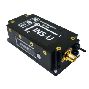
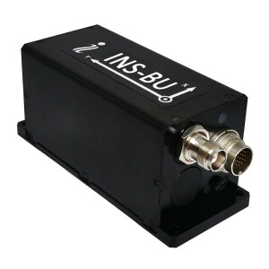
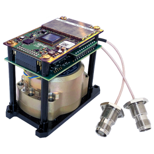
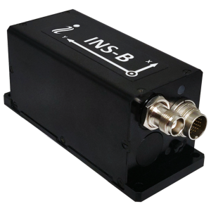
Inertial Navigation Systems (INS): Products like the INS-D and INS-P series combine IMUs with GPS/GNSS receivers, offering highly accurate positioning and navigation solutions for drones, robotics, and land vehicles.
Marine and Land Solutions: Inertial Labs’ offerings for marine and land applications, such as the MRU-B and the GPS-Aided INS, enhance navigation and control for ships, underwater vehicles, and land-based systems.
These products demonstrate Inertial Labs’ commitment to leveraging sensor fusion technology to deliver precise, reliable, and versatile solutions across various industries.
As sensor fusion technology continues to evolve, driven by companies like Inertial Labs, we can expect even greater precision, efficiency, and versatility in a wide range of technological applications. This technology will ultimately transform industries and improve the accuracy and functionality of various systems.
Do you have questions about this article?
Get in touch with Inertial Labs, Inc., and they would be happy to answer any questions you have about pricing, suitability, availability, specs, etc.


