


LiAir V70
Map the World in 3D
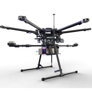
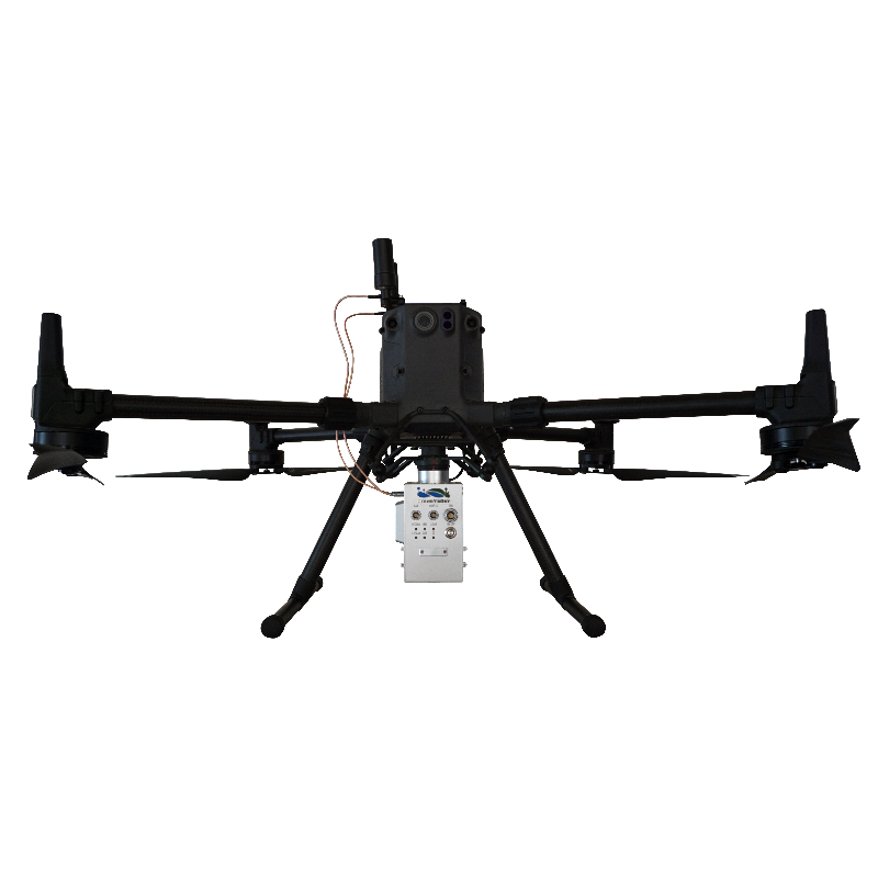
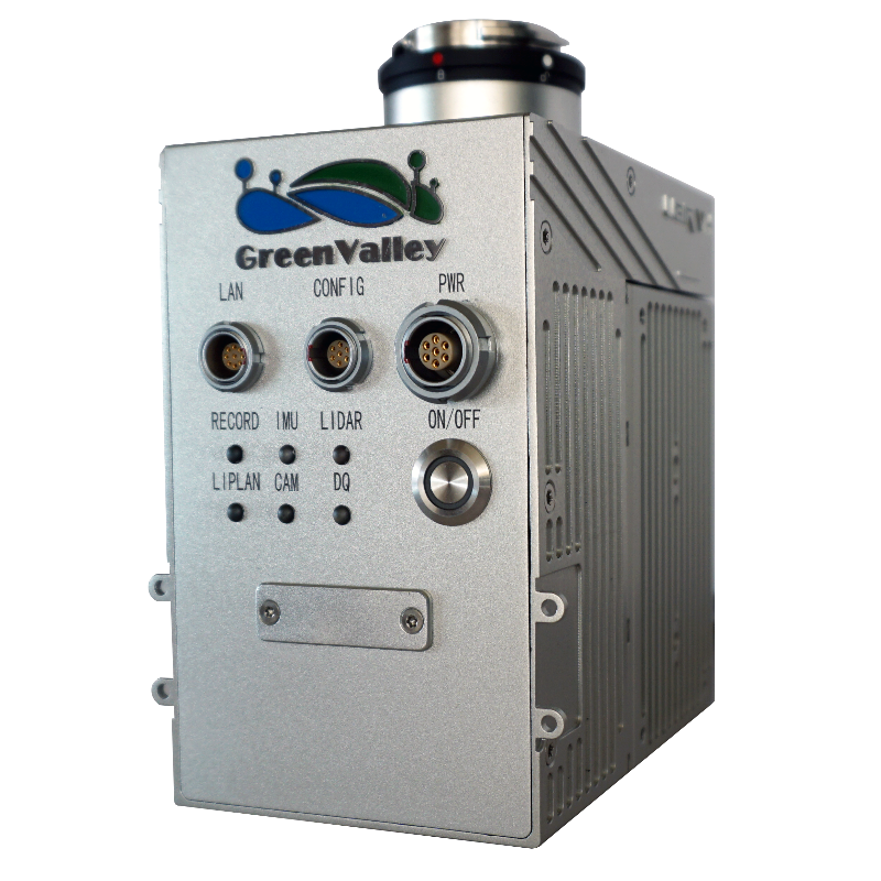
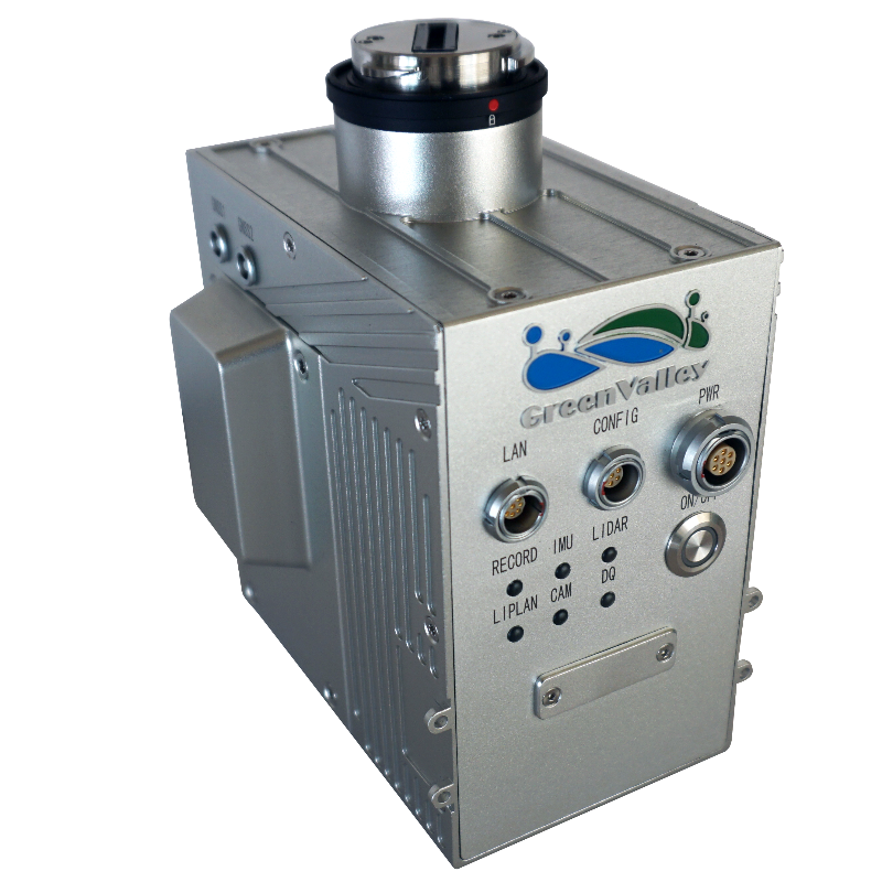
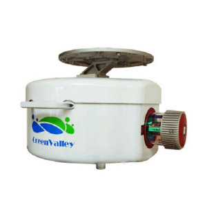
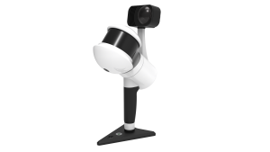
The LiAir V70 is a lightweight UAV- or sUAS-mounted LiDAR survey instrument designed and produced by GreenValley International (GVI). With its high flexibility and powered by a Livox AVIA, LiAir V70 can provide a high-accuracy point cloud for the users in various industries, e.g. surveying, forestry, powerline inspection.

GreenValley International
Berkeley, US
Description
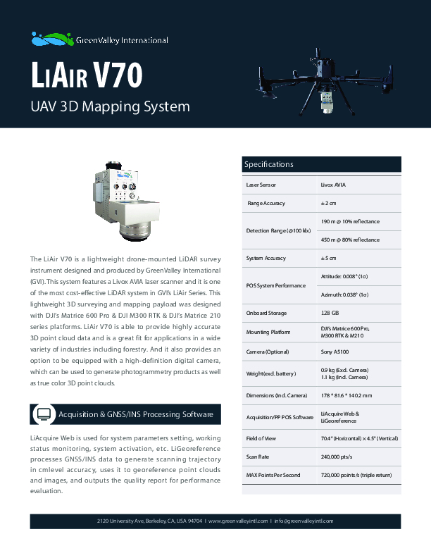
The LiAir V70 is a lightweight UAV- or sUAS-mounted LiDAR survey instrument designed and produced by GreenValley International (GVI).
This system features a Livox AVIA laser scanner and it is one of the most cost-effective LiDAR systems in GVI’s LiAir Series.
This lightweight 3D surveying and mapping payload was designed with DJI’s Matrice 600 Pro & DJI M300 RTK & DJI’s Matrice 210 series platforms.
LiAir V70 is able to provide highly accurate 3D point cloud data and is a great fit for applications in a wide variety of industries including forestry.
And it also provides an option to be equipped with a high-definition digital camera, which can be used to generate photogrammetry products as well as true colour 3D point clouds.
Do you have questions about this product?
- Questions about price, availability, and/or retailers
- Questions about technical specifications and usage
- Questions about suitability for your project or application
Specifications
-
Measurement Characteristics
-
Range accuracy [mm]
20
Max. field of view [degrees]
70.4
-
Physical Properties
-
Height [cm]
14
Length [cm]
11.6
Width [cm]
8.4
Weight [kg]
1.1
Water and dust proof
N/A
-
Laser Pulse Characteristics
-
Laser Class
1
Wavelength [nm]
905
-
Power Supply
-
Power requirements
External
-
Operation Characteristics
-
Mounting
DJI’s Matrice 600 Pro, M300 RTK & M210
Camera included
-
Data and Software
-
Included software
LiAcquire web & LiGeoreference
-
General
-
Year of last update
2020
Year of introduction
2020
Documents
Brochure
liair-v70-20210804-a.pdf
185.72 KB

