
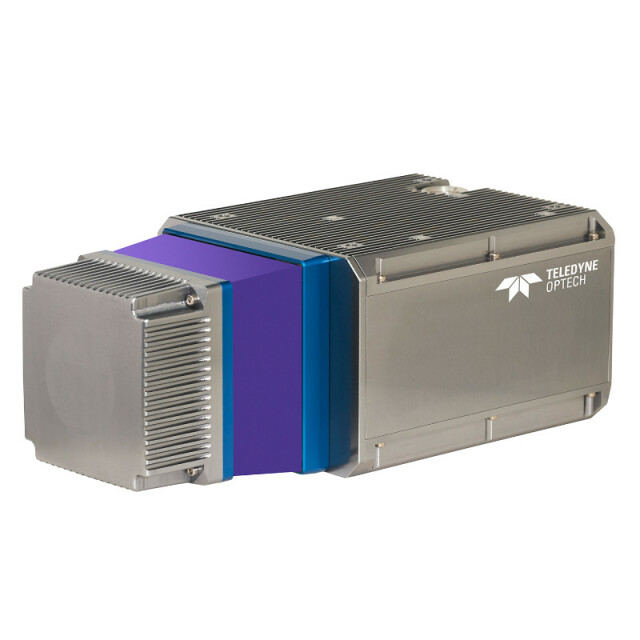
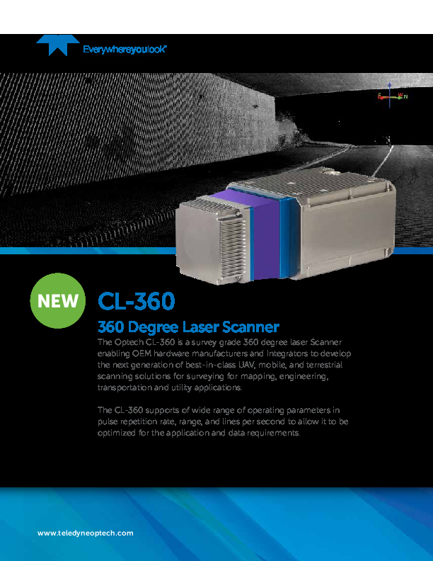
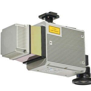
CL-360
Survey-grade OEM lidar sensor with a versatile 360-degree field of view employing a proven design.
The Optech CL-360 is a survey-grade 360-degree laser Scanner enabling OEM hardware manufacturers and Integrators to develop the next generation of best-in-class UAV, mobile, and terrestrial scanning solutions for surveying for mapping, engineering, transportation and utility applications.
Teledyne Geospatial
Vaughan, CA
Description
- Industry leading maximum scan speed of 250 lines / second for even x-y point distribution.
- Narrowest beam divergence of any commercially available OEM lidar scanner for superior vegetation penetration and small feature capture.
- Long range performance for maximum productivity in airborne applications.
- Best-in-class data precision for tight-tolerance applications.
Do you have questions about this product?
- Questions about price, availability, and/or retailers
- Questions about technical specifications and usage
- Questions about suitability for your project or application
Specifications
-
Measurement Characteristics
-
Range accuracy [mm]
10
multiple pulses in air
N
Min. pulse frequency [Hz]
50000
Max. pulse frequency [Hz]
500000
Max. field of view [degrees]
360
Max. number of recorded echoes per pulse
4
Recording of intensity of return signal [bits]
12
-
Physical Properties
-
Height [cm]
16
Length [cm]
31
Width [cm]
11.6
Weight [kg]
3.5
Water and dust proof
IP64
-
Laser Pulse Characteristics
-
Laser Class
Class 1 Eye Safe
Wavelength [nm]
1550
Beam divergence [mrad]
0.3
Min. range of laser pulse [m]
1.5
Max. range of laser pulse [m]
775
-
Power Supply
-
Power consumption
60W
Power requirements
11-36V
-
Operation Characteristics
-
Camera included
-
General
-
Year of last update
2019
Year of introduction
2019
Documents
Brochure
2019-09-04-tdop-cl-360-spec-sheet-web.pdf
472.98 KB


