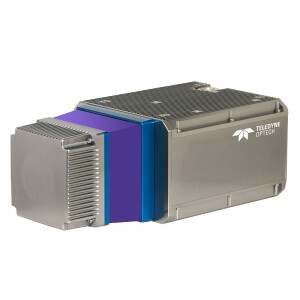


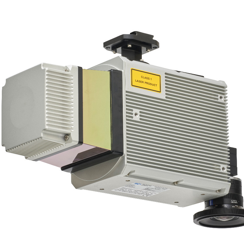
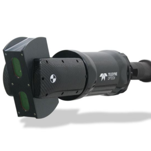
CLS-A
Survey Grade UAV Lidar System
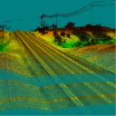
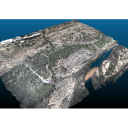
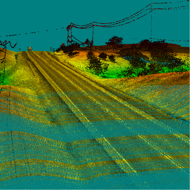
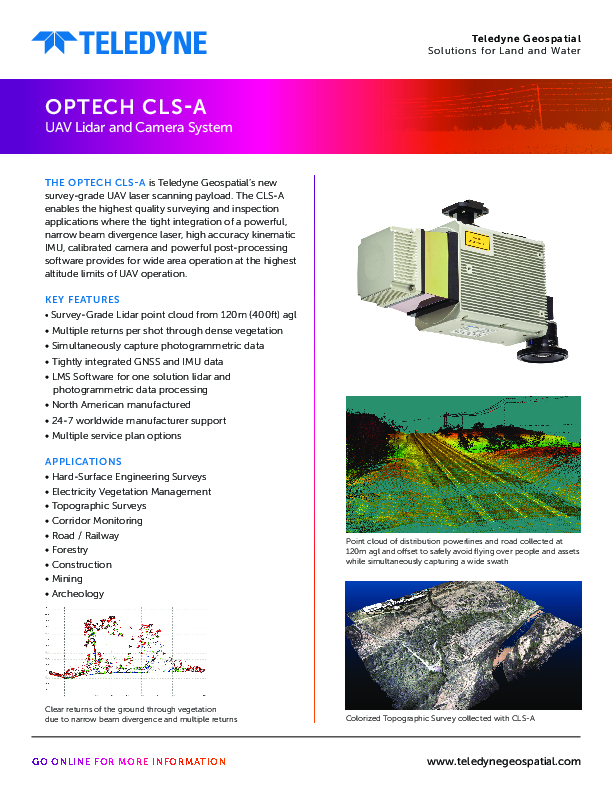
The Optech CLS-A is Teledyne Geospatial’s new survey-grade UAV laser scanning payload. The CLS-A enables the highest quality surveying and inspection applications where the tight integration of a powerful, narrow beam divergence laser, high accuracy kinematic IMU, calibrated camera and powerful post-processing software provides for wide area operation at the highest altitude limits of UAV operation.
Teledyne Geospatial
Vaughan, CA
Description
Key Features
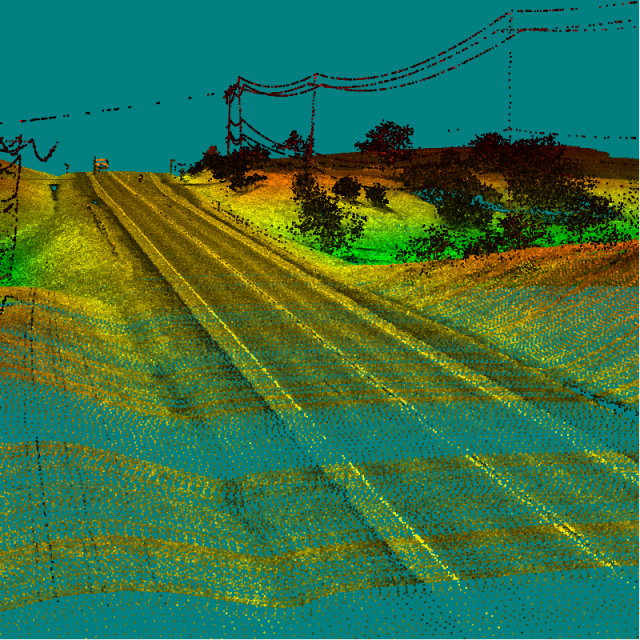
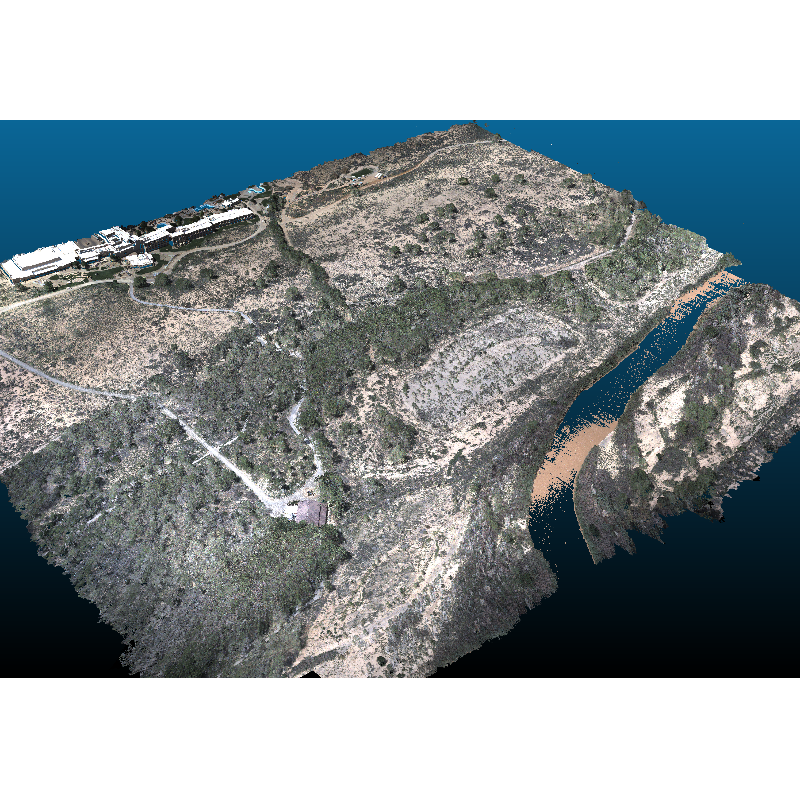
- Survey-Grade Lidar point cloud from 120m (400ft) agl
- Multiple returns per shot through dense vegetation
- Simultaneously capture photogrammetric data
- Tightly integrated GNSS and IMU data
- LMS Software for one solution lidar and photogrammetric data processing
- North American manufactured
- 24-7 worldwide manufacturer support
- Multiple service plan options
Applications
- Hard-Surface Engineering Surveys
- Electricity Vegetation Management
- Topographic Surveys
- Corridor Monitoring
- Road / Railway
- Forestry
- Construction
- Mining
- Archeology
Do you have questions about this product?
- Questions about price, availability, and/or retailers
- Questions about technical specifications and usage
- Questions about suitability for your project or application
Specifications
-
Application
-
Main applications
Engineering Grade Surveys
Distinguishable features
Survey grade point cloud with high accuracy and precision
-
Measurement Characteristics
-
Scanning method
Line Scan
Range accuracy [mm]
5
multiple pulses in air
Y
Min. pulse frequency [Hz]
200000
Max. pulse frequency [Hz]
500000
Max. field of view [degrees]
360
Max. number of recorded echoes per pulse
4
-
Physical Properties
-
Height [cm]
16
Length [cm]
31
Width [cm]
12
Weight [kg]
3.9
Water and dust proof
IP67
-
Laser Pulse Characteristics
-
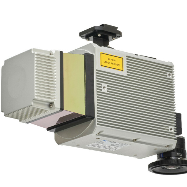
Laser Class
Class 1
Wavelength [nm]
1550
Beam divergence [mrad]
0.3
Max. range of laser pulse [m]
750
-
Power Supply
-
Power consumption
60W
Power requirements
11-36V
Type of battery
None
-
Positioning System
-
Number of GNSS positioning sensors
1
Heading, Pitch and Role internally captured
Y
Type of INS or IMU
APX-20
-
Operation Characteristics
-
Camera included
Optional
Camera specifications
24 Megapixel
-
Data and Software
-
Type of storage
SSD
Max. storage space [mb]
240000
Included software
Applanix Pospac, Teledyne Optech LMS
-
General
-
Year of last update
2022
Year of introduction
2022
Documents
Brochure
cls-a-datasheet.pdf
2.19 MB


