
About Teledyne Geospatial
Teledyne Geospatial presents CARIS OnDemand. This offers globally renowned CARIS software through customizable e-commerce licensing, providing accessible, flexible, and innovative solutions for geospatial projects.
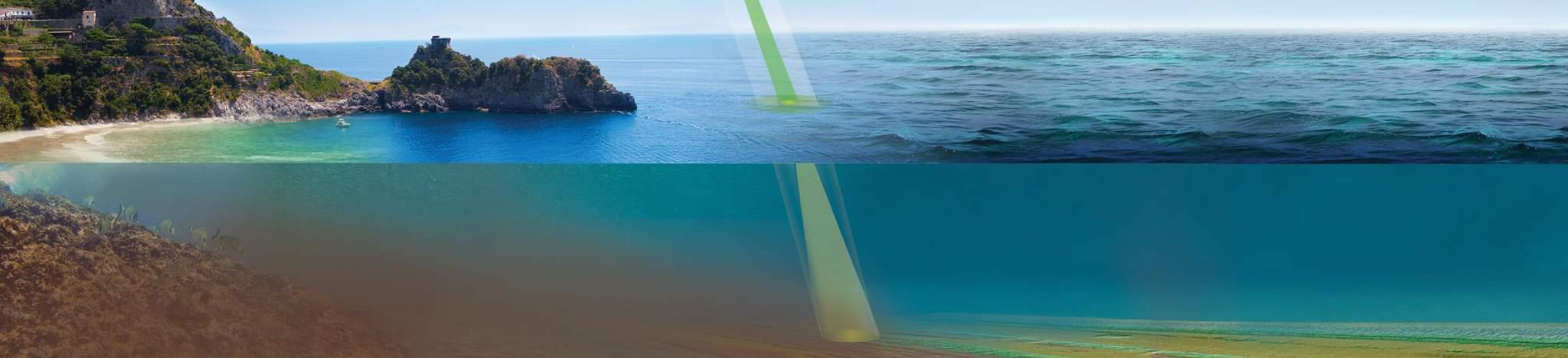
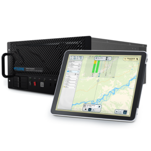
Teledyne Optech and Teledyne CARIS have united to form the new Teledyne Geospatial, offering holistic solutions to seamlessly map land and sea through the integration of industry-leading lidar sensors and world-renowned software workflows. This collaboration empowers customers with a competitive edge in mapping and delivering data products inside of one complete workflow. Ease of collection and processing through to final products is enhanced with efficiency-driving AI noise classifying algorithms and real time quality control.
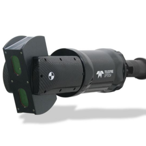
Teledyne Optech has been a world leader in the design, development and manufacture of advanced lidar instruments for more than 45 years. Teledyne Optech is widely recognized for its technological depth in lidar and related technologies, with decades of experience in lidar and photogrammetry, as well as auxiliary technologies such as GPS, inertial measurement systems, and waveform digitization. Our rugged, reliable, and innovative lidar and camera products are deployed on all seven continents—and even on other planets, where a Teledyne Optech lidar provided proof of precipitation on Mars. From this innovation heritage, our clients have come to depend on us to provide industry leadership with new technologies and capabilities to maximize their collection accuracy and efficiency.
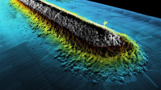
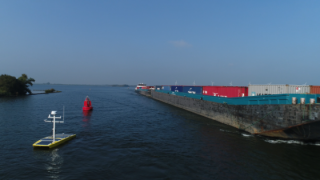
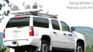
Teledyne Geospatial works closely with commercial, government, military, and space-based organizations to meet their specialized application requirements. As a Teledyne company, we are expanding our commitment to advancing the state of the art of the technology. We offer standalone and fully integrated lidar and camera solutions in airborne mapping, airborne bathymetry, mobile mapping, terrestrial laser scanning, mine cavity monitoring, and industrial process control, as well as space-proven sensors. Complete with extensive survey planning, operation and automated post-processing software, Teledyne Geospatial systems enable clients to collect, manage and deliver survey data to their customers quickly and profitably.
Teledyne Geospatial has extensive experience in deploying systems in challenging environments such as aircraft, vehicles, rail, boats, underground mines, and even in space. To understand and support our clients, our staff has flown in hundreds of aircraft and helicopters around the world, been down dozens of mines, walked hundreds of survey sites, and climbed up mountains and glaciers. Our success is based on our highly skilled and creative staff, drawn from a variety of engineering disciplines, physics, software, GIS and geomatics, as well as business and technical specialties.
With a global network of distributors and representatives, Teledyne Geospatial supplies and supports clients around the world. Headquarters in Toronto, Canada, designs, develops and produces innovative lidar technologies as well as camera production and global sales. Rochester, USA, designs, develops and produces new camera systems (RGB, thermal, multispectral) and defense and security solutions, as well as global marketing management. Mississippi, USA, designs and produces integrated airborne bathymetry sensors.
Established in 1974 under the name Optech, the company has grown into a global leader and is now part of Teledyne Geospatial. Teledyne Geospatial is based in Toronto, Canada, with offices in the USA, Europe and China and representatives worldwide.
Featured products

Recent articles

![2f781d80380a31fcbeca84ba9c7a8108774a05ac[1].jpeg](https://cdn.geo-matching.com/9p60977R.jpeg?w=320&s=e186fc69623f4070269b7ca1e2ced338)
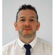
“At the heart of Teledyne Geospatial lies integrated solutions. The offering will include turnkey systems, Lidar, sonar, integrated workflows and a range of systems and solutions that support full, precise data collection.”
Andy Hoggarth
Main office
-
300 Interchange Way
Vaughan L4K 5Z8
Canada -
+1 905-660-0808
- https://www.teledyneimaging.com/en/geospatial/