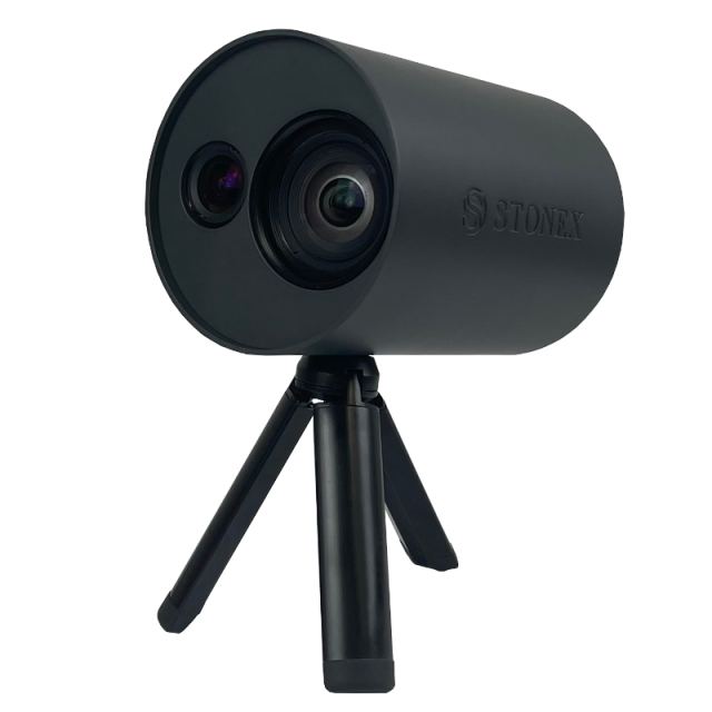
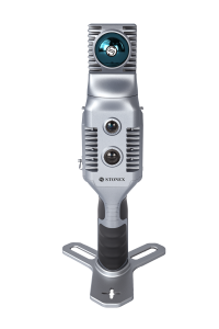
XVS vSLAM 3D Scanner
New generation photogrammetry - Visual SLAM
The system uses a technology based on the integration of high-resolution images, inertial systems and a complex algorithm: capturing a scenario with XVS, 3D model will be generated through photogrammetric techniques.

Stonex
Paderno Dugnano (MI), IT
Description
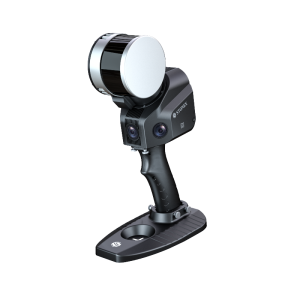
Walking and capturing the scene in motion, a real-time interface will guide you in the data collection, suggesting the speed of your movement and if necessary returning to an area to have enough image overlapping.
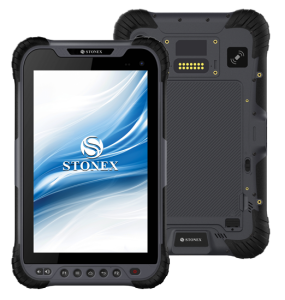
Thanks to Visual SLAM system (Simultaneous localization and mapping), your trajectory is displayed in real-time on a tablet. The Inertial Measurement Unit (IMU) sensor helps the algorithm to generate a continuous image block. The best result will be obtained automatically. Back in the office, the procedure to generate the 3D model is fully automatic, through a desktop PC.
Data coming from XVS can be integrated with video from UAV drone or any camera for a complete reconstruction of the area.
ACCURATE
Smart algorithm makes it possible to choose the best images and increase the accuracy of the derived model. If the capture is very close to the element (around 1m) and closing where you started-loop closure-the accuracy is 2-3mm.
HD TEXTURES
Based on advanced high-resolution images, it allows reconstructing the texture of the scanned material with great clarity and realism.
SCALED AND LEVELLED RESULTS
Through the automatic detection of targets and the use of inertial systems, scaled and levelled results can be obtained.
EASY TO USE
Because of its practicality and ease of use, it can be used by multiple people within a company or institution, without the need for prior knowledge of 3D scanners. The field application will guide in through the data collection.
VERSATILE
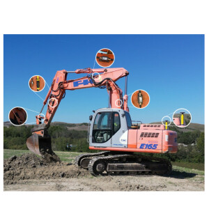
A variety of urban scenarios can be documented using XVS scanner, as infrastructures, accident reconstructions, gas/water connection works, building faces and others. The geometric accuracy and colour realism in the results, make it a companion also for archaeological, architectural and geological work
Do you have questions about this product?
- Questions about price, availability, and/or retailers
- Questions about technical specifications and usage
- Questions about suitability for your project or application
Specifications
-
General
-
Year of initial introduction
2022
Application
Indoor, Outdoor
-
Positioning
-
IMU: Brand and model
Y
-
Operation
-
Built-in Stabilisation
Y
-
Camera System
-
Brand and model
vSLAM camera + RGB camera
Number of cameras
2
Spectral Bands [PAN, RGB, NIR, CIR]
RGB
CCD size [.. x .. pixels]
2448x2048
FoV per camera [deg]
89
Maximum frames/sec. per camera
10
-
Dimensions & Environment
-
Size with case
151mm x 120mm (length x diameter)
Weight [kg]
0.72
Min. Operation temp. [°C]
0
Max. Operation temp. [°C]
40
-
Included Processing Software
-
Project Management Software
XVScloud
Other Software
XVSapp
-
Control Unit
-
Computer
Tablet
I/O port(s)
USB-C 3.0
Videos


