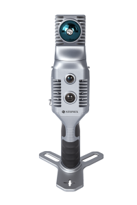
X100 Laser Scanner
Light & Fast
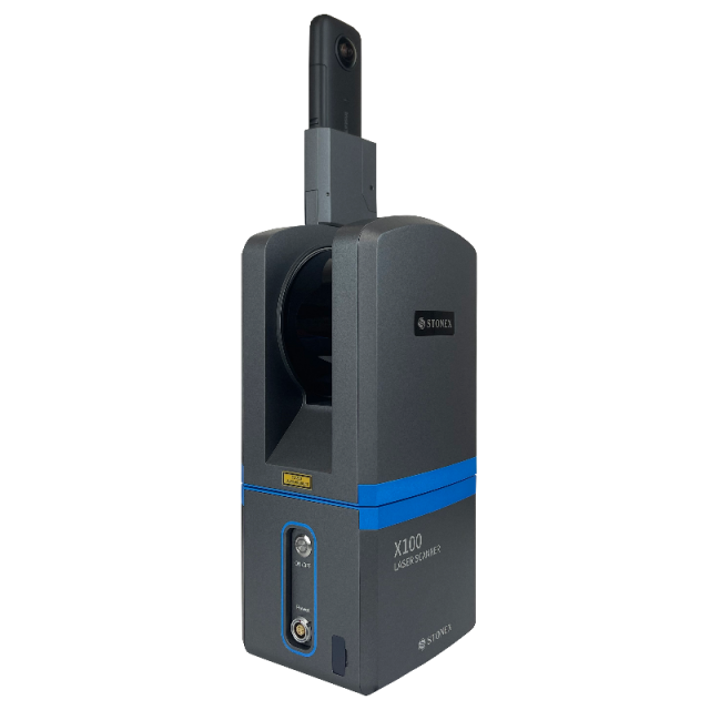
X100 is a small and compact terrestrial laser scanner that is quick and easy to use. Its multi-line lidar technology and ability to achieve complete coverage of the surrounding area enable it to calculate 3D models for a wide range of applications and scenarios, both outdoors and indoors.

Stonex
Paderno Dugnano (MI), IT
Description
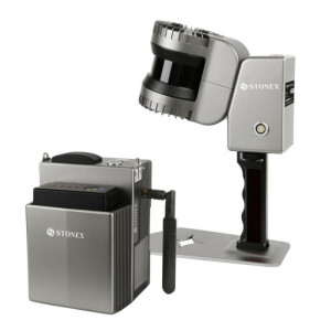
The scanner comes with its own X100app field app, making it easy to control the device. Thanks to the scan converter, the data is compatible with Cube-3d and Stonex Reconstructor, as well as third-party software.
The X100 is the perfect tool for quick topographic surveys, scans of building facades and data collection for floor plans; a quick 360° scan takes as few as 45 seconds. The built-in panoramic camera allows you to add true colour to your scans.
X100 is the perfect instrument for efficient and precise work in a wide range of applications:
- Land & Excavation
- Architecture & Real Estate
- Emergency Management
SMALL AND LIGHT
The scanner can be easily used by a single person thanks to its small size and weight of approximately 3 kg.
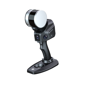
WIRELESS CONTROL
Through the dedicated APP it is possible to control the device remotely. Scan with one click and check quality via real-time preview.
PANORAMIC HDR CAMERA
Add colour to your scan.
SELF CALIBRATING
± 5 degrees tilt supplement angle for precise leveling. Monitor scanner leveling via electronic bubble available on the app.
FAST SCAN & DOWNLOAD
A 360° one-stop scan requires only 45 s. Data are saved on USB dongle directly. Post-processing begins after field work!
Do you have questions about this product?
- Questions about price, availability, and/or retailers
- Questions about technical specifications and usage
- Questions about suitability for your project or application
Specifications
-
Application
-
Distinguishable features
320.000 points/s
Main applications
Land & Excavation, Architecture & Real Estate, Emergency Management
-
Peripherals
-
External Camera
Y
User interface
Tablet, Smartphone
Specifications
360° HDR 18MP
-
Operation Characteristics
-
Operating temperature: min. [°C]
0
Operating temperature: max. [°C]
40
Control panel built in
Y
IP Rating
54
Dual Axis Compensation
Y
-
Scanning Characteristics
-
Max. vertical field of view [deg]
268
Max. horizontal field of view [deg]
360
Min. scan duration with typical resolution [min]
0.75
Scan duration with highest resolution [min]
3.75
-
Software Functionality
-
Software name
X100app
Real time visualization during scanning
Y
-
Laser Ranger
-
Wavelength [nm]
905
Laser safety classification
Class 1
Min. Range [m]
0.5
Max. Range [m]
120
Water/Dust Protection
Y
-
Power
-
Scan time per battery [h]
3
-
General
-
Year of introduction
2022
Height [m]
0.275
Depth [m]
0.113
Width [m]
0.125
Total Weight [kg]
3,2
Videos


