

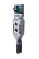

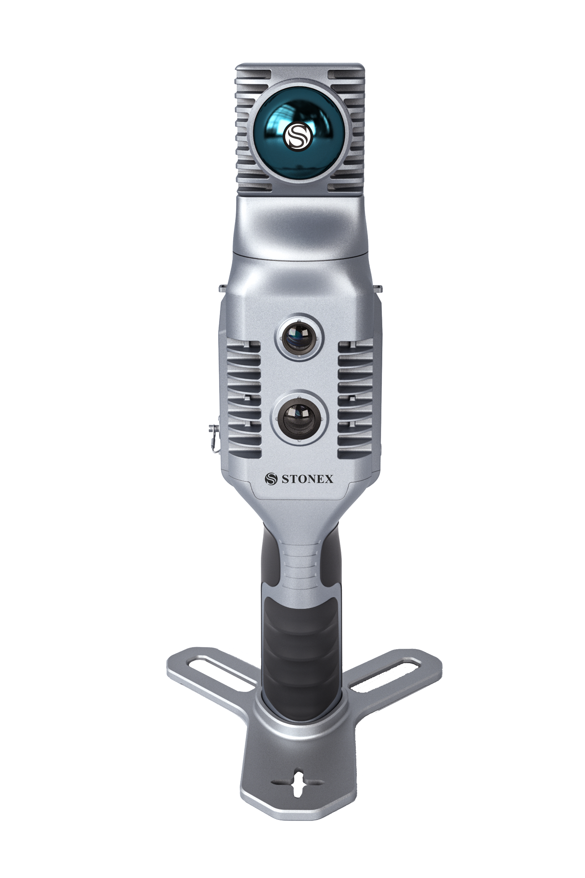
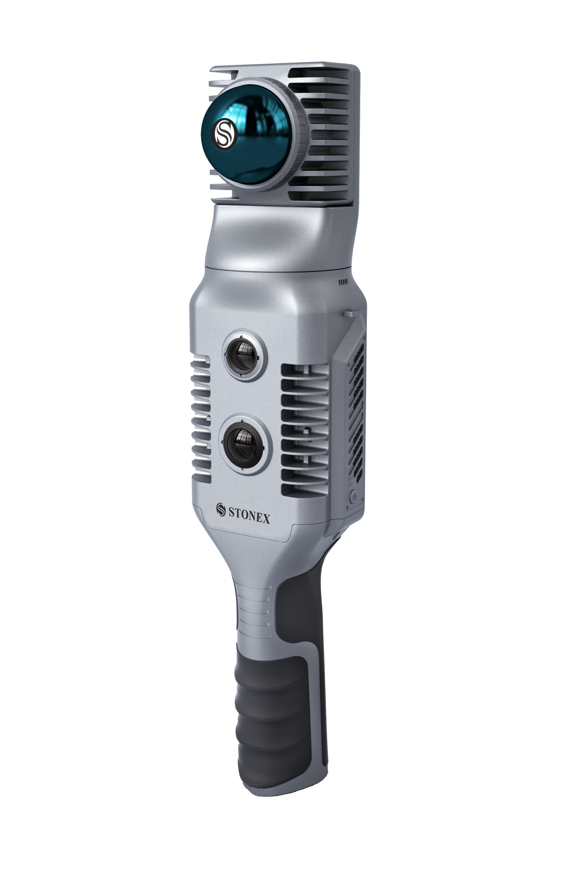
X70GO SLAM Laser Scanner
Static and Dynamic together with X-Whizz mode
The new era of hybrid scanning

Stonex
Paderno Dugnano (MI), IT
Description
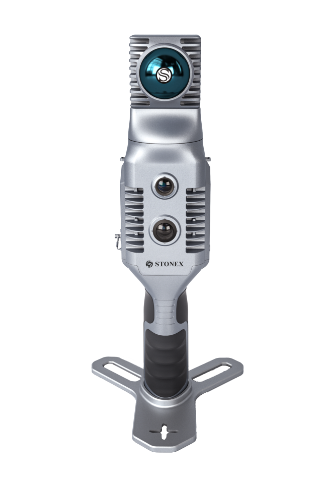
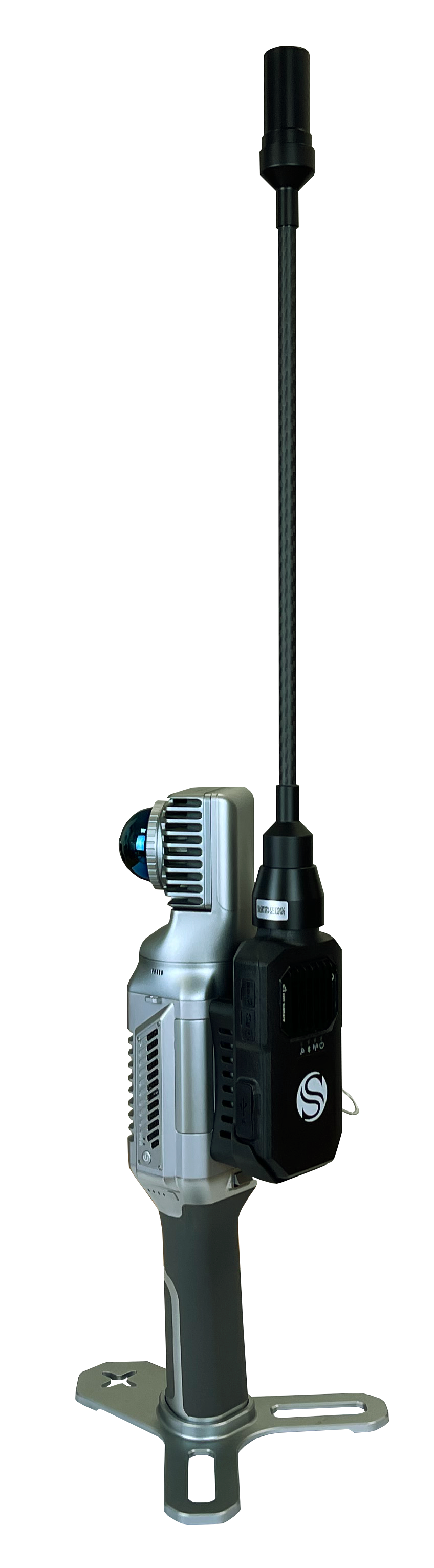
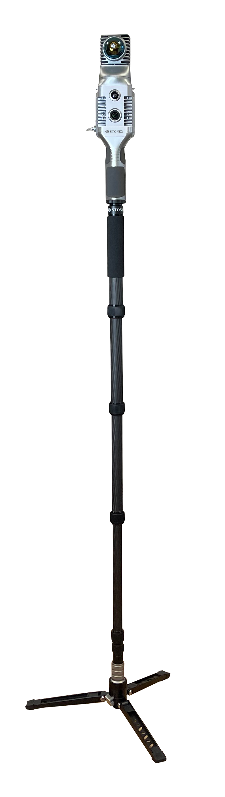
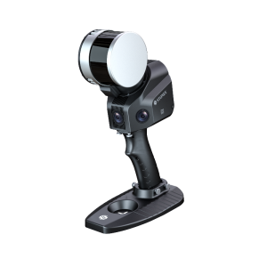
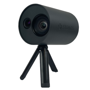
X70GO is a real-time 3D model reconstruction device which integrates inertial navigation module, high performance computer and storage system. It is equipped with a 360° rotating head, which, combined with the SLAM algorithm, generates high-precision point cloud data.
A 12 MP visible-light camera provides texture information, while a visual camera guarantees stronger real time preview with GOapp. Mapping results are generated immediately inside the scanner, right after scanning: choose if you want to color them and improve their accuracy, postprocessing with GOpost software.
X-WHIZZ MODE
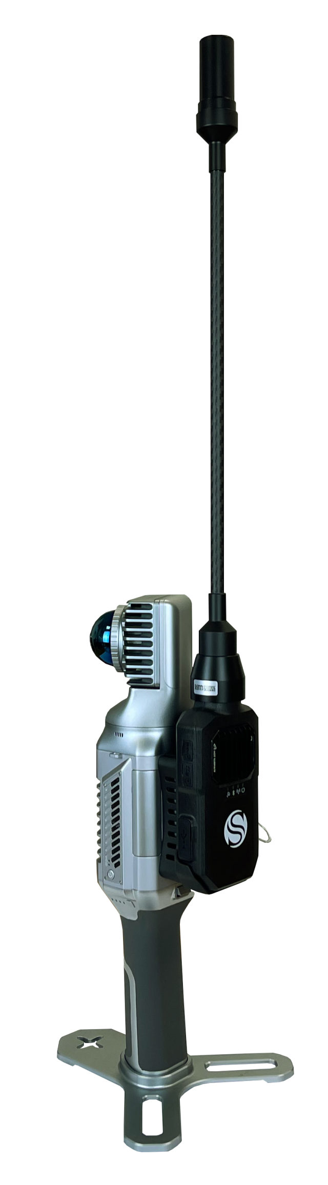
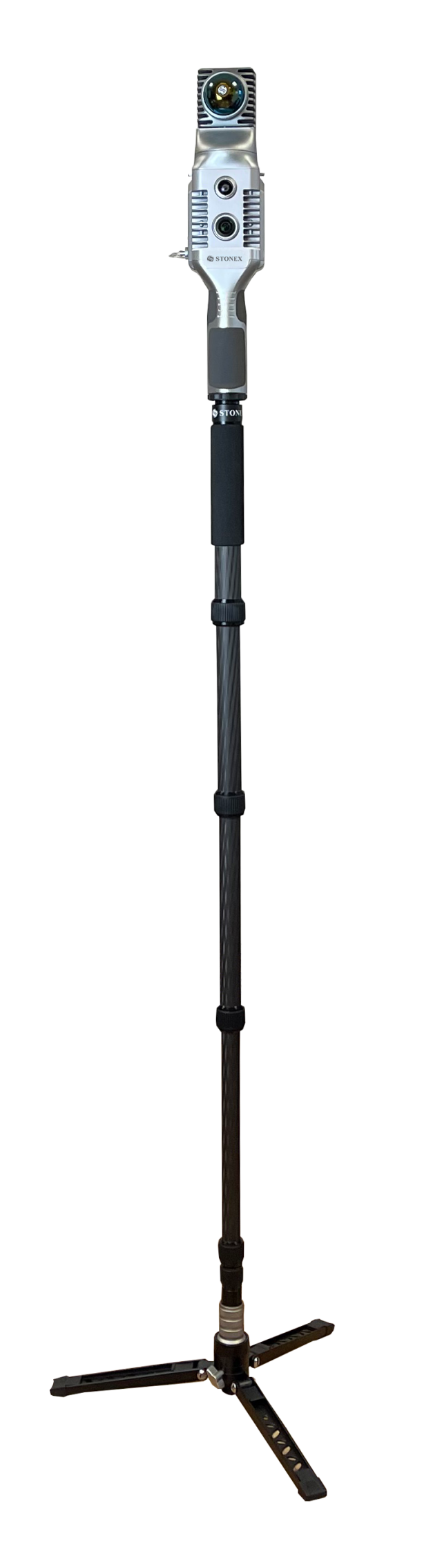
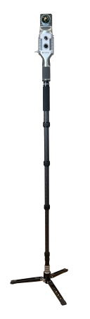
X70GO merges mobile and stationary surveying. To the advantageous SLAM solution that allows you to survey large areas in a very short time, it combines a stationary mode to scan with higher resolution. Mount X70GO on a monopod and stand still in key areas for a few seconds. It is the perfect trade-off for those who need speed and detail in a mobile survey.
REAL TIME RESULTS
The built-in visual camera makes the real time SLAM algorithm more stable, especially in weak structural textures environments. The data are ready to be used as soon as the survey is completed.
RAPIDITY AND REDUCED WORKLOAD
No more multiple scan station, just move around the scene to collect the entire 3D point cloud, without time-consuming cloud to cloud alignment.
AUTOMATIC CONTROL POINT MEASUREMENT
When capturing data, X70GO is able to collect reference points too. They can be matched with known control points to georeference the scans.
HIGH PERFORMANCE COMPUTATION
The system can directly output the mapping results after the acquisition is completed. You can choose to post-process the data, in case you desire to improve its accuracy.
Do you have questions about this product?
- Questions about price, availability, and/or retailers
- Questions about technical specifications and usage
- Questions about suitability for your project or application
Specifications
-
General
-
Depth [cm]
17
Height [cm]
36.4
Total Weight [kg]
1.450
Width [cm]
17.3
Year of introduction
2024
-
Application
-
Main applications
Archaeology, Heritage, BIM, Real Estate, Tunneling, Mining, Industrial
-
Scanning Characteristics
-
3D measurement accuracy [mm]
6
Color registration
Y
Data aquisition speed (points p/second)
200.000
Laser Class
1
Max. horizontal field of view [deg]
360
Max. Range [mm]
70000
Max. vertical field of view [deg]
52
Min. Range [mm]
100
wavelength light source [nm]
905
-
Operation Characteristics
-
Humidity range [%]
95
Operating temperature: max. [°C]
-20
Operating temperature: min. [°C]
+50
-
Power
-
Battery type
Lithium
Scan time per battery [h]
1.5
-
More information
-
Distinguishable features
X-Whizz mode
-
Functionality
-
Mesh as output
Y
Real time visualization during scanning
Y
Software name
Goapp, Gopost
-
Connectivity and Sensors
-
Other Sensors and Ports
LEMO
USB Port
Y
WiFi
Y
Videos


