Cube-3d
Photogrammetry & 3D Data Software
Cube-3d is a complete software for 3D data management, built by two modules for photogrammetry and for scanner data.

Stonex
Paderno Dugnano (MI), IT
Description
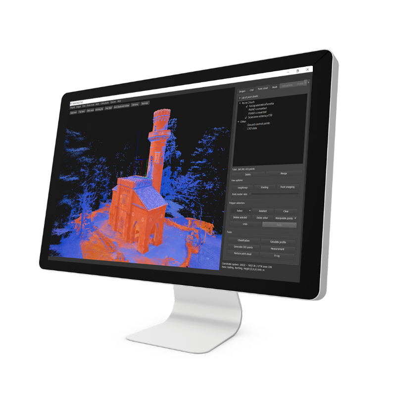
Cube-3d is a complete software for 3D data management, built by two modules for photogrammetry and for scanner data. The former processes images (or videos) to generate accurate digital maps and 3D models with extreme precision; the latter provides tools to align point clouds.
It is compatible with cube-a surveys and with any third-party 3D model. It is possible to draw on point clouds or meshes and merge data imported from traditional survey tools, all in a single software. The data can be then processed and enhanced thanks to the various CAD tools.
Among the many features available, most appreciated are the automatic classification, orthophoto, cross-sections and profile lines, volume calculation, and more. Licenses configuration is very flexible, from perpetual to temporary subscription, it adapts to the needs of many professionals.
Import and Data Processing
3D POINT & DIGITAL SURFACE GENERATOR
Cube-3d is a complete software for 3D data management, built by two modules for photogrammetry and for scanner data. The former processes images (or videos) to generate accurate digital maps and 3D models with extreme precision; the latter provides tools to align point clouds. It is compatible with cube-a surveys and with any third-party 3D model.
WIDE RANGE OF IMPORT OPTIONS
Without selecting a reference system or entering details on the formats used, Cube-3d can receive data directly from Cube-a, with the settings defined in the latter, and use them, for example, as a control point for georeferencing the models. It is possible to import point clouds from lidar, laser scanners, and without limitation from any tool capable of generating them. The compatibility of this software with all standard formats, used in traditional surveys, will be of great help to professionals.
NEVER-FAILING ORIENTATION
Cube-3d automatically detects both GCPs and detail points, allowing the operator to check the position of the detected targets, in the first step of the orientation. With Stonex targets, the time needed will be even shorter, centering is immediate. Even working with RTK drones, it will be easy to achieve centimeter accuracy without GCP.
Modules
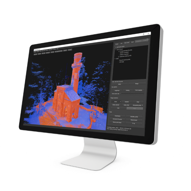
PHOTOGRAMMETRY MODULE
The program can process, in a single project, images captured by any handy camera, UAV drone, or multiple-camera and create extremely accurate and detailed high-definition 3D models. It can generate a fully geo-referenced, spatially orientated, and complete overview of your site configuration.
SCANNER MODULE
Import clouds from Lidar, Laser Scanners, and without limitation from any tool capable of generating them. Full support for Stonex Scanners and a wide range of import formats. Register point clouds in cube-3d and take advantage of all the excellent tools it provides.
Functionalities
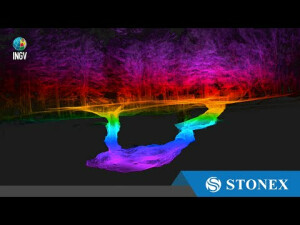
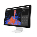
CLASSIFICATION
Benefits from an industry-leading classification engine with best-in-class point cloud customization tools that give users fast, easy-to-use, and simple data classification.
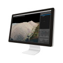
ORTOPHOTO
It allows to calculate high-resolution, traditional and true, digital orthophotos with cm-grade precision in perfect geo-referenced details. The X-ray feature helps to see through the rooftops, so drawing building walls and similar features on a survey map will be much easier.
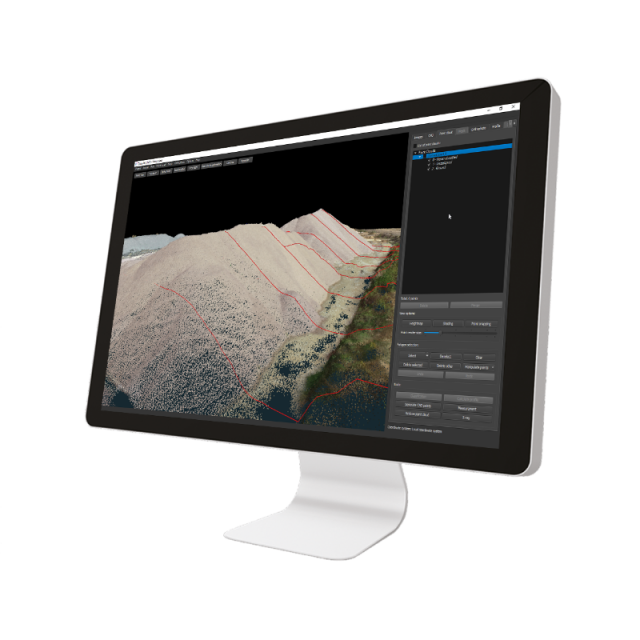
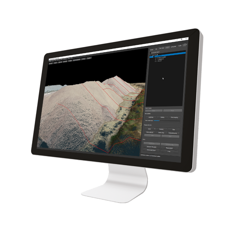
CROSS SECTIONS, PROFILES AND CONTOUR LINES
From point cloud data, it will draw a definition line and calculate single vertical cross-sections or multiple transverse profiles with user-defined intervals. Or it can instantly create topography maps, and freely explore terrain elevation data in 2D or 3D, thanks to the automated contour lines calculation.
CAD ENGINE
Integrated CAD functions give you the power to work on your project with a complete layer system, snapping tools, drawing options and measurements. No need of any further third-party CAD software.
Do you have questions about this product?
- Questions about price, availability, and/or retailers
- Questions about technical specifications and usage
- Questions about suitability for your project or application
Specifications
-
Feature Extraction and Mapping
-
Mapping facilities
Y
3D superimposition
Y
Integration with scanned maps
Y
Integration with 2D vector maps
Y
Integration with 3D vector maps
Y
Integration with point clouds
Y
-
Required Computer System
-
System includes hardware
N
Operating system(s)
Windows (7-8-10) 64bit
CPU (min.)
Intel i5 or Ryzen 5
CPU (preferred)
Intel i9 or Ryzen 9
Min. RAM memory [Mb]
16
Preferred RAM memory [Mb]
128
64-bit version of software available
Y
Min. data storage capacity [Gb]
500
Preferred data storage capacity [Gb]
1000
Min. graphic card
nVidia GTX 1050
Hardware handling of big data sets
2x nVidia RTX 3060
Cloud processing
Minimum Intel i5 - 16gb RAM - nVidia GTX 1050
-
Images and data
-
Source data
UAV, hand-held camera, mobile phone camera
Input image formats
Aerial images, Video, Images taken by any hand camera, Total stations & GNSS points, Region geoid data , *.dxf data, Cube-a format (*.cx3d) , Photogrammetry point cloud, LIDAR point cloud, XML surface data, Orthophoto maps, Underwater images, Predefined camera parameters import, Telemetry data import, Camera offset support
Export data formats
Orthophoto (*.Tiff, *.JPG, *.PNG, *KMZ, …), Textured 3D model (*.obj, …), Point cloud (*.e57, *.las, *.ply, …), Digital surface model (*.obj, *.xml), Regular/irregular grid mesh, Contour lines (*.dxf, *.pdf, …), CAD drawings (*.dxf), Selected points (*.dxf, *.txt, …), Quick sketches (*.pdf, *jpg, *.png), Survey maps (*dxf, *.pdf, *.jpg, …), Camera parameters, Undistorted images
Mission planning
N
-
DEMs & Orthoimages
-
Automatic matching
Y
Automatic breakline extraction
Y
Checking facilities (DEM editing)
Y
Automatic contour generation
Y
Mosaicing of orthoimages
Y
True orthoimage generation
Y
Dense DSM creating capability
Y
DSM to DTM filtering
Y
Automatic seam line creation
Y
Dense Image Matching
Y
-
General
-
Year of introduction
2022
Regional settings available
Y
License configuration
Perpetual - Yearly subscription - Educational
Year of last update
2023
Modular
Y
-
Orientation and triangulation
-
Automatic interior
Y
Relative
Y
Automatic aerotriangulation
Y
Automated blunder detection
Y
Self calibration
Y
images simultaneously processed
Y
Automatic Relative
Y
-
Measurement tools
-
Length
Y
Area
Y
Volume
Y
lengte / area / volume
Y
Stereoscopic measurements
Y
Vegetation index calculation
N
Automatic classification
Y
-
Image manipulation & processing
-
Automatic contrast manipulations
Y
Spatial convolution
Y
Resampling
Y
Radiometric adjustment for mosaicing
Y
-
More information
-
Main applications
Survey maps, Orthophoto, Volume calculation, Point cloud management, cross sections, contour lines, CAD tools
Distinguishable features
automatic classification, orthophoto, cross-sections and profile lines, volume calculation


