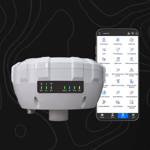
X5R Plus
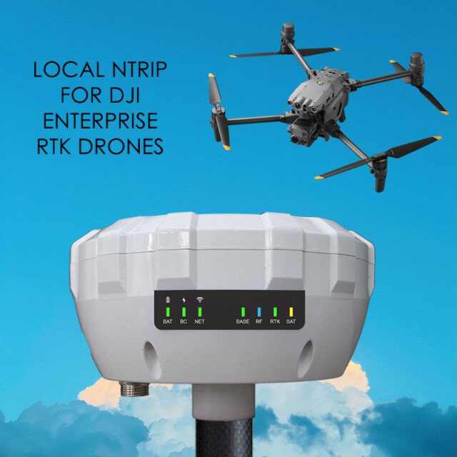
The X5R Plus with NTRIP LOCAL can send NTRIP corrections to DJI Enterprise and Autel RTK Drones without the need of an internet connection.
The X5R Plus includes all the features of the X5R Standard such as PPK, RTK (10km) and NTRIP. It seamlessly integrates with RTK-compatible drones from DJI Enterprise (Pilot 2 App) and Autel RTK. Harness the power of our innovative system as it transmits RTK corrections to your drone through a dedicated WiFi service and NTRIP Caster.

METTATEC
San Borja, PE
Description
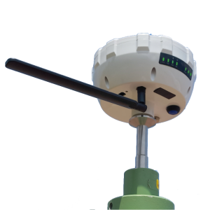
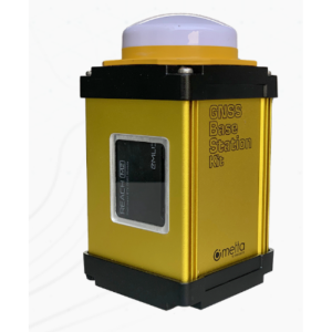
Experience unparalleled precision and accuracy with the X5R Plus, which includes all the features of the X5R Standard such as PPK, RTK (10km) and NTRIP. It seamlessly integrates with RTK-compatible drones from DJI Enterprise (Pilot 2 App) and Autel RTK. Harness the power of our innovative system as it transmits RTK corrections to your drone through a dedicated WiFi service and NTRIP Caster, achieving remarkable levels of precision by installing it as a base on a point with known coordinates.
With a multiband GNSS receiver boasting centimetre-level accuracy, the X5R Plus operates flawlessly in PPK, RTK, and NTRIP modes. It supports GPS, Glonass, L1/L2, Galileo E1/E5b, Beidou B1I/B2I, and QZSS L1/L2C signals, guaranteeing comprehensive satellite coverage.
Unlock the future of drone-based surveying and mapping with 184 channels at your disposal.
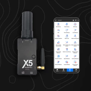
Main features:
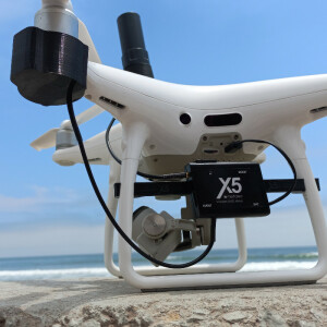
- Integrates seamlessly with RTK-compatible drones from DJI Enterprise (Pilot 2 App) and Autel RTK
- Transmits RTK corrections to the drone via its own WiFi service and NTRIP Caster
- Can be installed as a base on a point with known coordinates for greater precision
- Multiband GNSS receiver with centimeter precision
- Works in PPK, RTK and NTRIP mode
- GPS, GLONASS L1/L2, Galileo E1/E5b, Beidou B1I/B2I, QZSS L1/L2C
- Number of channels: 184
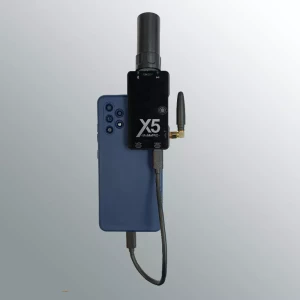
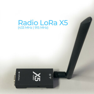
- Available frequencies: 915 MHz and 433 MHz
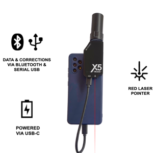
- Compatible with software or apps: Field Genius, Survey Master, SurvPC, SW Maps and any GIS software that supports NMEA via Bluetooth
- Works in RTK mode with LoRa Radio up to 10+ km with line of sight
- Battery up to 12 hours
- IP67 protection
- Weighs only 650 grams.
Do you have questions about this product?
- Questions about price, availability, and/or retailers
- Questions about technical specifications and usage
- Questions about suitability for your project or application
Specifications
-
General
-
Type
Aerial, Land, Marine
Year of initial introduction
2023
Height [m]
0.85
Depth [m]
0.45
Width [m]
0.6
Total Weight [kg]
1.8
Housing Material
IP67
