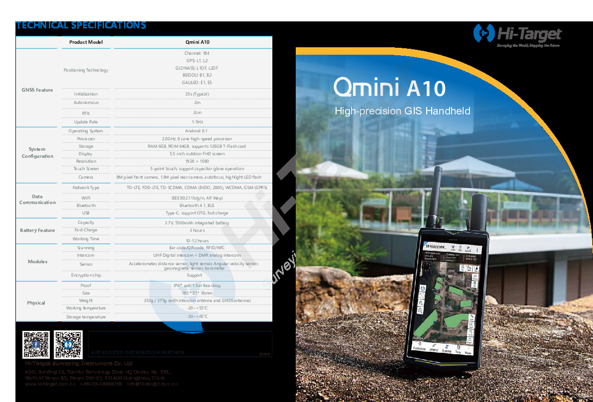
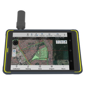
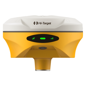
Qmini A10 GIS Handheld
High-Precision GIS Handheld Collector with Intercom Function
Qmini A10 provides a combination of Beidou high-precision positioning, dual-mode intercom, 4G smartphone, with background multi-network interconnection and other functions.

Hi-Target
Guangzhou, CN
Description
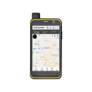
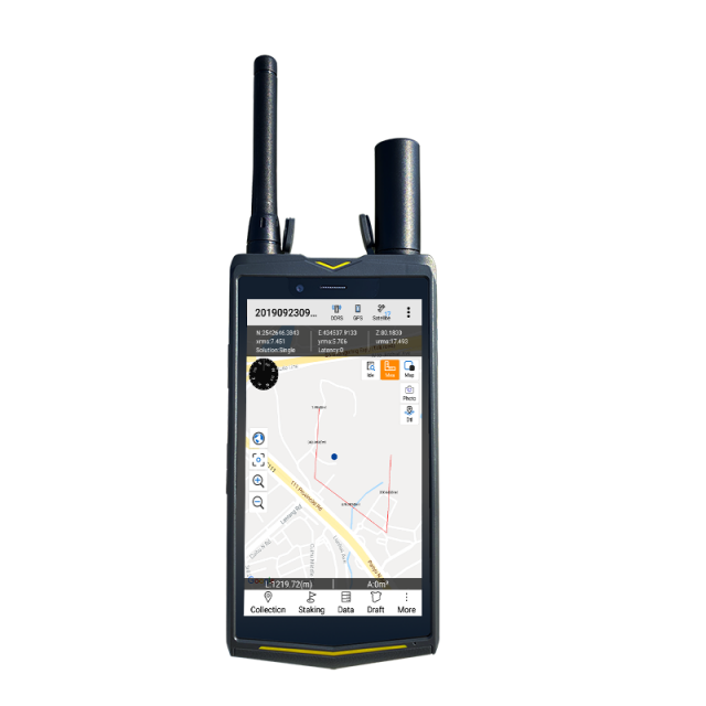
Qmini A10 GIS Handheld is small with complete functions and a high level of protection. Besides, it is a new type of rugged centimeter-level precision intelligent terminal product.
High-Precision
With 184-channel positioning chip and removable spiral GNSS antenna, Qmini A10 supports all constellations GPS/GLONASS/BDS/Galileo, and the positioning accuracy can reach 2cm.
Intercom
Qmini A10 integrates UHF analog intercom and DMR digital intercom, communication distance can reach 5 km and support radio relay, special intercom button can improve work and cooperation efficiency.
Military quality
Rugged design, FHD screen, super performance and long battery life.
Do you have questions about this product?
- Questions about price, availability, and/or retailers
- Questions about technical specifications and usage
- Questions about suitability for your project or application
Specifications
-
General
-
Year of introduction
2020
Main design elements
hardware
Total Weight [kg]
0.37
Width [m]
0.085
Height [m]
0.165
Depth [m]
0.018
Resolution: horizontal pixels
1920
Resolution: vertical pixels
1080
Touchscreen
Y
Display Panel
5.5-inch
Product Description
smaller, compatable and portable
-
More information
-
Main applications
Land and water resource inspection, pipeline and utilities inspection, environmental and other public work applications.
Distinguishable features
Qmini A10 provides a combination of Beidou high-precision positioning, dual-mode intercom, 4G smartphone, with background multi-network interconnection and other functions. It is small with complete functions and a high level of protection.
-
Software
-
Name of GIS package
Qmini A10 GIS Handheld
Panning
Y
Map rotation
Y
Editing of points
Y
Editing of lines
Y
Editing of polygons
Y
Editing of attributes
Y
Query
Y
Sketching of notes on map
Y
Display of external data and photos
Y
Measurements: length
Y
Measurements: area
Y
Import/Export Formats
*.edt, *.ed2, *.shp, *.dxf, *.gpx, *.kml, *.mif, *.txt, *.csv, *.dt
Name of survey data collection software
Hi-Q Pro data collection Android software
-
Connectivity
-
User Interfaces
Android
Wireless Data Transfer
Network, Wi-Fi
Bluetooth
Y
Ports
Type-C
WiFi
Y
Supply Voltage [V]
3.7V
-
GNSS Receiver
-
GNSS Systems Supported
GPS; Glonass; Compass
Number of Channels
184
Integrated SBAS
Y
Update Rate [Hz]
5
Time to first fix after cold start [s]
30
Multipath Mitigation
Y
Compatible external GNSS receivers
Yes
Stand alone positional accuracy [m]
0.02
Compatible GNSS correction signals
SBAS
-
Computer
-
Processor
8 core high-speed processor
RAM [MB]
6144
Hard Disk [MB]
65536
Types of Replaceable Memory
128GB T-Flash
Audio: speaker
Y
Range measurement
Y
Operating System
Android
Built-in Camera: megapixels
8
Hard Disk
Flash
Audio: microphone
Y
-
Horizontal uncertainty
-
phase: RTK kinematic (constant part) [m]
0.2
code: SBAS (constant part) [m]
1
-
Operation Characteristics
-
Integrated sensors
Operating temperature: min. [°C]
-20
Operating temperature: max. [°C]
55
Water and dust proof [IP]
67
Humidity resistance
100%
Shock proof
1.5m free-fall
Operation time per battery [hr]
10
Battery Field Replaceable
Y
Pole mount available
N
Documents
Brochure
hi-target-qmini-a10-gis-handheld-brochure-en-20201012.pdf
699.24 KB


