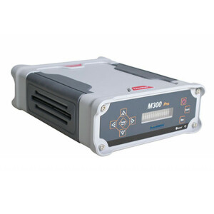
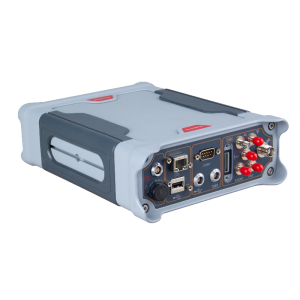
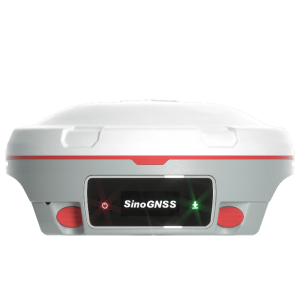
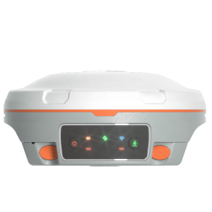
M300 GNSS Receiver
A multi-purpose device for high-precision GNSS applications featuring full-constellation tracking, for centimeter accuracy survey on demand.
M300 is designed as the multi-purpose sensor for different kind of applications. With the powerful integration ability, M300 provides the solutions for the geodetic reference station, deformation monitoring system, machine guidance, harbour construction, land surveying, marine surveying and other related high accuracy requested projects.

ComNav Technology
Shanghai, CN
Description
M300 is designed as the multi-purpose sensor for different kind of applications. With the powerful integration ability, M300 provides the solutions for the geodetic reference station, deformation monitoring system, machine guidance, harbour construction, land surveying, marine surveying and other related high accuracy requested projects.
- GPS L1/L2/L5, BeiDou B1/B2/B3,GLONASS L1/L2, Galileo E1/E5a/E5b
- DP-Filter Smooth Function
- Support PPS and Event Marker
- Easy to Intergrate
- 8 GB Internal Memory
Do you have questions about this product?
- Questions about price, availability, and/or retailers
- Questions about technical specifications and usage
- Questions about suitability for your project or application
Specifications
-
General
-
Year of initial introduction
2013
Height [m]
0.08
Depth [m]
0.2
Width [m]
0.145
Total Weight [kg]
1.3
Housing Material
Aluminium Alloy
Type
Land
-
Performance
-
Max. simultaneous tracked channels
496
Tracked satellite signals
GPS L1/L2/L5, BeiDou B1/B2/B3, GLONASS L1/L2, Galileo E1/E5a/E5b
SBAS differential signals
WAAS, EGNOS, MASAS,GAGAN, SDCM
Type of measurements
C/A code; P code; Full Carrier Phase
Reacqisition time [s]
1.5
RTK Network Compatibility
Y
No. channels
496
-
Environment
-
Operating temperature: min. [°C]
-40
Operating temperature: max. [°C]
70
Humidity resistance
95% no-condensing
Water sand and dust proof
IP67, can float on the water
Shock and vibration proof
survives a 2-meter drop on to concrete
ROHS compliance
Y
WEEE compliance
N
-
Communication: general
-
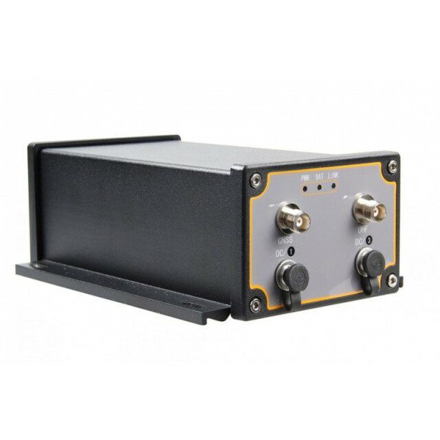
Communication ports
2 serial ports (7 pin Lemo), 2 TNC ports
Simultaneous links
Y
PPS Out
Y
Bluetooth
N
-
Communication: Protocols
-
RTCM standards for differential data
RTCM2.X, RTCM3.X
CMR standards for differential data
CMR/CMR+
Other formats for differential data
ComNav Binary
NMEA output format
NMEA0183
other output formats
ComNav Binary
Configuration method
CRU OEM Board Control Software
-
Communication: links
-
Radio modems
Internal
Landline modems
Optional
-
Horizontal uncertainty
-
code: DGNSS/RTC (constant part) [m]
0.4
phase: RTK rapid static (constant part) [m]
0.0025
phase: RTK rapid static (variable part) [ppm]
1
phase: RTK kinematic (constant part) [m]
0.008
phase: RTK kinematic (variable part) [ppm]
1
phase: static post processing (constant part) [m]
0.003
phase: static post processing (variable part) [ppm]
0.1
phase: kinematic post processing (constant part) [m]
0.008
phase: kinematic post processing (variable part) [ppm]
1
Initialization time on the fly [s]
10
RTK network solution methods
VRS
-
Power
-
Operating power: min. [V]
10.5
Operating power: max. [V]
28
Typical consumption [W]
2.5
Internal power supply
N
External power supply
Y
Operating time with internal power supply [hr]
0
Certifications
CE, ROHS
Rechargeable with (auto)battery
N
Direct car connection cable available
N
-
Recording
-
Memory medium
Internal
Data capacity [MB]
8192
Type of data (on board recording)
ComNav GNSS raw data
Data input
Auto
-
More information
-
Distinguishable features
1. GPS L1/L2/L5, Beidou B1/B2/B3, GLONASS L1/L22. Configurable GPS/Beidou/GLONASS single system positioning and multi-system positioning 3. Support long base line E-RTK4. Advanced QUAN algorithm technology
Documents
Brochure
migrationthuy3k.pdf
378.46 KB


