


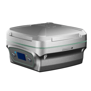
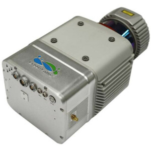
LiBackpack DGC50H
GNSS+Panoramic Camera+Dual Laser Scanners Integration
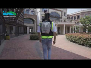
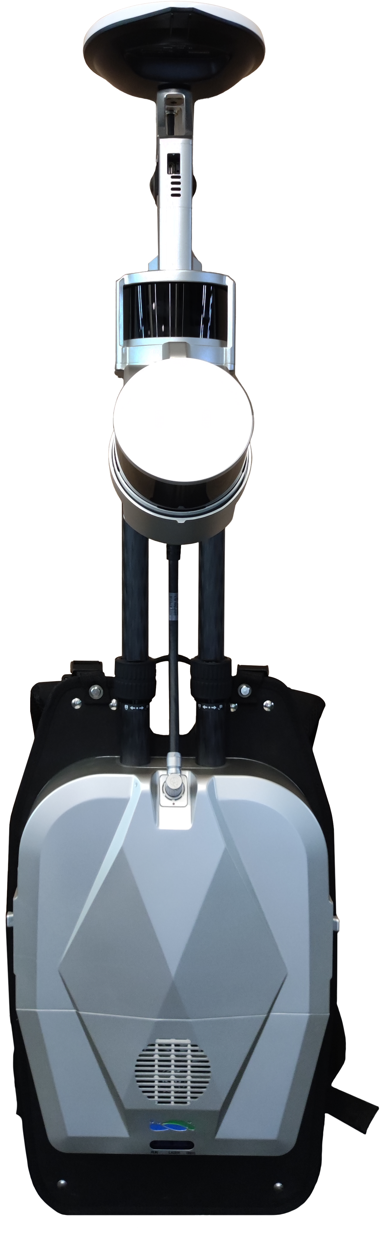
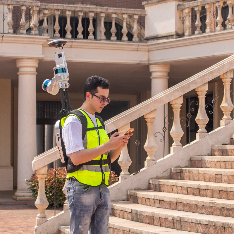
The Libackpack DGC50H backpack LiDAR scanning system is an upgraded version of the Libackpack Product Series. This device integrates a longer-range laser radar sensor in the horizontal and vertical directions, with better inertial navigation systems and self-developed batteries. The GNSS device and synchronization positioning and chart construction (SLAM) technology, regardless of whether there is GNSS information in the scanning environment, can obtain high-precision 3D points within the scanning range, exquisite, double the efficiency! It can be used in the fields of power patrol, forestry survey, mining measurement, underground space information acquisition, building facade measurement, BIM, and other fields.

GreenValley International
Berkeley, US
Description
High-resolution Panoramic Camera
Adopt a high-resolution panoramic camera, and support 5.7K delay photography, the panoramic view is clearer and more realistic. The video size is reduced by 30-40 times compared to the previous generation backpack, shortening the video copy and transcoding time by 20 times.
High Precision, High Efficiency
The LiBackpack DGC50H can directly acquire point cloud data with absolute coordinates when used with virtual base stations or self-racked base stations. The laser range can reach 120 meters, the battery life is 2.5 hours, the park can be measured in 30min of 2W flat, and the laser point cloud data within 5cm of absolute accuracy can be output to meet the requirements of high-precision mapping.
Simple to Handle, Easy to Operate
With LiFuser-BP post-processing software, high-precision color point cloud data and panoramic images can be generated with one click. Combined with LiDAR 360 software, it can realize urban road component census, floor plan drawing, elevation measurement, single wood division, mine cave measurement, and other applications.
Do you have questions about this product?
- Questions about price, availability, and/or retailers
- Questions about technical specifications and usage
- Questions about suitability for your project or application
Specifications
-
Application
-
Training facilities
Yes
Main users
Surveyor
Distinguishable features
Stable Performance, Accurate, Lightweight
Main applications
Forest, Mining, BIM
-
Peripherals
-
External Camera
Y
Export formats of camera image
.jpg
User interface
Browser
-
Operation Characteristics
-
Operating temperature: min. [°C]
-10
Operating temperature: max. [°C]
40
Internal Camera
Y
Control panel built in
N
-
Scanning Characteristics
-
Max. vertical field of view [deg]
30
Max. horizontal field of view [deg]
360
Min. horizontal step size [deg]
2
Min. vertical step size [deg]
0.1
Max. measurement rate [kHz]
600
Min. scan duration with typical resolution [min]
120
-
Software Functionality
-
Software name
LiFuser-BP
Real time visualization during scanning
Y
Geo-referencing
Y
-
Laser Ranger
-
Range measurement principle
pulse
Laser safety classification
Class 1
Operating Time
2h
Max. Range [m]
100
Wavelength [nm]
903
Range uncertainty (constant part) [mm]
30
Rotating Speed
16
-
Power
-
Battery type
5700mAh
Scan time per battery [h]
2
-
General
-
Year of introduction
2020
Total Weight [kg]
8.6
Height [m]
1.01
Depth [m]
0.344
Width [m]
0.252
Documents
Brochure
Libackpack DGC50H 20230803(EN) .pdf
11.02 MB


