GNSS+INS for Hydrographic Survey Applications
GNSS+INS technology combines GNSS positioning with inertial navigation system (INS) measurements like velocity, attitude and heave
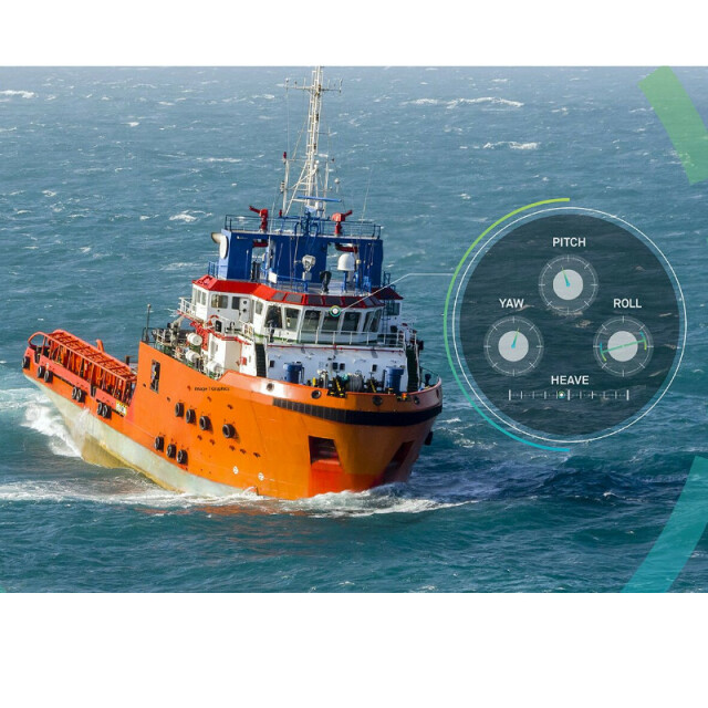
SPAN GNSS+INS technology combines GNSS positioning with inertial navigation system (INS) measurements like velocity, attitude and heave. In a solution customized for hydrographic survey applications, the 3D positioning provides accurate measurements even through extended GNSS outages.
Veripos
United Kingdom
Description
By deeply coupling the GNSS and inertial measurements, GNSS tracking is refined to aid acquisition of satellite signals. This process strengthens the accuracy of your current position, and extends positioning reliability.
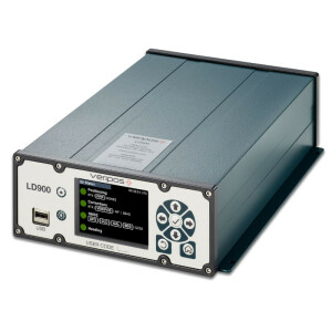
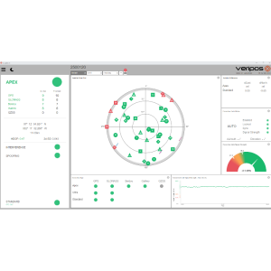
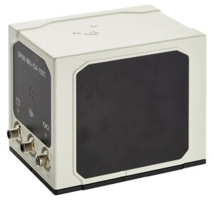
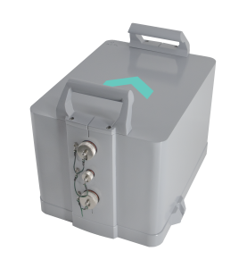
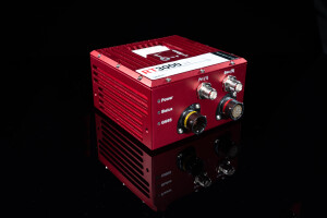
SPAN GNSS+INS technology, developed by Hexagon | NovAtel, has delivered assured positioning for over 15 years. Now optimized for the marine environment and for hydrographic survey applications, SPAN technology is scalable with multiple different IMUs like our IMU-ISA-100C and IMU-μIMU-IC, the LD900 receiver, and Quantum visualization software.
Features and Benefits
- Inertial navigation measurements monitored through external IMU for 3D navigation of a marine environment, including velocity, attitude and heave
- GNSS positioning provides absolute reference point to verify INS measurements
- SPAN technology blends GNSS and INS measurements through deep coupling to further refine GNSS tracking and acquisition of satellite signals
- Optimized for hydrographic survey applications
SPAN GNSS+INS technology combines GNSS positioning with inertial navigation system (INS) measurements like velocity, attitude and heave. In a solution customized for hydrographic survey applications, the 3D positioning provides accurate measurements even through extended GNSS outages.
By deeply coupling the GNSS and inertial measurements, GNSS tracking is refined to aid acquisition of satellite signals. This process strengthens the accuracy of your current position, and extends positioning reliability.
SPAN GNSS+INS technology, developed by Hexagon | NovAtel, has delivered assured positioning for over 15 years. Now optimized for the marine environment and for hydrographic survey applications, SPAN technology is scalable with multiple different IMUs like our IMU-ISA-100C and IMU-μIMU-IC, the LD900 receiver, and Quantum visualization software.
Features and Benefits
- Inertial navigation measurements monitored through external IMU for 3D navigation of a marine environment, including velocity, attitude and heave
- GNSS positioning provides absolute reference point to verify INS measurements
- SPAN technology blends GNSS and INS measurements through deep coupling to further refine GNSS tracking and acquisition of satellite signals
- Optimized for hydrographic survey applications
GNSS+INS For Hydrographic Survey Product Sheet
Specifications
-
General
-
Type of application
Documents
Brochure
SPANGNSSINSTechnologyProductSheet.ashx?la=en&hash=54689D14FA091083EE08352767F8C199

![YRBKMWXn[1].png](https://cdn.geo-matching.com/En53gY1o.png?w=300&h=300&crop=1&s=024b01a5456af84a24979824702460d7)


