
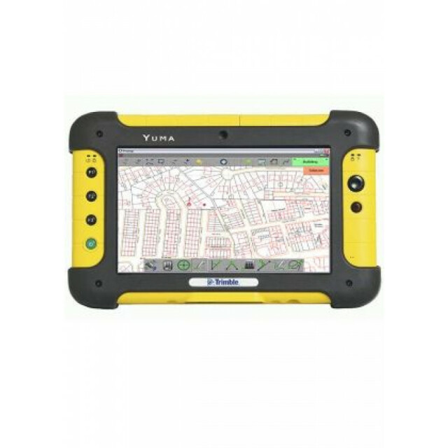
Description
Specifications
-
General
-
Year of introduction
2010
Main design elements
hardware and software
Total Weight [kg]
1.4
Width [m]
0.23
Height [m]
0.14
Depth [m]
0.05
Resolution: horizontal pixels
1024
Resolution: vertical pixels
600
Display: width [m]
0.155
Display: height [m]
0.09
-
More information
-
Main applications
utilities; surveying; cadastre; archaeology; geology
Distinguishable features
touch interface - no stylus required; very intuitive to use; real-time map display; GPS; total-station; laser rangefinder; cm-accuracy
-
Software
-
Name of GIS package
EncoreT
Zooming
Y
Panning
Y
Map rotation
Y
Editing of points
Y
Editing of lines
Y
Editing of polygons
Y
Editing of attributes
Y
Query
Y
Sketching of notes on map
Y
Display of external data and photos
Y
Measurements: length
Y
Measurements: area
Y
Import/Export Formats
Autodesk; ESRI; Smallworld; CSV
-
Connectivity
-
User Interfaces
touch
Wireless Data Transfer
Y
Bluetooth
Y
Ports
serial; usb
-
GNSS Receiver
-
GNSS Systems Supported
GPS; Glonass; Galileo
Number of Channels
220
Integrated SBAS
Y
Update Rate [Hz]
20
Time to first fix after cold start [s]
10
Multipath Mitigation
Y
Compatible GNSS correction signals
-
Computer
-
Processor
Intel Atom 1.6GHz
RAM [MB]
1024
Hard Disk [MB]
32000
Types of Replaceable Memory
SDIO; ExpressCard 34mm
Built-in Camera: megapixels
2
Audio: speaker
Y
Range measurement
Y
Operating System
Windows 7
Hard Disk
-
Operation Characteristics
-
Integrated sensors
Operating temperature: min. [°C]
-30
Operating temperature: max. [°C]
60
Water and dust proof [IP]
IP67
Shock proof
1.22m; IP67; MIL-STD-810F
Operation time per battery [hr]
8
Battery Field Replaceable
Y


