


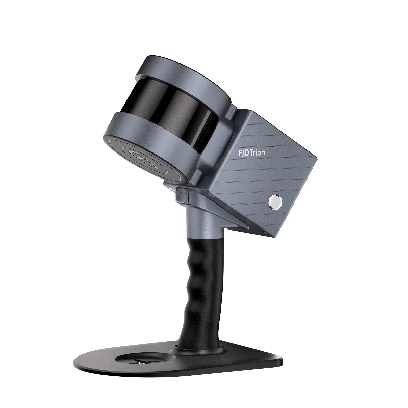


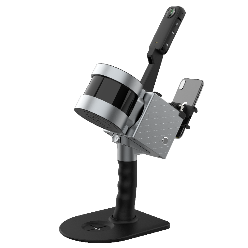

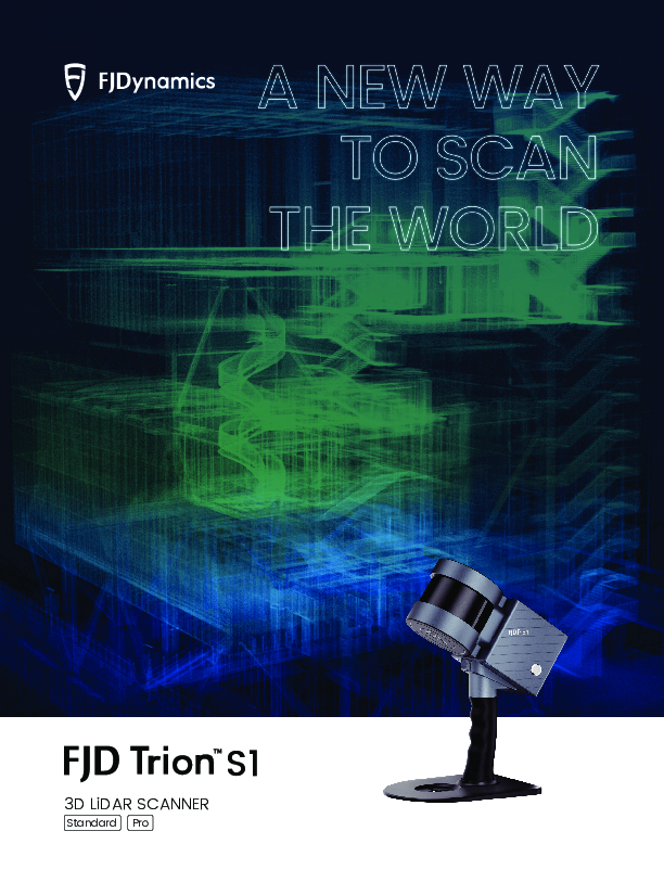
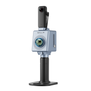
FJD Trion S1 Handheld LiDAR Scanner
A New Way To Scan The World
With an industry-leading SLAM algorithm, S1 and S1 Pro can quickly capture high-quality scans, while processing and displaying accurate point clouds on the mobile terminal in real-time.

FJDynamics
Singapore
Description
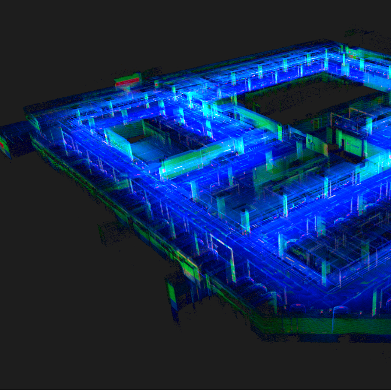
Real-time Point Cloud
Powered by a leading SLAM algorithm, the FJD Trion S1 builds your reality as you scan. Capture indoor and outdoor environments as you walk, and view real-time point clouds on your mobile device.
320,000 / 640,000 Points Per Second
Up to 2 cm relative accuracy
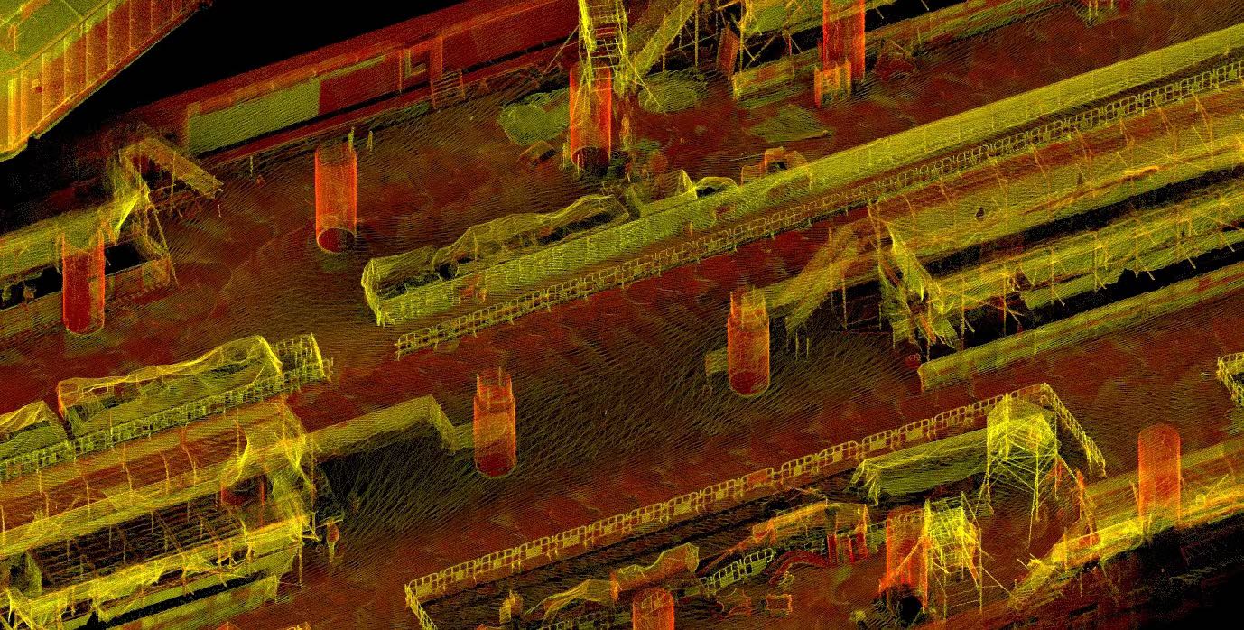
Repeatable Accuracy, Long-Range Measurement
Scan a 100 m²/1,000 sq ft area in just 2 minutes with Trion S1 3D LiDAR scanner allows you to capture precise long-range 3D measurements of complex objects and shapes from up to 120 meters.
360° Vertical FOV
270° Horizontal FOV
120 m Range
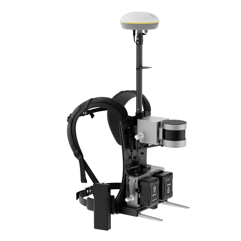
Dual Battery
Hot-swappable dual batteries for uninterruptible power supply. Reliable SLAM for scanning across multiple floors.
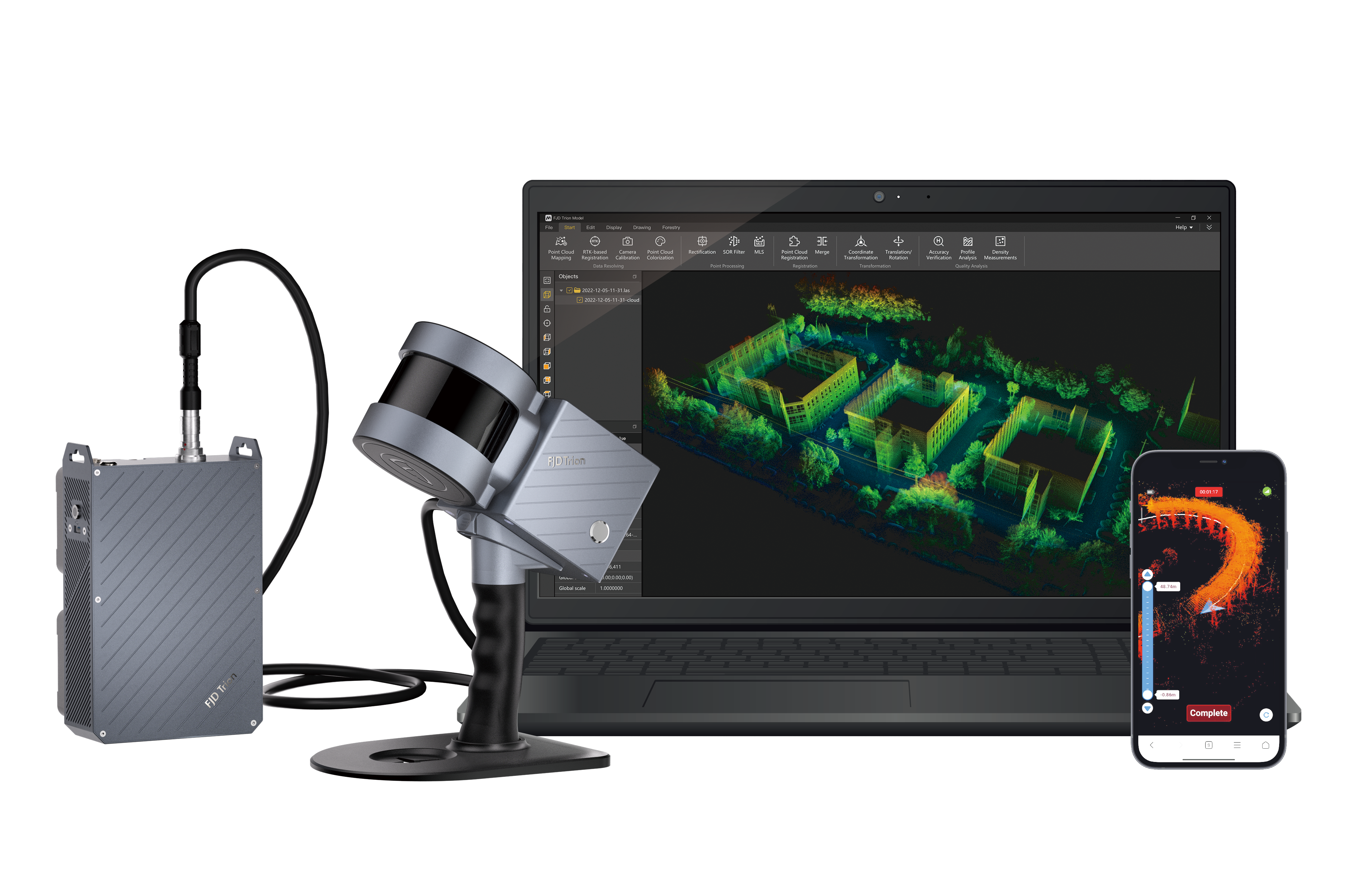
Complete Point Cloud Solution
FJD Trion Scan
Real-time point cloud visualization software
Enhance your scanning experience with the FJD Trion Scan software. This real-time visualization tool can help you monitor the scanning process thus ensure a complete data capture in one scan.
Real-time point clouds
Project visualization and management
Battery and storage display
FJD Trion Model
Post-processing software
FJD Trion Model is a PC-based complete point cloud processing solution that enables denoising, colorization, stitching, and classification of point clouds. Industry-specific modules empower quick and seamless results for like floor plan generation for construction, volume calculation for tunnels, and tree segmentation for forestry.
Application Scenarios
The Trion S1 is designed for both indoor and outdoor scanning, making it perfect for a wide range of scenarios including scan to BIM, property management, building surveys, forestry surveying, facility digitization, heritage conservation, mining and tunnels, and more.
Do you have questions about this product?
- Questions about price, availability, and/or retailers
- Questions about technical specifications and usage
- Questions about suitability for your project or application
Specifications
-
General
-
Total Weight [kg]
1.8
Year of introduction
2022
-
Application
-
Main applications
Point cloud model, BIM, volume calculation, area calculation, forestry, mining, asset digitization, heritage conservation
Main users
BIM, AEC professionals, mining professionals, surveyors
-
Scanning Characteristics
-
3D measurement accuracy [mm]
20
Calibration
No calibration needed
Color registration
Y
Data aquisition speed (points p/second)
320,000
Laser Class
I
Max. horizontal field of view [deg]
270
Max. Range [mm]
12000
Max. vertical field of view [deg]
360
Scanning Speed
100 m2 or 1000 sq ft scanned in 2 min
-
Operation Characteristics
-
Operating temperature: max. [°C]
50
Operating temperature: min. [°C]
-10
Humidity range [%]
90
-
Power
-
Battery type
External hot-swappable batteries
Scan time per battery [h]
2
-
More information
-
Distinguishable features
Multiple configurations, efficient LiDAR mapping, hot-swappable battery
-
Functionality
-
Mesh as output
Y
Other Formats
.las, .pts, .pcd, .ply
Real time visualization during scanning
Y
Software name
FJD Trion Model
max. size of model [points]
100000000
-
Connectivity and Sensors
-
Bluetooth
N
Other Sensors and Ports
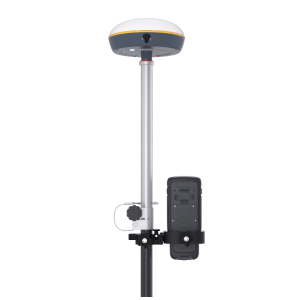
External camera for colourized point clouds. RTK for georeferenced point clouds.
USB Port
Y
WiFi
Y
Documents
Brochure
EN_20230824_FJD Trion S1_Brochure.pdf
7.21 MB
Other documents
-
EN_20230905_S1 Stablizing Vest_Brochure.pdf1.35 MB
Videos


