


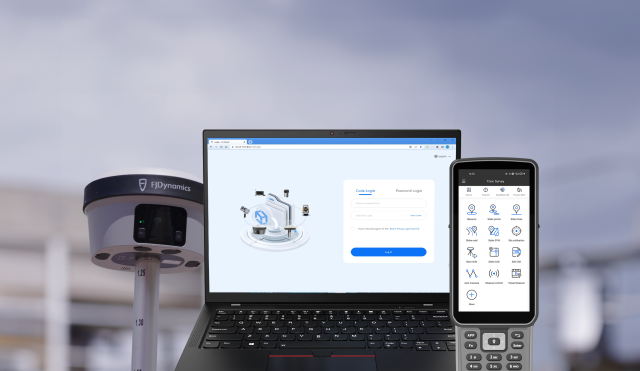


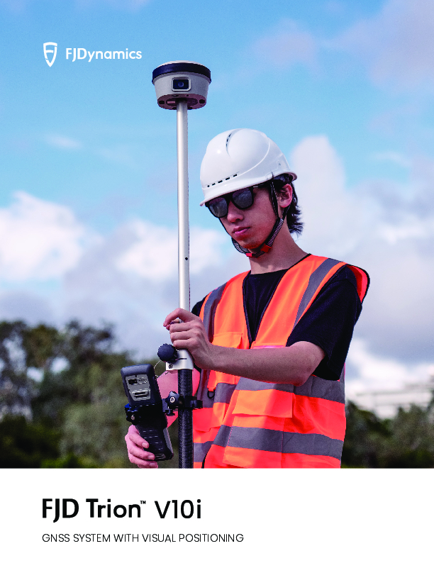
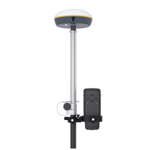
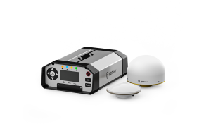
FJD Trion V10i GNSS System with Visual Positioning
Precision Redefined: Vision Beyond Coordinates
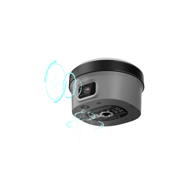
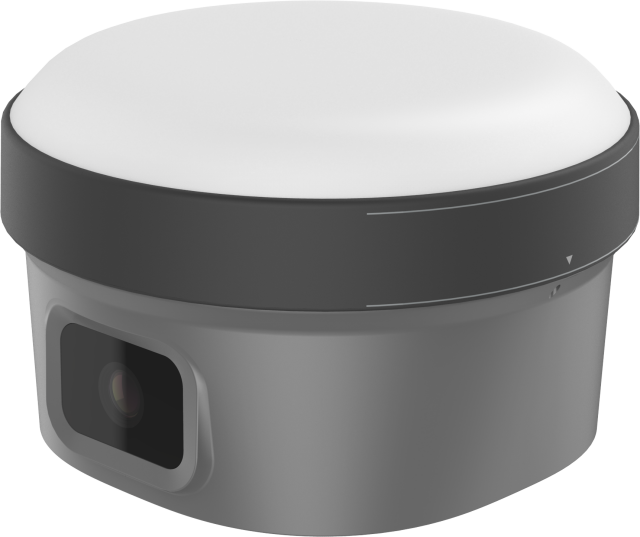
Grab the V10i and get measuring. Integrating GNSS, IMU and 2 cameras, the V10i gives you real-time visual guidance on stakeouts and a next-level productivity boost in operations in hard-to-access locations.

FJDynamics
Singapore
Description
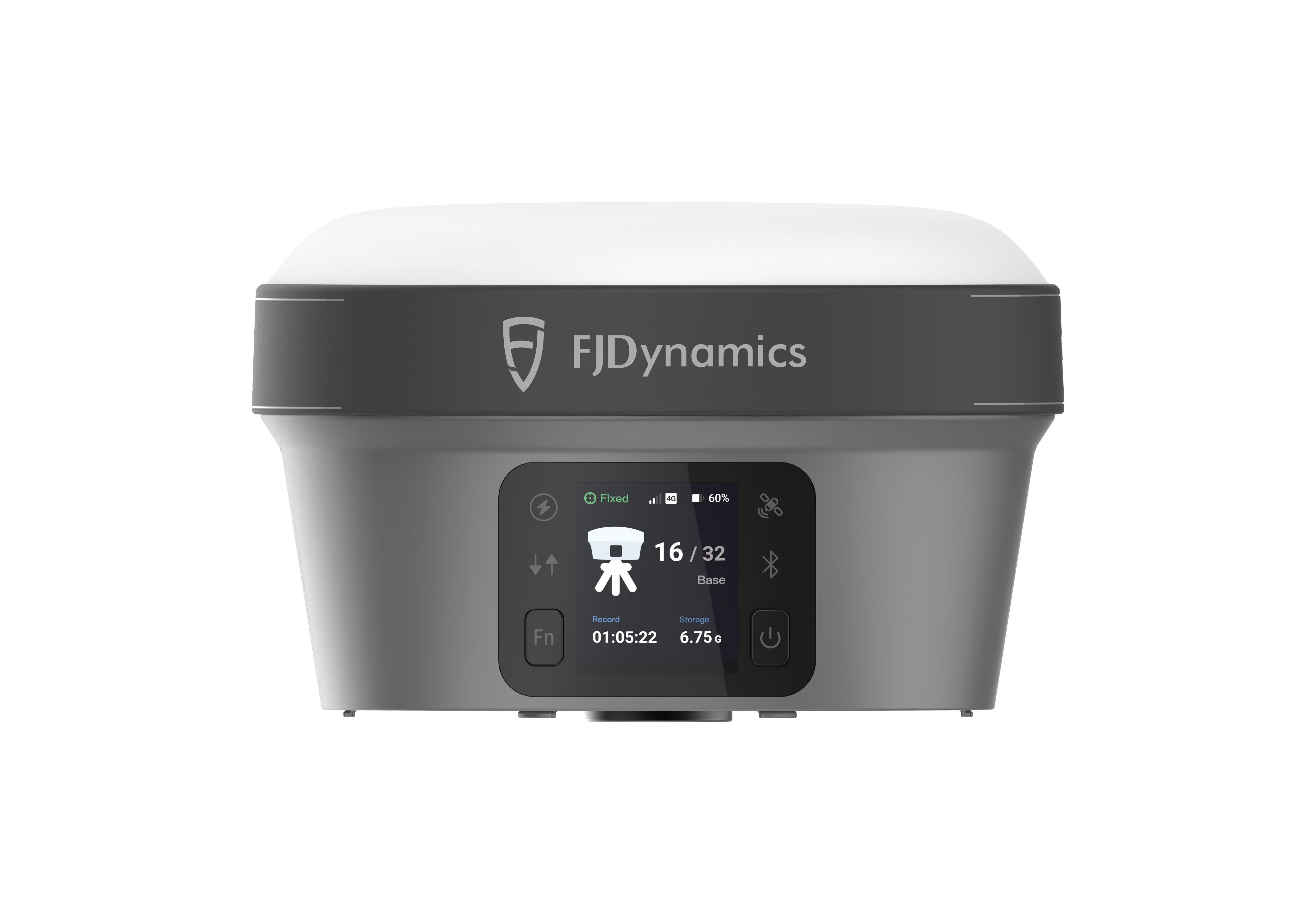
Capture More, Worry Less
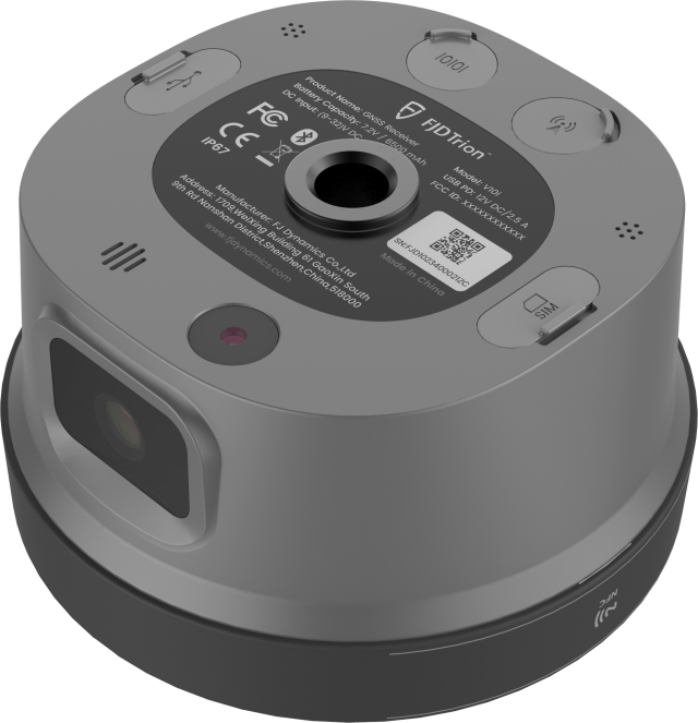
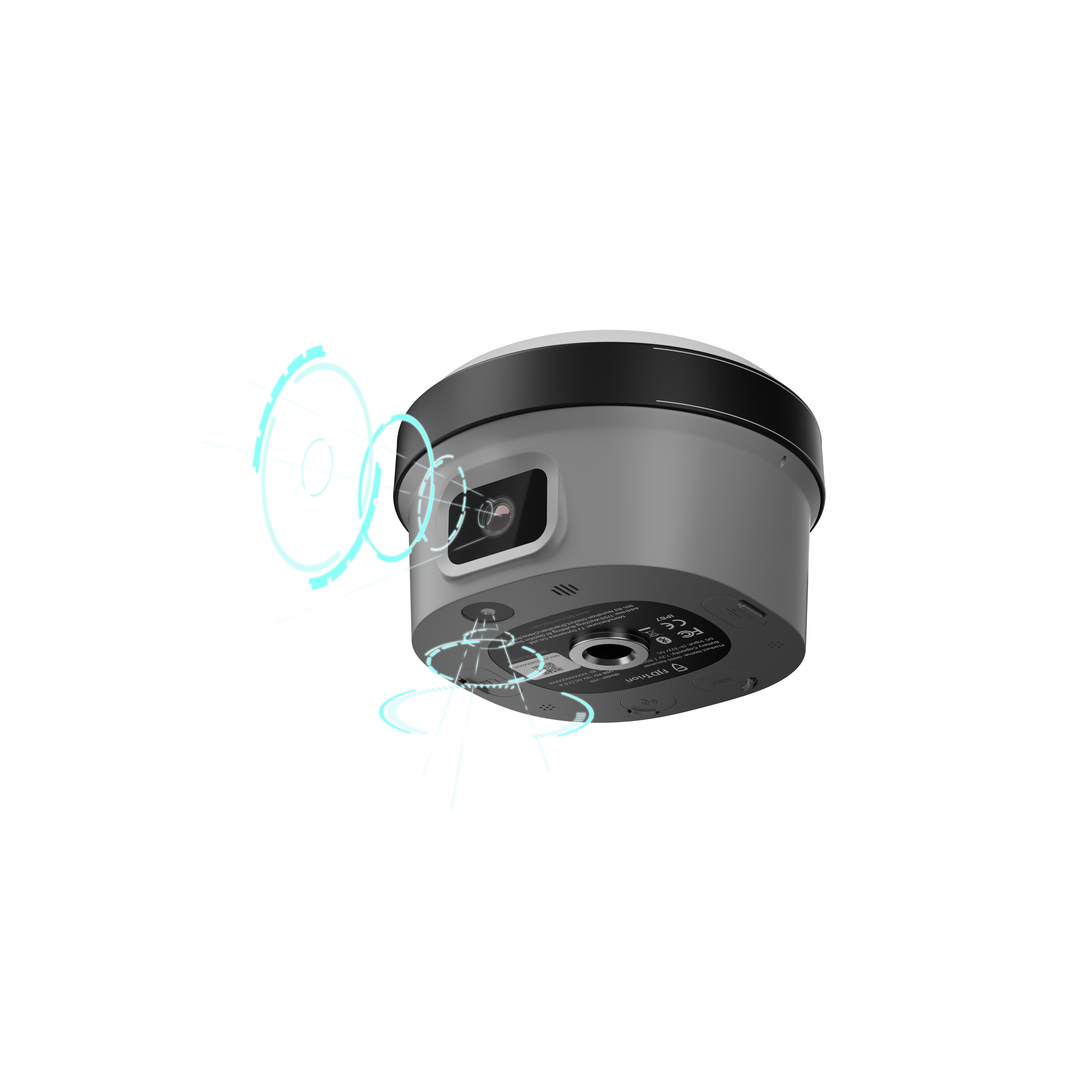
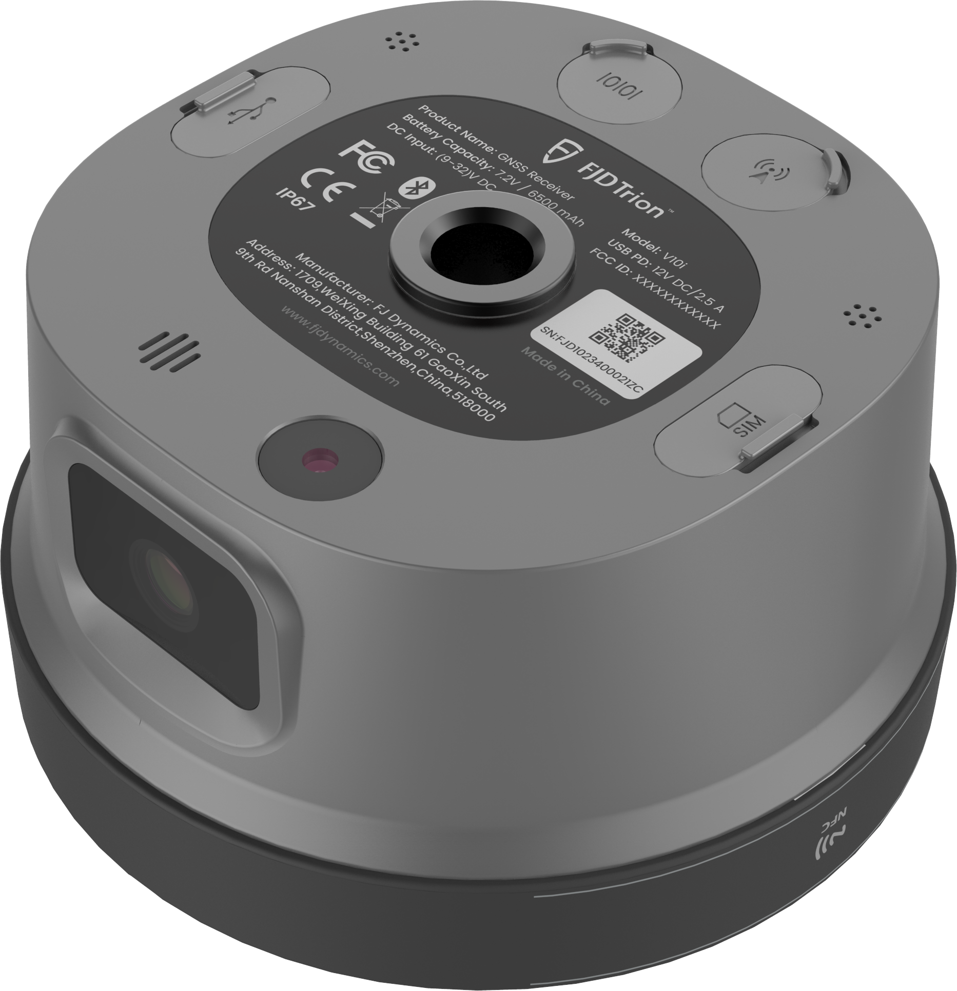
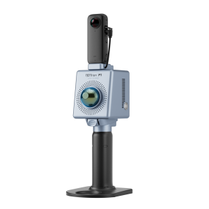
The V10i is designed to get the data you need even if the location is obstructed, dangerous, or inaccessible by foot. The onboard processing software, along with a 2 MP front camera and a 5 MP downward camera equipped with global shutters, seamlessly generate coordinates and measurements directly on the field controller. View and save coordinate information with just a few taps.
Visual Positioning and AR Stakeout
Dual cameras: global shutter, 2MP forward, 5MP downwardIMU-based
Tilt Compensation
Max tilt 60°, calibration-free
RTK Accuracy
H: 8 mm + 1 ppm RMS
V: 15 mm + 1 ppm RMS
Rugged Reliability
IP68, 2 m drop-proof
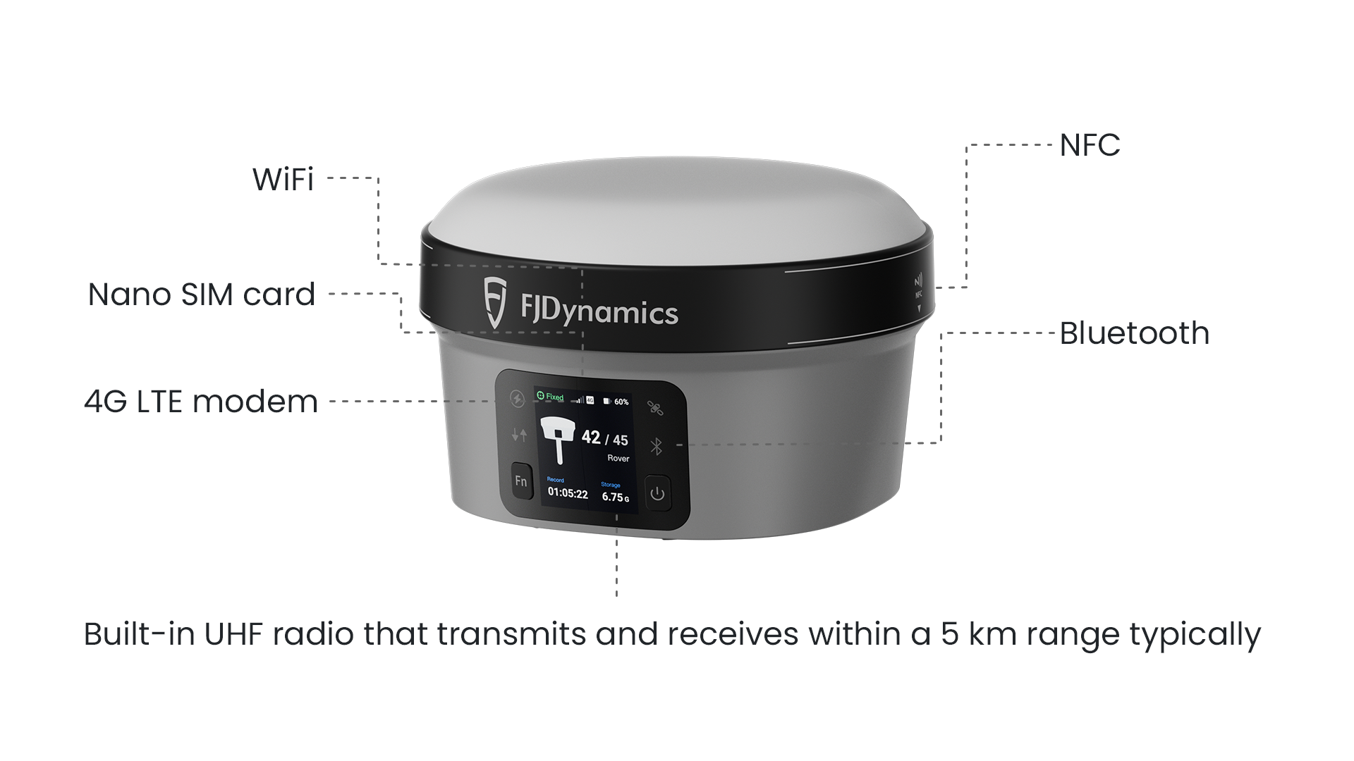
Consistent Connectivity
Built-in 4G LTE and UHF, supports NFC, WiFi, and Bluetooth
Global Constellations Supported
1408 channels; GPS, GLONASS, Galileo, Beidou, QZSS, SBAS, IRNSS
Maximize Safety and Mission Control
AR Stakeout
Stay safe as you get mission-critical data, let AR Stakeout guide you in the field. Measure and stake out points by following on screen instructions and never needing to traverse dangerous locations or busy traffic.
Tilt Compensation
IMU-based tilt compensation lets you measure points easily and requires no calibration at up to 60°.
Enhance Productivity with Trion Survey Cloud
Field and Office in Sync
Seamlessly connect field and office teams. Transmit field data and project updates in real-time, expediting work on both ends. No more waiting, just productivity.
Easy Project Management
Share system parameters and set up data, including coordinate systems, geoid models, and datum grid files.
Consistent connectivity
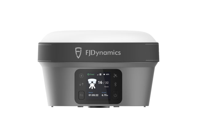
Never worry about losing data transmission when you're in the field. Check connection status on the large, 350 nits OLED screen with a quick glance, even in direct sunlight.
Do you have questions about this product?
- Questions about price, availability, and/or retailers
- Questions about technical specifications and usage
- Questions about suitability for your project or application
Specifications
-
General
-
Housing Material
Aluminum Magnesium Alloy
Total Weight [kg]
1
Year of initial introduction
2023
Type
Land
-
Performance
-
No. channels
1408
Reacqisition time [s]
1
RTK Network Compatibility
CORS
Tracked satellite signals
GPS, GLONASS, Galileo, Beidou, QZSS, SBAS, IRNSS.
-
Environment
-
Humidity resistance
95% non condensing
Operating temperature: min. [°C]
-30
Operating temperature: max. [°C]
60
Shock and vibration proof
Yes
Water sand and dust proof
IP67
-
Communication: general
-
Communication ports
BT4.2 & BLE, 7-pin Lemo port, UHF antenna port
Bluetooth
Y
-
Horizontal uncertainty
-
Initialization time on the fly [s]
5
Range on the fly [km]
5
-
Power
-
Operating time with internal power supply [hr]
15
-
More information
-
Distinguishable features
Integrates IMU, 2 cameras for ultimate efficiency.
Documents
Brochure
EN_20231203_FJD Trion V10i_Brochure.pdf
6.8 MB
Videos

