


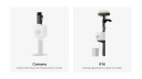


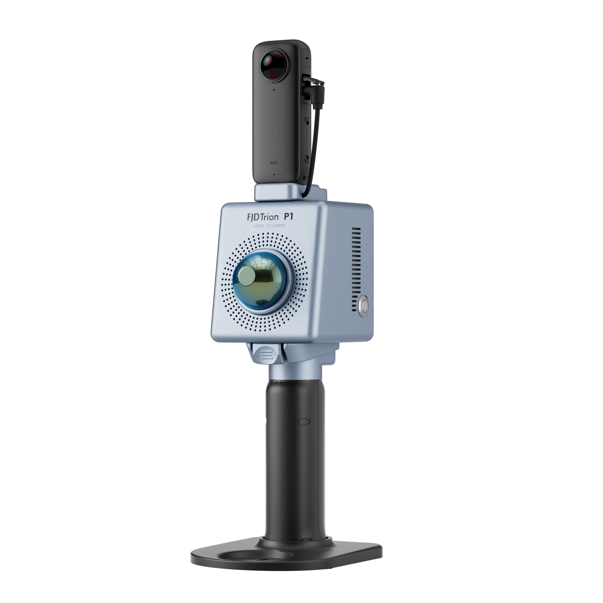


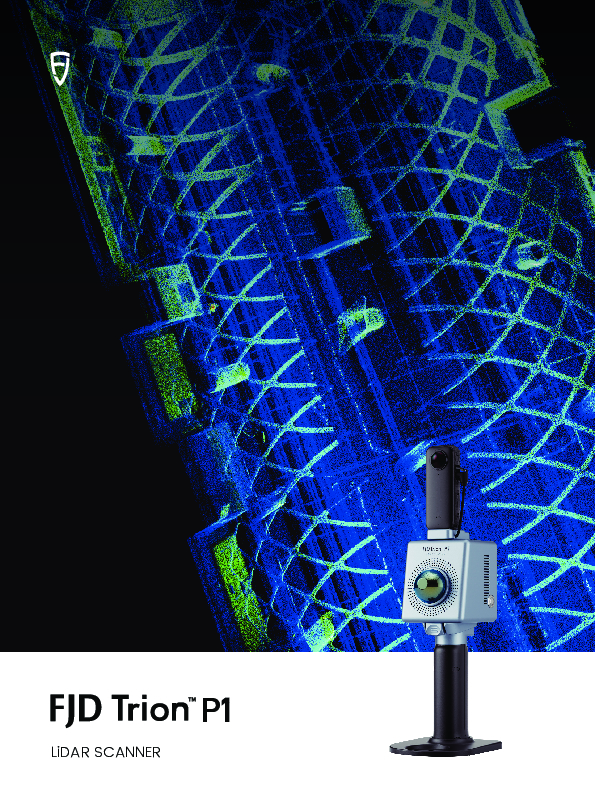
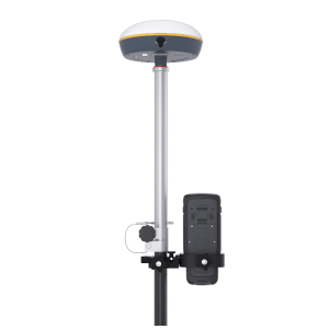
FJD Trion P1 LiDAR Scanner
New Demensions Unfold
Whether you are a seasoned laser scanning pro or just curious about capturing your world in 3D, a walk around the site with the SLAM-empowered FJD Trion P1 lets you digitize your environment quickly and accurately.

FJDynamics
Singapore
Description
Easy Reality Capture
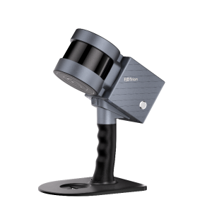
The FJD Trion P1 is designed for grab-and-go scanning missions.
Relative Accuracy: Up to 2 cm
Scanning Range: 40 m @ 10% reflectivity
LiDAR FOV: 360° × 59°
200,000 pts/s
Lightweight and Portable: 1.15 kg / 2.51 lbs
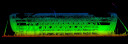
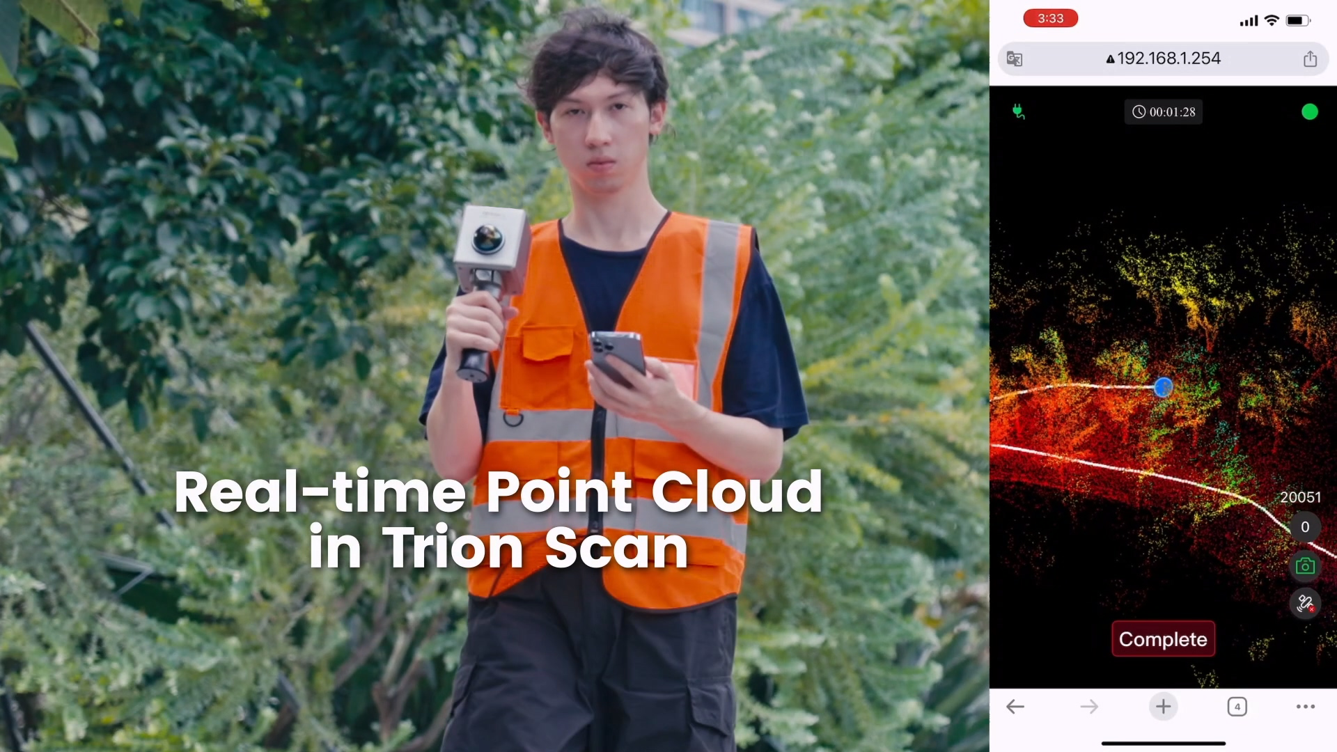
Real-time Point Cloud: Visualize your mission on Trion Scan
Indoor, Outdoor, Underground, all Day Long
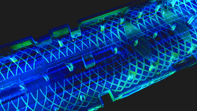
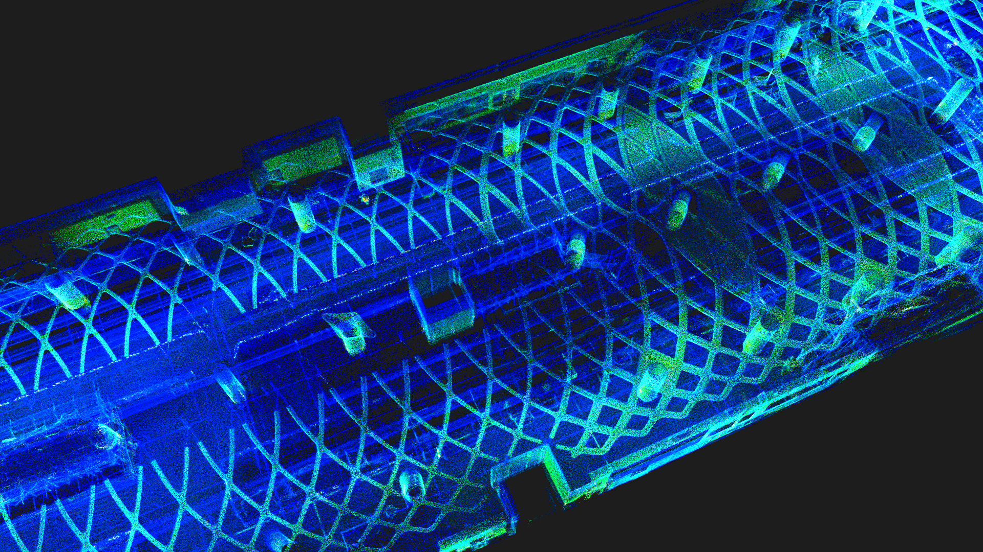
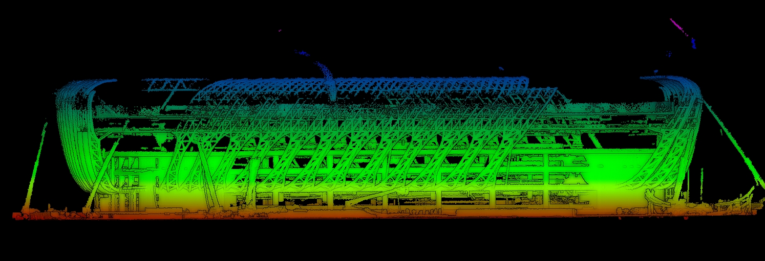
Advanced SLAM technology on the P1 lets you map the environment with intricate details inside and outside. Buildings, tunnels, forests, pipes, or even accident scenes can be captured in minutes. You don’t need to worry about lighting either, as long as you can point the P1 at an object, you will be able to see it recreated before your eyes.
Compact Design that Packs a Whole Lot of Performance
The P1 weighs only 1.15 kg with the fisheye camera and grip battery. You can put it in a messenger bag and bring it anywhere easily. A quick battery swap will let you work all day, with each battery lasting 2 hours.
A Simple Workflow
Capture data
Walk and scan with the P1, while viewing the real-time point cloud data on your mobile device via FJD Trion Scan. Check for data completeness and note the loop closure numbers to ensure enough data is captured for proper post-processing. A stadium with a 550-meter diameter only takes 7 minutes to capture.
Analyze data
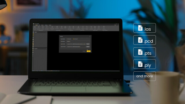
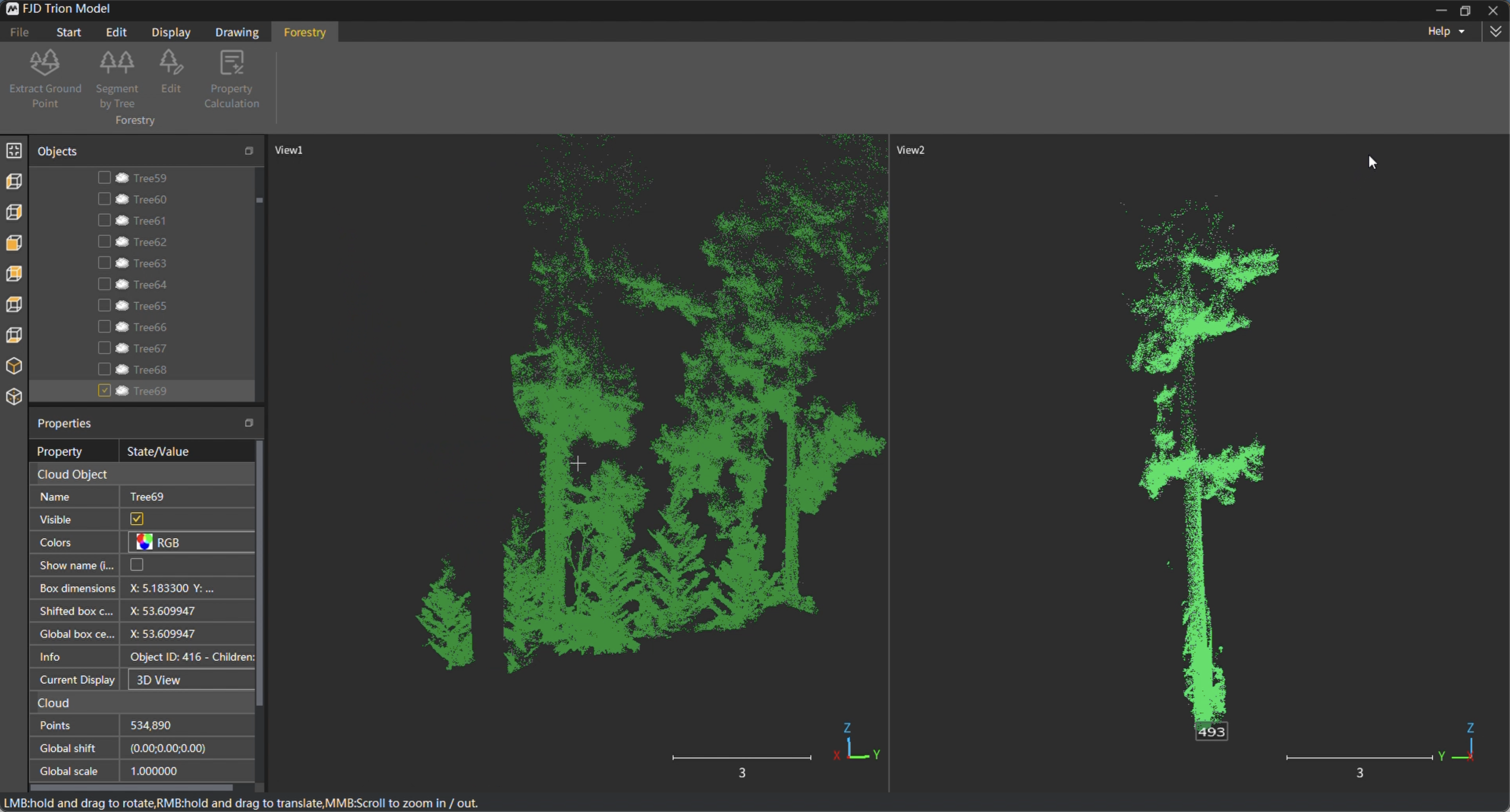
The P1 produces universal point cloud data formats in las, pcd, pts, and ply. Download and import the field data into the Trion Model point cloud processing software or a compatible third party software program to classify, register, and calculate point cloud data for your specific application.
The optimized processing speed allows you to process a project in 1/3 of the time it takes to capture the data.
Generate a variety of deliverables
Generate deliverables such as contour maps, distance, area, and volume calculations, floor plans, tree and forest analyses, and 3D models like BIM, DEM, and 3D mesh.
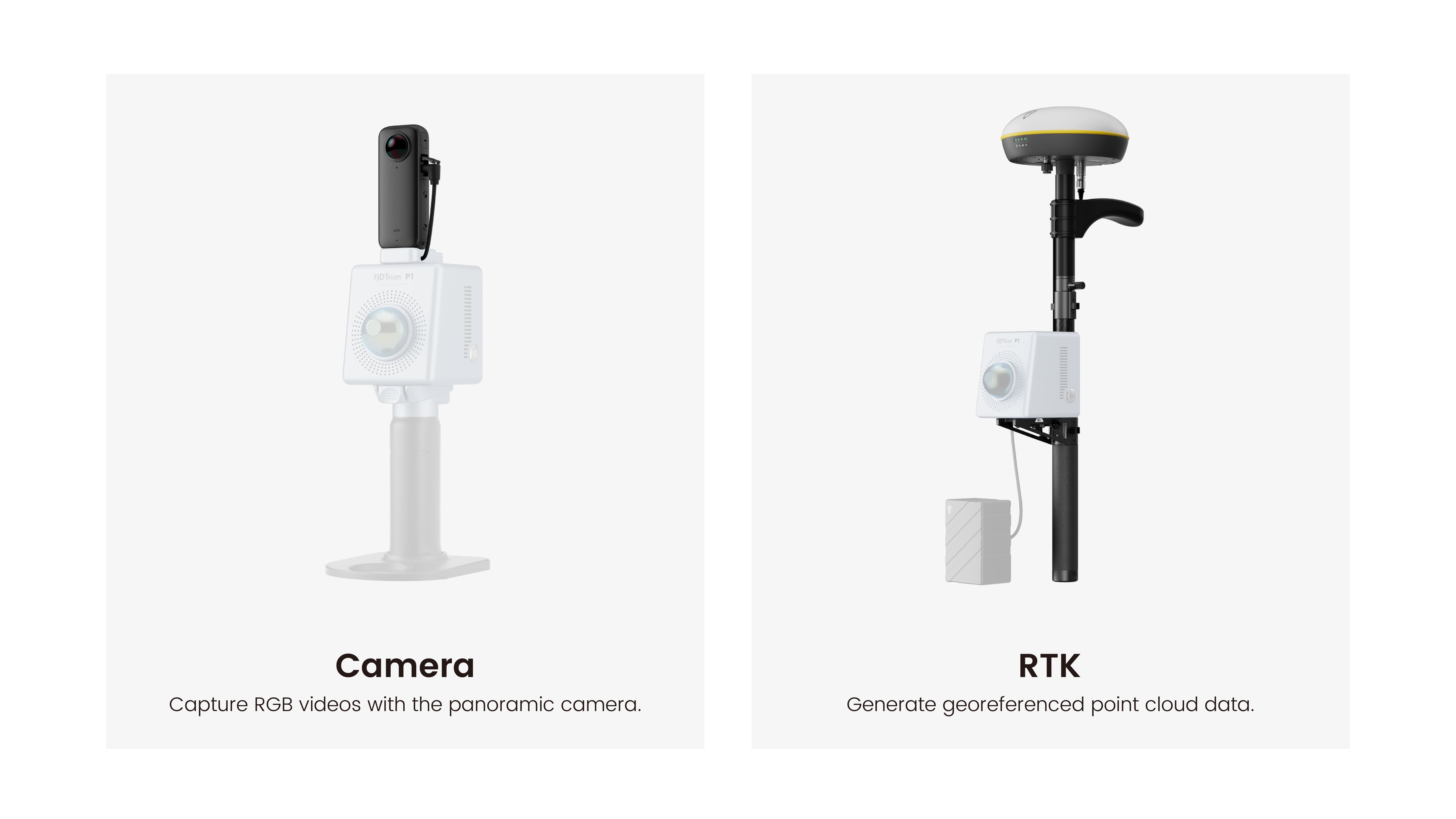
Multiple Configurations
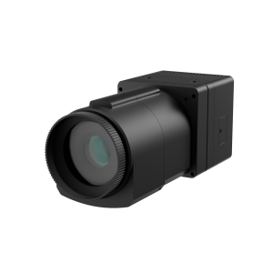
Integrate the P1 into your workflow to maximize efficiency in data capture. Capture RGB videos with the fisheye camera, or generate georeferenced point cloud data with an RTK rover attachment.
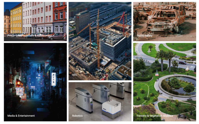
Application Scenarios
Property Management and Assessment
Assess structural integrity, plan spaces, and identify areas in need of repair or renovation. Reduce uncertainty in investment decisions with insights from a rich spatial dataset.
Public Safety
Leverage point cloud data to enhance disaster preparedness and recovery plans. Quickly record evidence and crime or accident scenes for immediate and accurate forensic documentation.
AEC
Make more informed decisions on your projects from blueprint to QA/QC with building surveys, scan to CAD&BIM, as-built documentation, floor plans, and stockpile volumes.
Media and Entertainment
Craft new realities based on real-world inspirations. Whether you're creating video games, virtual tours, or cinematic environments, capture the essence of both indoor and outdoor settings.
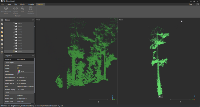
Forestry and Vegetation Analysis
Manage and monitor tree inventory with a quick walk in the forest. Measure crowns, analyze breast diameter and tree height using precise point cloud data.
Robotics
Facilitate communications between teams before and during robotics deployment. Plan routes and enhance robot obstacle avoidance with 2D maps and 3D models of the environment.
Do you have questions about this product?
- Questions about price, availability, and/or retailers
- Questions about technical specifications and usage
- Questions about suitability for your project or application
Specifications
-
General
-
Total Weight [kg]
1.15
Year of introduction
2023
-
Application
-
Main applications
Point cloud model, BIM, volume calculation, area calculation, forestry, mining, asset digitization, disaster preparedness
Main users
BIM, AEC professionals, mining professionals, game designers, real estate, property management, property valuation, forensic teams, firefighters.
-
Scanning Characteristics
-
3D measurement accuracy [mm]
20
Calibration
No calibration needed
Color registration
Y
Data aquisition speed (points p/second)
200,000
Laser Class
Class 1/λ 905nm
Max. horizontal field of view [deg]
360
Max. Range [mm]
7000
Max. vertical field of view [deg]
59
Min. Range [mm]
1000
Scanning Speed
550 m diameter stadium scanned in 7 min
wavelength light source [nm]
950
-
Operation Characteristics
-
Operating temperature: max. [°C]
45
Operating temperature: min. [°C]
-10
Humidity range [%]
90
-
Power
-
Battery type
Grip battery
Scan time per battery [h]
2
-
More information
-
Distinguishable features
Ultra lightweight, multiple configurations, fast LiDAR mapping
-
Functionality
-
max. size of model [points]
10000000
Mesh as output
Y
Other Formats
.las, .pts, .pcd, .ply
Real time visualization during scanning
Y
Software name
FJD Trion Model
-
Connectivity and Sensors
-
Bluetooth
N
INS
N
Other Sensors and Ports
External camera for colourized point clouds. RTK for georeferenced point clouds.
USB Port
Y
WiFi
Y
Documents
Brochure
EN_20231214_FJD Trion P1 Brochure.pdf
8.34 MB
Videos

