Drone System for Bathymetry with Echo Sounder
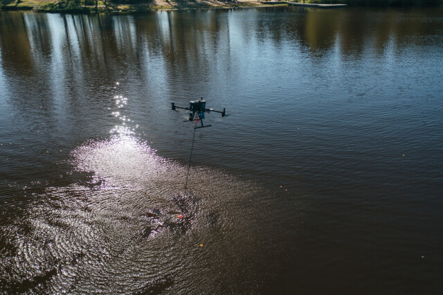
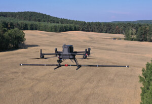
The standard measurement tool for bathymetry is echo sounding, and the survey process involves the use of a ship, boat or unmanned surface vehicle (USV) as a platform for the sensor. An alternative is to fly a drone (UAV) to carry the echo sounder. A drone is compact and easy to transport and deploy. Drones also have a high precision of following planned survey lines and can be used in any place where there is at least a small area for take-off and landing near the surveyed water surface.

SPH Engineering
Balozi, LV
Description
Bathymetry is the measurement of the depth of water in oceans, rivers, or lakes. The standard measurement tool for bathymetry is echo sounding, and the survey process involves the use of a ship, boat or unmanned surface vehicle (USV) as a platform for the sensor.
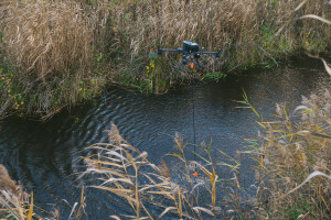
Sometimes, the use of a boat can be complicated, especially in the case of small or hard to reach rivers and lakes. The use of USV is not feasible in every situation either. Firstly, it is necessary to have a good point of entry to the water for deployment/recovery. Secondly, it may be impossible to use USV in shallow lakes with lots of seaweed. Last but not least, in many cases, USV should be big enough to resist the waves and a big car may be necessary to transport it.
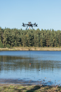
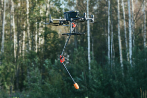
An alternative is to fly a drone (UAV) to carry the echo sounder. A drone is compact and easy to transport and deploy. Drones also have a high precision of following planned survey lines and can be used in any place where there is at least a small area for take-off and landing near the surveyed water surface.
The system includes:
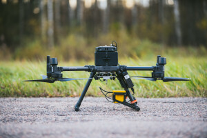
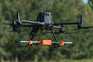
A commercially available drone like DJI M350 RTK, DJI M300 RTK, M210 or M600 Pro (as well as drones based on the Pixhawk autopilot)
Echo sounder sensor on a rope (cable)
Radar altimeter to measure the precise altitude of the drone over the water surface
On-board computer SkyHub to control the mission and store geotagged measurements
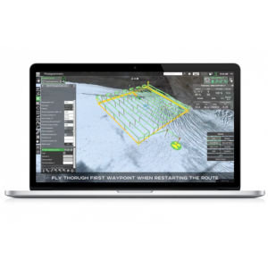
UgCS Expert ground control software
SPH Engineering offers three standard options available with different echosounder sensors:
Do you have questions about this product?
- Questions about price, availability, and/or retailers
- Questions about technical specifications and usage
- Questions about suitability for your project or application
Specifications
-
General
-
Year of initial development
2021
-
System integration
-
Data displayed in real time
Depth below transducer, depth profile
Real-time sound velocity and temperature profile inclusion
Y
Remote operation capability
Y
Supported external data inputs
position, roll & pitch, tide
-
Mode of operation
-
Number of simultaneous frequencies
2
Documents
Brochure
SPHE Integrated Systems - Echo-sounder-SystemDescription.pdf
5.2 MB

