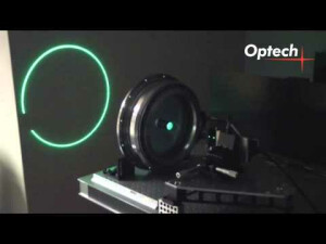
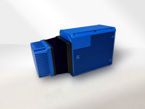
CZMIL Supernova
Topo / Bathy multichannel green and infrared laser scanning system.
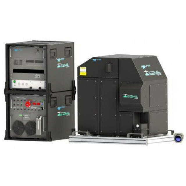
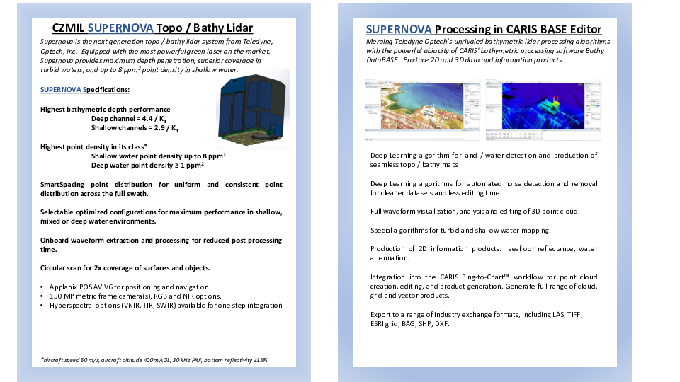
Supernova is the next generation topo/bathy lidar system from Teledyne Geospatial. Equipped with the most powerful green laser on the market, Supernova provides maximum depth penetration, superior coverage in turbid waters, and up to 8 ppm2 point density in shallow water.
Teledyne Geospatial
Vaughan, CA
Description
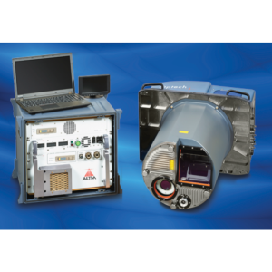
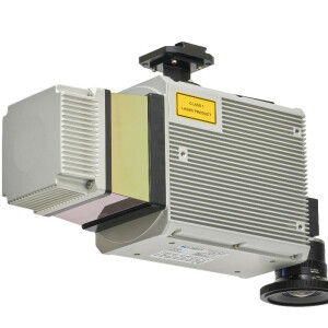
Teledyne Optech Inc. has been making laser systems for over 40 years for space, airborne and fixed applications. Participating with the US Navy, Army Corps of Engineers and NOAA, Teledyne Optech developed the first airborne green laser scanning system, SHOALS (Scanning Hydrographic Oceanographic Airborne Laser System). Continuing the Army / Navy /NOAA partnership, the survey consortium JALBTCX (Joint Airborne Lidar Bathymetric Technical Center of Expertise) was born. The next development was the Coastal Zone Mapping Imaging Lidar (CZMIL) system, which first flew in 2012; there are now 9 systems worldwide. Improvements in the CZMIL system electronics and processing produced the Nova system. Now, in 2021, the CZMIL Supernova is introduced. This system has the deepest depth penetration on the market, yet can be programmed for shallow water surveys where water can be optically complex and higher point densities can be required. Key products points:
- Programmable for deep, shallow and topographic modes
- Best depth penetration on the market: 4.4 /Kd for deep channel and 2.9/Kd for shallow channel
- SmartSpacing mode for more even point distribution across the swath
- Onboard real-time data processing - land the survey flight with a point cloud
- CARIS Base Editor software for data processing, visualization and product generation
- CARIS Bathy Database for data management and exploitation
Do you have questions about this product?
- Questions about price, availability, and/or retailers
- Questions about technical specifications and usage
- Questions about suitability for your project or application
Specifications
-
General
-
Year of introduction
2012
Year of last update
2021
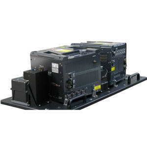
Total Weight [kg]
287
Power requirements
85 A; 28 VDC
Type of GNSS/INS positioning system
Applanix POS AV V6
Camera
150 MP RGB metric frame camera with Infrared sensor head option (Phase One)). Hyperspectral options for VNIR, SWIR, Thermal
Data storage facilities
Removable solid state disks
Mission planning software
Optech Airborne Mission Manager (AMM)
Postprocessing software
CARIS Base Editor
-
Application
-
Main applications
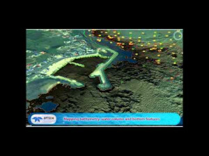
Seamless bathymetric data generation in clear waters to 80m and turbid water; nautical charting; shallow coastal area monitoring; navigation hazard detection; seafloor reflectance image and classification for environmental assessment. Results include high accuracy bathymetry (to 80 m) with seamles data transition to topography; true water column characterization; submerged object detection; bottom feature classification; unmatched shallow and turbid water results.
-
Measurement Characteristics
-
Scanning method
Circular prism scanning
Scan frequency [Hz]
27
Min. pulse frequency [Hz]
10,000
Max. pulse frequency [Hz]
30,000
Max. field of view [deg]
40
Max. number of recorded echoes per pulse
Full waveform
Full-wave form digitization
Y
Pulse sampling frequency [GHz]
1
Recording of intensity of return signal [bits]
12
multiple pulses in air
N
-
Operation Characteristics
-
Platform
Helicopter, Fixed-wing
Min. flying height [m]
300
Max. flying height [m]
600
Max. acquisition time [hr]
999
-
Laser Pulse Characteristics
-
Wavelength [nm]
532
Beam divergence [mrad]
7
Type/class laser
Class IV
Eyesafe range [m]
260
-
Uncertainty and resolution
-
Elevation precision at 1 km [m]
0.05
Planimetric precision at 1km [cm]
40
Pitch and roll pointing precision [deg]
0.005
Heading pointing precision [deg]
0.01
-
Application areas
-
Select an application area:
Documents
Brochure
supernova-productsheet-specifications-01-27-2021.pdf
276.45 KB
Other documents
-
Protecting our oceans withOptech CZMIL7.29 MB


