SuperSurv 10.2
SuperGIS Mobile products help users to accomplish various tasks during field works, such as spatial data collection, online service integration, data synchronization, waypoint guidance, and more. Find the mobile GIS that suits your system and experience the power on-site!
Supergeo Technologies Inc.
Taipei, TW
Description
Sync and Manage Data with Novel Cloud Techs
SuperSurv is able to download, upload, and manage data as layers with cloud storage services— Google Drive and Dropbox. By sending the collected data to the cloud, it will enable users to inspect a much broader area than before because they receive the data from their colleagues in real-time. Thus, it saves a lot of time spent on communication.

Build a Team That Collaborates Closely
SuperSurv 10 has significantly extended the capability of using OGC web standards. Besides the already supported WMS and WMTS, this mobile GIS app now make good use of WFS/WFS-T, helping people retrieve, edit, and send back the data to GIS servers with ease. In that way, your field workers can work more closely with the analysts in the office.

Import and Export Spatial Info Effortlessly
Other than widely-used vector and raster data formats, SuperSurv supports Geospatial PDF so that you can add more information to your projects. Quick Report is the function allowing users to export the result of fieldwork in simple layouts. It’s also very useful since users can add them to documents for further uses.

Collect Highly Accurate Location Information
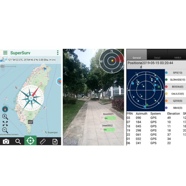
Powerful GPS positioning functions are what we are proud of. Via NTRIP service, you can capture high-accuracy geodata down to decimeter level. Furthermore, a dashboard is added for checking azimuth, system, elevation, and SNR of satellites, enhancing the data quality. Lastly, the Z value collection is supported in SuperSurv 10.

Master Features with Intuitive Interface
Ease-of-use is the core concept when designing SuperSurv. The area for map display becomes larger than before, as well as icons are redesigned, helping people perform different functions and manipulate layers easily. You and your colleagues can master this versatile mobile GIS app immediately.

Specifications
-
General
-
Year of introduction
2019
Main design elements
software
Total Weight [kg]
0
Width [m]
0
Height [m]
0
Depth [m]
0
Resolution: horizontal pixels
0
Resolution: vertical pixels
0
-
More information
-
Main applications
field survey; facility management; road data collection; census investigation; biology research
Distinguishable features
SuperSurv 3.1 integrates with GIS and GPS technologies to help filed surveyors collect spatial data with ease. The mobile GIS application supports common vector layer format (GEO and SHP), allowing users to read the cached map (SGT file) in local machine or connect to the map services published by SuperGIS Server as the base map to increase field productivity.The new editing functions and layer management for offering more user-friendly manipulations. The new editing tools such as feature rotation and snapping can assist users in editing feature on mobile devices more effectively and precisely.
-
Software
-
Name of GIS package
SuperSurv 10.2
Zooming
Y
Panning
Y
Map rotation
Y
Editing of points
Y
Editing of lines
Y
Editing of polygons
Y
Editing of attributes
Y
Query
Y
Sketching of notes on map
Y
Display of external data and photos
Y
Measurements: length
Y
Measurements: area
Y
Import/Export Formats
geo; shp; dxf; sgr; bmp; gif; png; sid; ecw; lan; tiff; jp2; geotiff; spatialite; mbtiles
-
Connectivity
-
User Interfaces
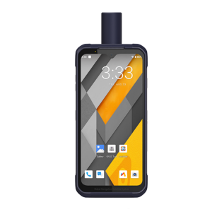
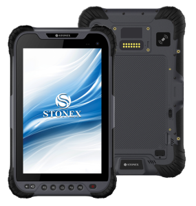
Android; iOS
Wireless Data Transfer
Y
Bluetooth
Y
-
GNSS Receiver
-
GNSS Systems Supported
GPS; Glonass; Galileo; Beidou; SBAS; QZSS
Integrated SBAS
Y
Multipath Mitigation
Y
Compatible GNSS correction signals
-
Computer
-
Processor
N
Hard Disk
Nand Flash
Types of Replaceable Memory
N
Audio: speaker
N
Audio: microphone
N
Range measurement
N
Operating System
Android; iOS
-
Operation Characteristics
-
Integrated sensors

