
PDS Processing Software
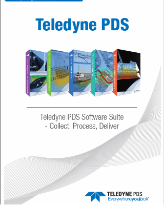
Teledyne PDS – Collect, Process and Deliver
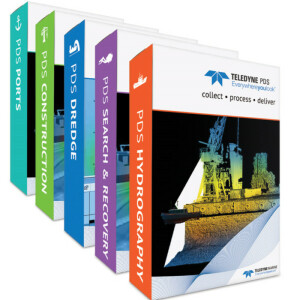
Teledyne PDS is a multipurpose software platform and supports a wide range of tasks within hydrography, dredge guidance, construction support, search & recovery operations and port entrance monitoring. Teledyne PDS is off-the-shelf software and developed to solve the variety of challenges that arise from each specific task in the main business segments served by Teledyne Marine.

Teledyne Marine
Daytona Beach, US
Description
Teledyne PDS is of-the-shelf software and developed to solve the variety of challenges that arise from each specific task in the main business segments served by Teledyne Marine. It interfaces with a wide range of survey instruments such as Lidar, Multibeam and Singlebeam Echosounders, and is an optimal tool for interfacing to a variety of periphery sensors, including dredge and construction sensors, sound velocity measurements, positioning, motion systems and most other devices that output data.
Teledyne PDS is an optimized solution for both Teledyne Marine products and almost all other available systems in the market from recognized manufacturers, and enables immediate data visualization and quality control, so you can view results as images or numerically in real time. The software is designed to be used in the maritime world with an intuitive user interface that is easy to learn. Support is provided worldwide by Teledyne Marine expert surveyors including survey assistance and training of operators.
With Teledyne PDS you only need one software suite to collect, process and deliver data with in the same workflow.
*Teledyne PDS is a Teledyne RESON product line
Learn more about Teledyne PDS at: https://www.teledyne-pds.com
Do you have questions about this product?
- Questions about price, availability, and/or retailers
- Questions about technical specifications and usage
- Questions about suitability for your project or application
Specifications
-
Hardware/software requirements
-
RAM [MB]
4
HD{GB}
500
Use of GPU
Y
Processor
["32-bit","64-bit"]
Stereo Display
N
Field of Use
Multibeam Survey and Processing/Charting; Singlebeam Survey and Processing/Charting; Magnetometer Survey and Processing/Charting; Bar Sweep Survey; MotionScan
Languages Supported
English, Dutch, Russian, Chinese, Espanol
-
General
-
Year of last update
2019
Year of initial introduction
2008
Modules
Editing module is availabe in: Multibeam Survey and Processing/Charting; Singlebeam Survey and Processing/Charting; Magnetometer Survey and Processing/Charting; Bar Sweep Survey; MotionScan
Supported Systems (SB, MB, SSS, Lidar etc.)
Multibeam, Singlebeam, Laserscanner, Motion, Heading, Position, Heave, Tide, SV, SVP, Depth, Doppler, USBL, Magnetometer, ...
-
Processing
-
Sound velocity correction
Single profile support, Multiple profile correction support
Sound velocity correction type
Time
Tidal reduction
RTK-tide, Tide
Support tidal reduction network
Y
Gridding/Interpolation techniques
Circular, Triangular, Directional, Singlebeam
Grid attributes {Std., Mean, Max, etc.}
Hit Count, Z Average, Z Standard Deviation, Z Minimum (Deepest), Z Maximum (Highest), Tim, Total Vert. Uncertainty Average, Total Hor. Uncertainty Average, Backscatter
Lay-back correction
Y
Siant range correction
Y
Mosaic creation
Y
Mosaic creation algorithms
GeoCoder with PDS extensions and PDS UI
SSS Targeting
Yes
Video integration
N
Assessment of bathymetry IHO Cat S-44
Y
Type of automatic cleaning algorithm(s)
Gridmodel, CUBE, Misc. multibeam filtering
Multibeam water column imaging support
Y
Multibeam Backscatter Processing Functionality
Yes
Mulitbeam Calibration mehods
Automatic and Manual
Manual editing capability
Y
-
Geodetic Functionality
-
Supported coordinate systems
Predefined world area based, User defined, World WGS84 - UTM; all are selectable from a database
Geographical Coordinates {Lat, Long}
Y
Ground Coordinates {E,N}
Y
Seven Parameter shift supported
Y
Supported vertical reference frames
Any
Separation model for vertical datum shift support
Y
Local datum support
Y
Ellipsoidal reference support (GRS80)
Y
-
Product Generation
-
Automatic top of pipe calculation
Y
Slope analysis
Y
Dynamic event numbering
Y
Automatic cross profile creation
Y
Volume calculation
Y
Contouring
Y
Sounding Selection methods
Y
Export/Exchange options
PDS, Excel, Simrad EM, CSV, Multibeam points (ASCII), XTF, S7K, Sz, Magnetometer, FAU, GSF, Backscatter points (ASCII), UKOOA P1/90
Combining bathymetry / terrestrial point clouds
Y
-
Visualisation and Editing
-
2D Editing
Y
2D Visualization
Y
Fly-throughs support
N
Area based 3D editing
Y
Area based 3D View
yes
3D View max number points
100000000
3D Integrated models
DXF, 3DS, SKP
Sounding cleaning algorithms
Gridmodel, CUBE, Misc. multibeam filtering, manual
4D support
Y
-
Files and Registering
-
Input Formates {XTF, XYZ, GSF etc}
PDS, XYZ, XTF, S7k, Sz, All, RDF, SON, JSF, MST, SDS, SDF, ...
Max. Number of Soundings
100000000
Supported Hydrographic Systems
Multibeam, Singlebeam, Laserscanner, Motion, Heading, Position, Heave, Tide, SV, SVP, Depth, Doppler, USBL, Magnetometer, ..
Background format support {Google, Bing, OGC, CAD etc.}
S-57, C-MAP, GeoTiff, PDS1000, Microstation (DGN), Esri (SHP), Drawing Exchange Format (DXF), BSB charts (KAP), grid model, TIN model, 3D model
Documents
Brochure
teledyne_pds_application_collection?e=0
Related products