Silas Acquisition
SILAS is a complete data acquisition, processing and interpretation package to cover a wide range of tasks
It is source independent and can handle analogue or digital data from boomers, sparkers, parametric and chirp systems. Used by professionals such as universities, dredgers, geophysical & hydrographic surveyors.
Stema Systems
Geldermalsen, NL
Description
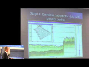
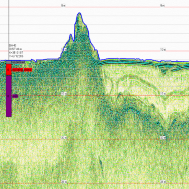
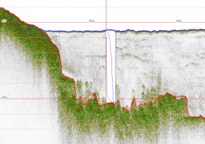
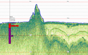
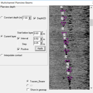
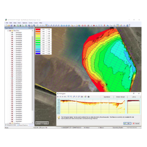
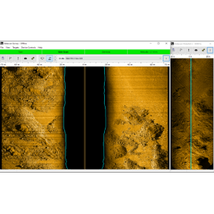
Digital data-acquisition for high resolution seismics Features: - Calibration of source signal - All raw reflection data are recorded on harddisk - Online link with navigation system for synchronisation and position control - Real-time data acquisition control - Vertical data density can be determined by user by setting the sampling rate - Control of the number of samples per shot, without interruption of data acquisition - Adjustment of recorded depth interval - Modifications of settings are recorded in shotheader - Real-time monitoring of reflected signal intensity - Real-time monitoring of incoming data quality - Real-time tracking of seabed/acoustic interface or muddensity level
Specifications
-
General
-
Year of initial development
1996
Year of latest version
2017
Operating System
Win2000, WinXP, Win7, Win8
Area of Application
Hydrography, Geophysics, Fluid mud, Site surveys, Pipeline detection, Cable detection, Object detection
-
Geodetic Functionality
-
Supported coordinate systems
Predefined X,Y coordinates
Supported datum transformations
N/A
Geographical coordinates (Lat, Long)
N
Ground coordinates (E,N)
Y
Seven Parameter shift supported
N
Time-dependent Transformation Parameters (14param)
N
Supported vertical reference frames
N/A
Ellipsoidal reference support (GRS80)
N
Separation model for vertical datum shift support
N
Local datum support
Y
Supported map projections
N/A
-
Data / System Support
-
Recorded data storage formats
.SEI & .XYD
Supported Hydrographic Systems
Multibeam, Singlebeam, Sub-bottom profiler, Boomer, Sparker, Chirp
Supported AUVs
N/A
Supported ROVs
N/A
Supported ROTVs
N/A
Supported underwater positioning systems
N/A
Supported multibeam systems
N/A
Supported surface positioning systems
In combination with survey software
Supported singlebeam systems
Teledyne ODOM / Teledyne Reson / Innomar SES-2000 / Boomer / Sparker / Chirp
Supported sidescan sonar systems
N/A
Supported magnetometer systems
N/A
Supported gyrocompass systems
N/A
Supported motion sensor systems
All
Supported imaging systems
N/A
Supported sub-bottom Profiler systems
Silas EBP-5-10, ODOM CV200-300, Innomar SES, Teledyne Chirp III, All analog systems
Supported ADCP systems
N/A
Supported (underwater) laser scanner systems
N/A
Supported INS
N/A
Metadata management
Y
Time synchronization methods
PPS
Supported total station systems
N/A
-
Online capabilities
-
Helmsman display
N
Max. number cloned displays
N/A
Supported background formats
In combination with Silas Processing
Available real-time cleaning techniques
N/A
Type of navigation screens
2D
Survey data types real-time navigation display
In combination with Silas Processing
Max number of online displayed ROVs
N/A
Max number of online displayed surface vessels
N/A
Computed orientation solution
N
3D real time display
N
Supported 3D display data
N
Real time tidal correction methods
Y
RTK GPS height correction
Y
Real time video integration
N
Real-time Pipe detection
N
Real time IHO / IMCA TPU support
Y
SSS waterfall display
N
SSS target annotations
N
Backscatter display
Y
Online filtering options
N
Status Views equipment
N
Multibeam bathymetry coverage
N/A
GIS integration
N
Remote control
N
Real-time DTM vizualization
N
Online eventing
N
Real-time DTM comparison
N
-
Hardware requirements
-
RAM
256
HD (GB)
8
Processor (CPU)
32-bit, 64-bit
Languages Supported
English


