Silas Processing
Data acquisition, processing and interpretation tool sub-bottom profiling and seismic survey
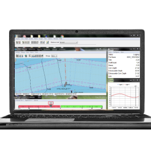
SILAS is a complete data acquisition, processing and interpretation package to cover a wide range of tasks. It is source independent and can handle analogue or digital data from boomers, sparkers, parametric and chirp systems. Used by professionals such as universities, dredgers, geophysical & hydrographic surveyors.
Stema Systems
Geldermalsen, NL
Description
SILAS is a complete data acquisition, processing and interpretation package to cover a wide range of tasks. It is source independent and can handle analogue or digital data from boomers, sparkers, parametric and chirp systems. Used by professionals such as universities, dredgers, geophysical & hydrographic surveyors.
Specifications
-
Hardware/software requirements
-
RAM [MB]
256
HD{GB}
1
Field of Use
Hydrography, Geophysics, Fluid mud, Site surveys, Pipeline detection, Cable detection, Object detection
Languages Supported
English
Processor
[]
-
General
-
Year of last update
2018
Year of initial introduction
1996
Modules
Silas Pro
Supported Systems (SB, MB, SSS, Lidar etc.)
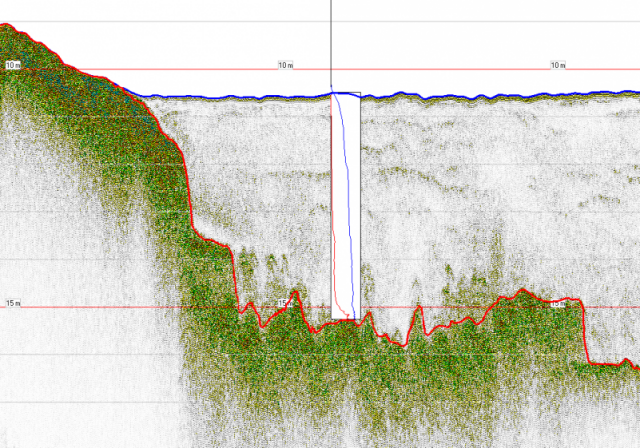
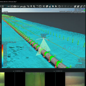
Sub-bottom data, supports sparker, boomer, bubblegun, SBP systems side scan sonars multibeam chirp systems etc. Ultra high reslolution subbottom software for professionals
Area of Application
The system covers the range from deep penetration to ultra-high resolution. Whether you look for general sub-surface geology, cables, pipelines and other objects or fluid mud surveys.
Operator license needed
yes
Product Brochure
yes
Product manual
yes
Supported operation system
Windows
-
Processing
-
Sound velocity correction
Single profile support
Sound velocity correction type
Time
Support tidal reduction network
N
Gridding/Interpolation techniques
No
Grid attributes {Std., Mean, Max, etc.}
N/A
Lay-back correction
Y
Siant range correction
Y
Mosaic creation
N
Mosaic creation algorithms
N/A
SSS Targeting
No
Video integration
N
Number of video channels
0
Assessment of bathymetry IHO Cat S-44
Y
Type of automatic cleaning algorithm(s)
Swell filter, Frequency filtering, mutliple reduction, Deconvolution, TVG, AVG, Ringing removal, Amplification
Multibeam water column imaging support
N
Multibeam Backscatter Processing Functionality
N/A
Manual editing capability
Y
Tidal reduction
Mulitbeam Calibration mehods
-
Geodetic Functionality
-
Supported coordinate systems
Predefined X,Y coordinates
Geographical Coordinates {Lat, Long}
N
Ground Coordinates {E,N}
Y
Seven Parameter shift supported
N
Supported vertical reference frames
N/A
Separation model for vertical datum shift support
N
Local datum support
Y
Ellipsoidal reference support (GRS80)
N
-
Product Generation
-
Automatic top of pipe calculation
Y
Slope analysis
Y
Dynamic event numbering
Y
Automatic cross profile creation
Y
Volume calculation
Y
Contouring
N
Sounding Selection methods
N
Export/Exchange options
XYZ-data of all project layers, SEGYCoda, SEY Rev1, Targets, Contacts, HTML, JPEG, BITMAP, AutoCAD, Isopach, PDS1000, Blue Pack, AutoCad Profile, Hypack All, Volumes
Combining bathymetry / terrestrial point clouds
Y


