Planning the Security of Public Events with IMMS
One of the main problems in planning a public event is the lack of updated data. Over time, a site is subject to multiple changes (sidewalks, green areas, maintenance or remediation, etc.) and not always the maps, available for civil protection, represent real metric data.
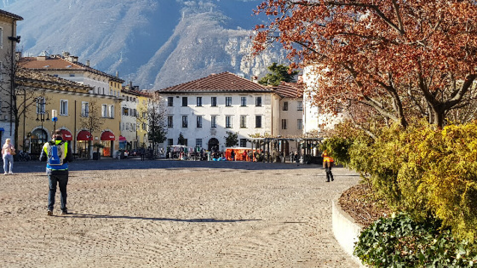
One of the main problems in planning a public event is the lack of updated data. Over time, a site is subject to multiple changes (sidewalks, green areas, maintenance or remediation, etc.) and not always the maps, available for civil protection, represent real metric data. All these issues were met in the present use case, where a tensile structure was planned in the main square of Trento.
NEEDS AND GOALS
- Check for any differences between the existing cadastral maps and the current state of the square to detect the presence of new elements potentially obstructing the public security plans.
- Provide easy and effective analysis of places dedicated to events/fairs, starting from real and updated data.
''I’ve been amazed by the speediness of HERON in providing us with real data of the location we chose for the event! Without the HERON real data, we would not have seen that this space was not suitable for the structures and the pool of people we had in mind.''
Stefano Farina | Safety Consultant and Trainer
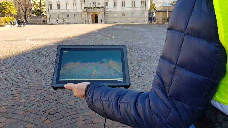
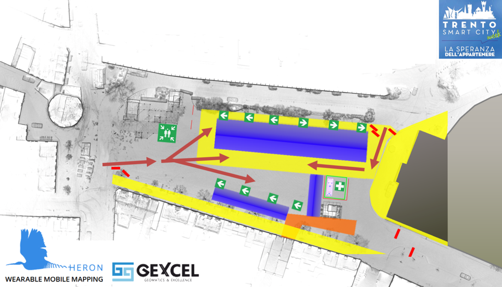
Thanks to a quick walk with HERON it was possible to generate an updated map of the square and proceed with the planning of the safest routes. It was possible to discover that the large trees (not marked in the old maps) were a serious obstacle to the management of the event. It was therefore decided to change locations, preventing a huge waste of money and work.
HERON AC-1 MAIN BENEFITS
- Rapid survey and analysis of (large) external and internal environments.
- Real-time generation of 3D and 2D maps with 2-3 cm accuracy.
- Quick and frequent update of 2D and 3D maps thanks to the automatic localisation of the instrument. Operators easily manage surveys with minimal knowledge of surveying.
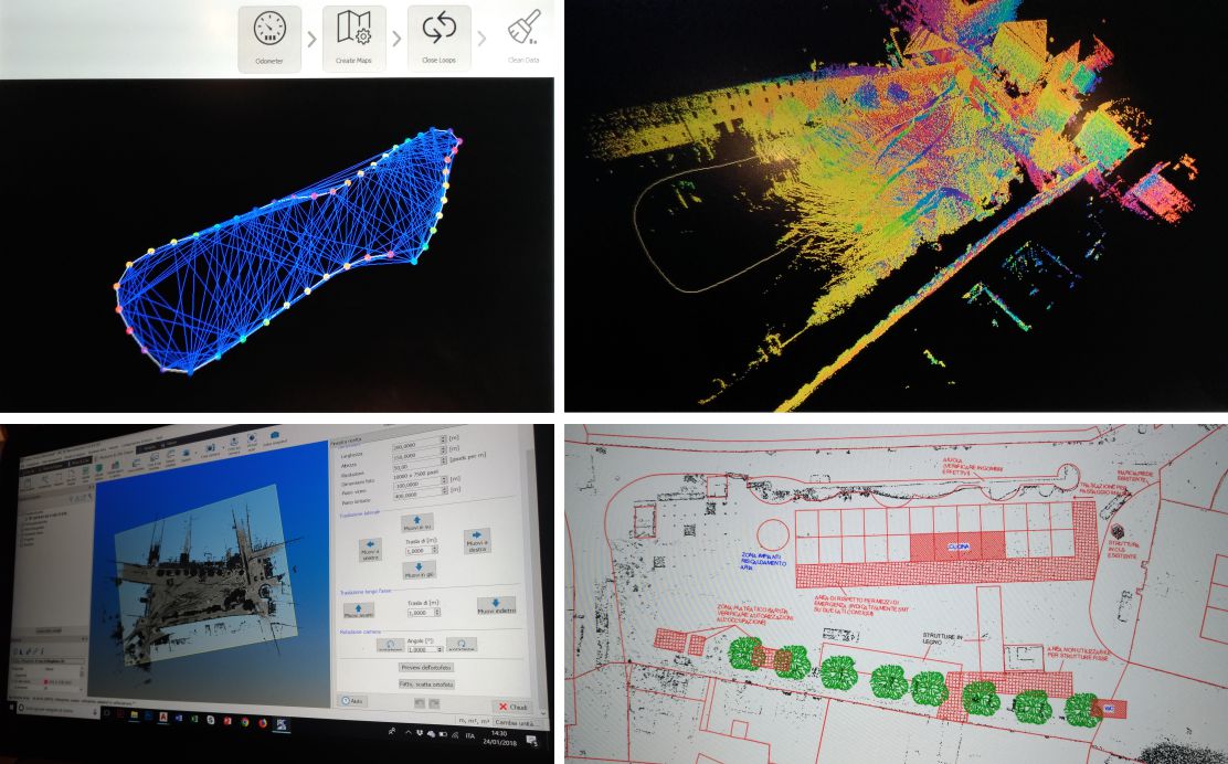
RESULTS
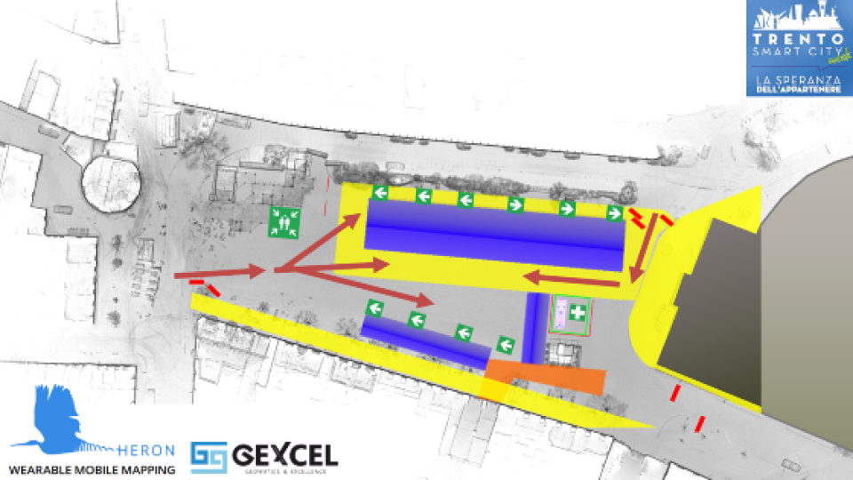
- Blueprint map of the square
- CAD map with safety path scheme
- 3D point cloud model of the square
TECHNICAL DETAILS
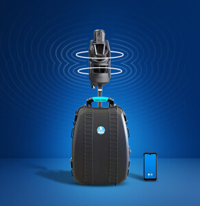
- Surveying System: Heron AC-1 Color
- Surveying Time: 720 mt in 9 Minutes by Walking
- Processing Software: Heron Desktop - JRC 3D Reconstructor
- Data Processing Time: 45 Minutes
ABOUT
The Client must Gexcel the rent of HERON with the operator for the surveying activities and the data processing delivery. For a privacy agreement, Gexcel cannot show the Client’s name.
Do you have questions about this case study?
Get in touch with GEXCEL, and they would be happy to answer any questions you have about pricing, suitability, availability, specs, etc.


![3月21日-封面[1].jpg](https://cdn.geo-matching.com/voeE1ywo.jpg?w=320&s=6b3b1a0215d770f8797653e9202a8f52)


