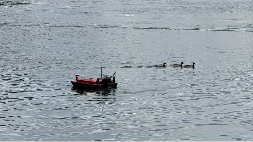
Multibeam Echo Sounder survey on the river Tevere with CK-14 ASV
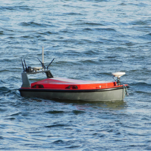
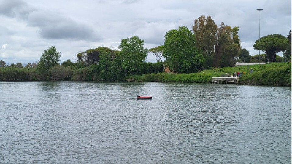
During the Codevintec Days, a special event commemorating the 50th anniversary of Codevintec, the afternoon demonstration showcased the remarkable capabilities of the CK-14 marine drone. This marine drone was equipped with the T-20 ASV Multibeam Echosounder, developed by Teledyne, along with a highly precise inertial navigation system, by Applanix. This advanced combination of technologies allowed for the efficient surveying of a designated area in the river Tevere.
THE RIVER TEVERE
The river Tevere, one of the most important rivers in Italy, is formed in the Tuscan-Emilian Appennines and flows into the Tyrrhenian Sea after a course of about 405km. With an average depth of around 10 meters, this majestic river holds a significant presence within the Italian landscape.
SURVEY AREA
The monitoring area is that between Tor Boacciana and the pier, the docking area for access to the Archaeological Park of Ancient Ostia via the river, of which it is an integral part. Within this specific area, the average depth reaches approximately 12 meters, providing an ideal setting for comprehensive monitoring and surveying activities.
SURVEY OPERATION
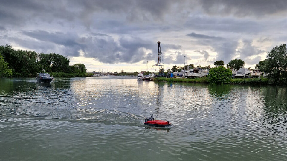
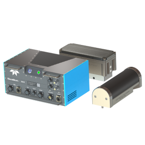
CK-14 was equipped with a Teledyne T-20 ASV MBES and an Applanix high-precision inertial navigation system. The marine drone followed lines parallel to the banks, both upstream and downstream. Routes were created using the drone's autonomous navigation software: this ensured correct and complete data acquisition. You can also use the manual mode from the smartcontroller to be able to operate the CK-14 with total freedom.
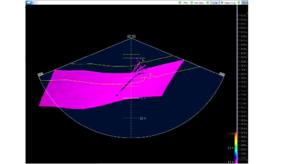
DATA PROCESSSING
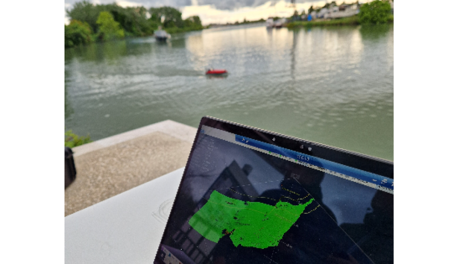
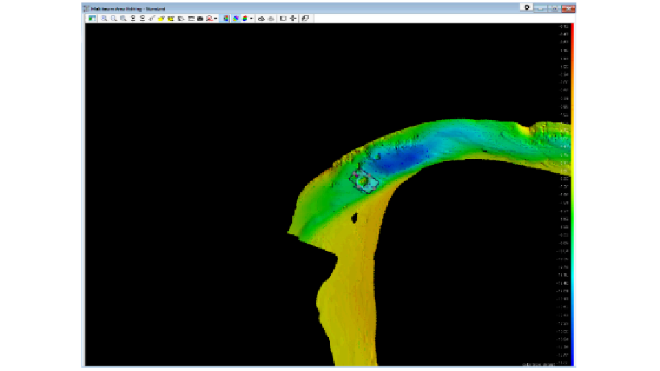
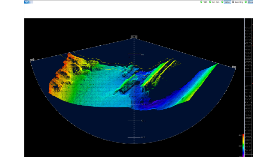
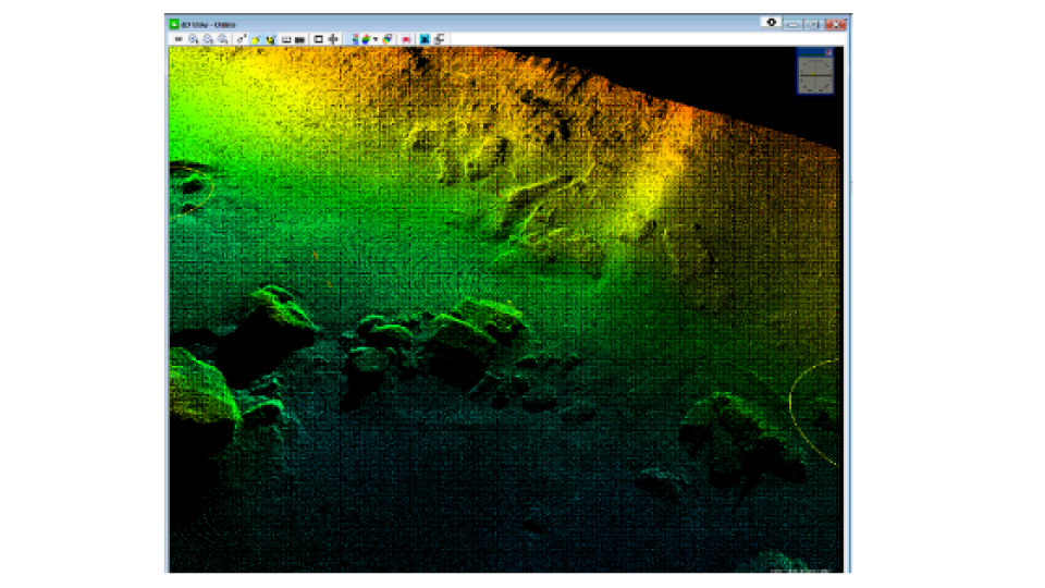
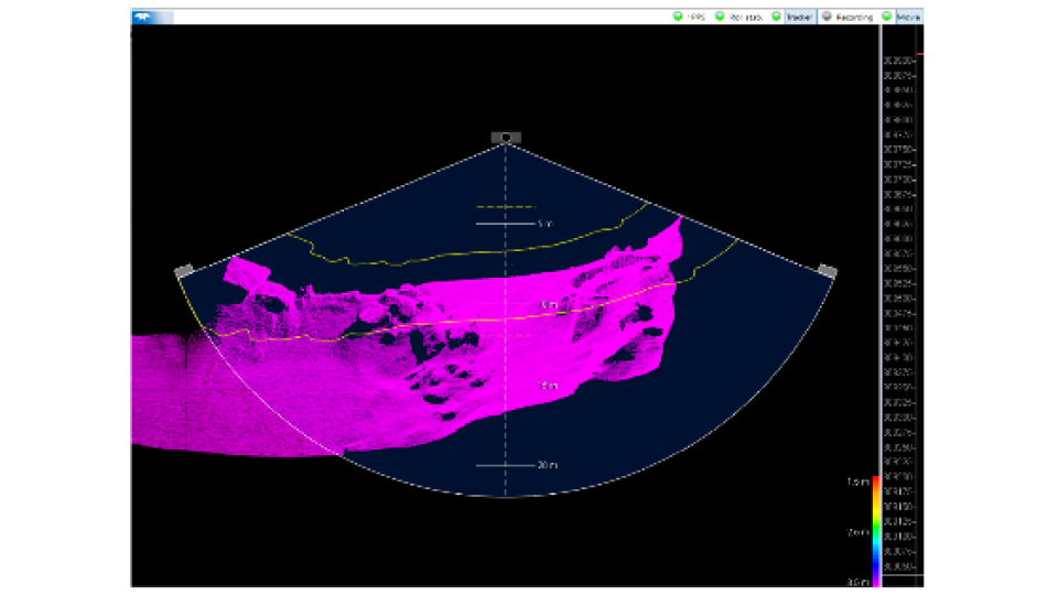
PDS, a software developed by Teledyne, allows to control and monitoring the T-20 ASV MBES in real time. With Teledyne PDS you only need one software suite to collect, process and deliver data within the same workflow. Additionally, Teledyne has created Sonar UI, another remarkable software tool that offers real-time visualization of the underwater environment. Sonar UI enhances the monitoring process by providing a live display of the detailed information captured by the T-20 ASV, enabling users to effectively observe and analyze the underwater in real time.
WHY MONITORING
The precise and scientific survey of the underwater terrain is very important. Indeed, it allows in a comprehensive way the monitoring of sediments and the seabed with the detection, also, of the possible presence of assets pertaining to the submerged cultural heritage, thus facilitating the planning and management of maintenance and cleaning of the river Tevere compatibly with the preservation of the submerged cultural heritage.
CONCLUSION
In terms of efficiency and cost-effectiveness, the use of Unmanned Surface Vehicles (USVs), particularly the CK-14, proved to be a time and labor-saving solution across various applications. Thanks to its lightweight design and ease of transportation, the CK-14, proudly manufactured by Codevintec, offers versatility and adaptability to meet diverse requirements. Whether it's a basic singlebeam configuration or advanced setups like multibeam, Side Scan Sonar, or ADCP, the CK-14 can be customized accordingly. Looking ahead, there is potential for further enhancements in survey efficiency and coverage through the integration of laser scanners. This possible future integration holds the promise of improving data collection capabilities and expanding the range of applications for the CK-14.
ACKNOWLEDGEMENTS
We extend our sincere appreciation to Dr. Alessandro D'Alessio, the Director of Ostia Antica Archaeological Park, and Dr. Alessandra Ghelli, the dedicated underwater archaeology officer. Their invaluable contributions and expertise have been fundamental in enabling these surveys and monitoring activities. Their commitment to preserving and exploring the submerged cultural heritage within the river Tevere is truly commendable. Their passion and dedication have played a vital role in furthering our understanding of the historical significance and underwater treasures within the park.
Do you have questions about this case study?
Get in touch with Codevintec, and they would be happy to answer any questions you have about pricing, suitability, availability, specs, etc.


![3月21日-封面[1].jpg](https://cdn.geo-matching.com/voeE1ywo.jpg?w=320&s=6b3b1a0215d770f8797653e9202a8f52)


