![screenshot-2022-10-03-152758.png](https://cdn.geo-matching.com/XRwO3lR5.png?w=480&s=efe09b9a843a1b0fb6dddd8cd55c11b2)
![red-pointcloud.jpg](https://cdn.geo-matching.com/wpXDempX.jpg)
![phoenix-lidar-systems-logo-black.png](https://cdn.geo-matching.com/xRKyO5p2.png)
Showing 1-5 of 5 results
![screenshot-2022-10-03-152758.png](https://cdn.geo-matching.com/XRwO3lR5.png?w=480&s=efe09b9a843a1b0fb6dddd8cd55c11b2)
![rail.jpg](https://cdn.geo-matching.com/EnkrOWR5.jpg?w=480&s=3e4775d549ee2c58f8710270f5e5a4df)
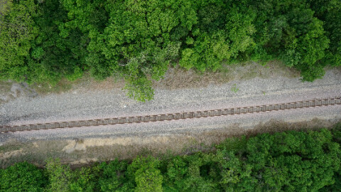
CSX Rails Against Traditional Asset Management
![screenshot-2022-08-11-150216.png](https://cdn.geo-matching.com/voeP25pB.png?w=480&s=b46ac0d2df9b83e3bbb9fb34372a6c72)
Implementing Lidar in Pipeline Surveys Expands Project Scope Capabilities for MSI
![picture3-6.jpg](https://cdn.geo-matching.com/PoE88Ep9.jpg?w=480&s=4487539b0fdf75695d682c2ca6306a44)
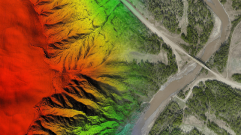
Mapping the Rocky Mountain Foothills with the Helicopter-Mounted RANGER Series
![mobile1-1.png](https://cdn.geo-matching.com/voa119oK.png?w=480&s=b31f6a46d7616082c4e4f863b22344d5)
Join 40,000+ geospatial professionals and get technology news delivered straight to your inbox every week. Subscribe today.
Global Technology Company Leading Advanced Innovations for 3D Remote Sensing Solutions.
Showing 1-5 of 5 results
You don't have any products to compare.
Phoenix LiDAR Systems team is happy to assist.
By completing this form, you acknowledge and agree to abide by our Terms and Conditions, Privacy Policy and Cookie Policy.