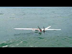


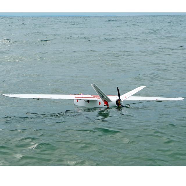


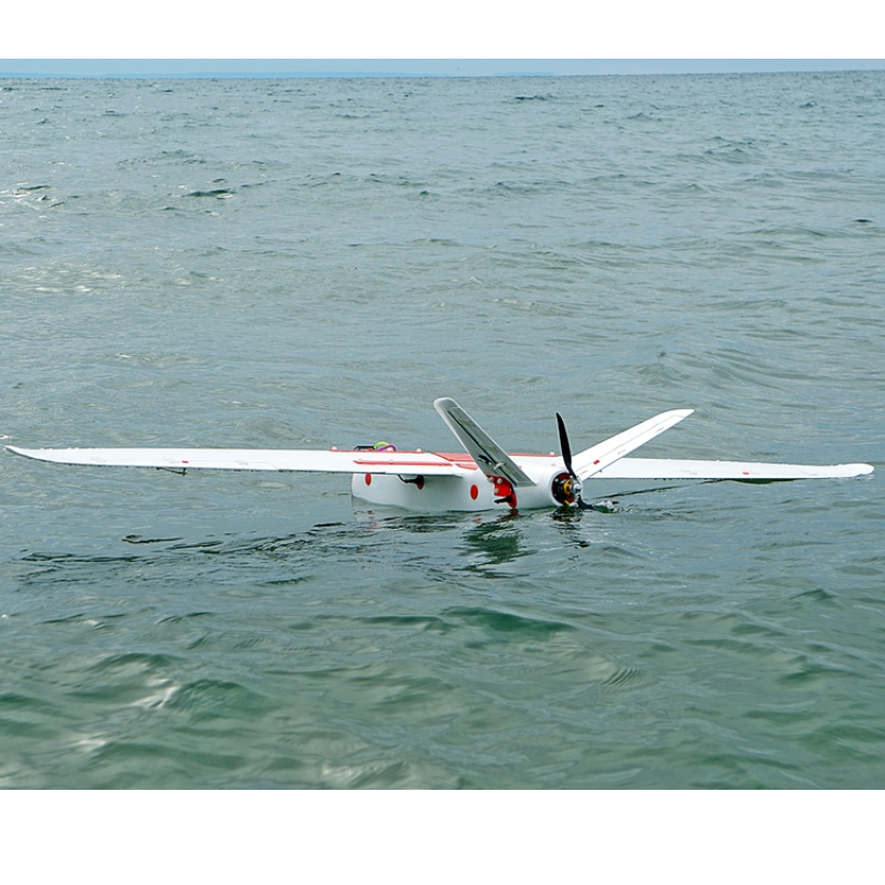
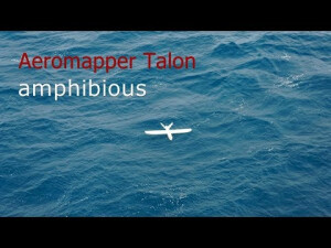
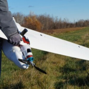
Aeromapper Talon Amphibious
Allows Maritime Operations by Autonomously Belly Landing on Water
It’s the perfect solution for aerial observation, data collection, and mapping thanks to its dual camera set up and video link range up to 20km. The drone allows for easy operation thanks to its autonomous take-off upon hand launch, autonomous navigation, and automatic belly land on water. Ideal for surveyors, research, inspection, emergency responders, search and rescue, surveillance, wildlife monitoring, river and coastal mapping, conservation efforts, marine management & water management.

Aeromao Inc.
Mississauga, CA
Description
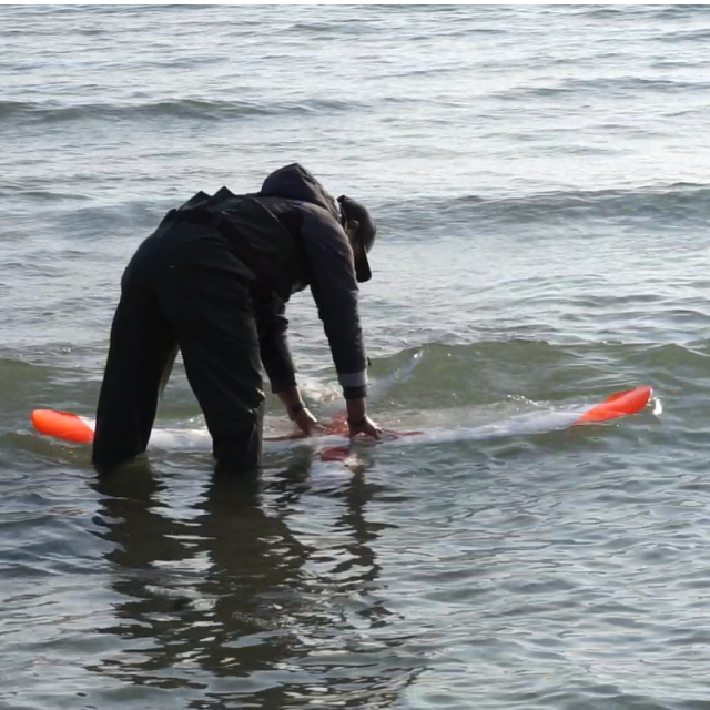
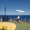
Expand your operations like never before by using lakes, rivers, and oceans as airfields.
Pack the Aeromapper Talon Amphibious drone on a boat and head to those islands that were impossible to map before, or survey along 30km of coastline that were unreachable by land, monitor the amount of algae that spread over the lake or finally get to survey that impenetrable marshland, or search those bird populations with its real-time video system.
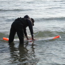
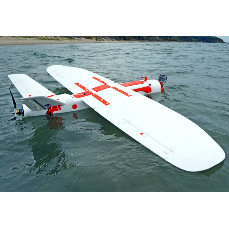
How does it work? The Aeromapper Talon Amphibious is fully waterproof, externally and internally. Even if filled up completely with water internally, it won’t sink, it won’t suffer any damage. Each component is waterproof and modular, minimizing maintenance costs. This redundant approach that guarantees repeatability and dependability.
The drone allows for easy operation thanks to its autonomous take off upon hand launch, autonomous navigation, and auto land.
Best of all, forget about paying an arm and a leg for a dependable – portable amphibious drone that are usually only a luxury of military budgets. The Aeromapper Talon amphibious comes in an affordable package and its components are modular and future-proof. Its rugged and durable construction allows for repeated use and tough handling and still being very easy to repair in the field.
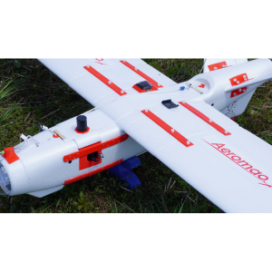
Capture 20Mp stills or HD video facing down, or add the optional forward-looking camera with long range real-time video link of exceptional image quality. The forward-looking camera can be panned from the hand-held remote control to look sideways and lock on points of interest by loitering the UAV around them. The standard range of the video signal is 15-20 Km but it can be extended to 40km using our 24 dBi parabolic antenna (optional).
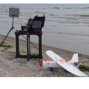
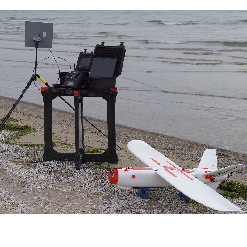
The forward-looking camera system comes complete and ready to use, including the heavy-duty Ground Control Station, with 10’’ LCD monitor and diversity receiver.
Best of all, you can still parachute down on dry land when required. The Aeromapper Talon Amphibious version also features our standard long-range capabilities for BVLOS (Beyond Visual Line of Sight operations) (+30Km control and telemetry links).
Do you have questions about this product?
- Questions about price, availability, and/or retailers
- Questions about technical specifications and usage
- Questions about suitability for your project or application
Specifications
-
Environment
-
Min. operation temperature [°C]
-20
Max. operation temperature [°C]
40
Max. wind speed [m/sec]
12.5
-
Imaging/scanning devices
-
Onboard imaging/scanning devices
RGB Camera
Type of Camera
Sony 20mp camera. Optional forward-looking camera can be panned from the hand-held remote control to look sideways and lock on points of interest by loitering the UAV around them.
Sensor tilting to allow oblique views
Y
Additional Sensors and additional information
Forward looking long range video downlink (HD, 20km link range), paning axis
-
Platform
-
Platform
Aircraft
Brand
Aeromao
Max. stay in the air [min]
120
Max. speed [km/h]
85
Max. height above sea level [m]
4500
Propulsion
electric
-
Accessories
-
Transportation accessories
Heavy duty carrying cases.
Included batteries and charger
One set of batteries for 2 hrs of flight time. Lipo Battery Charger.
More included products and spare parts
+30 Km Link system.
-
Operation Characteristics and Safety
-
Launching method
Hand-launch
Automatic launch and landing
Y
Autonomous emergency landing
Y
Training provided
Y
-
Dimensions
-
ø / wingspan [cm]
200
Weight [kg]
3.6
Number of rotors
1
Transport on human back
N
-
Base Station
-
Sensor control
Y
Real time image and video download link
Y
Ground computer included
N
-
Navigation Sensors
-
Type of GNSS receiver and captured signals
GPS
-
General
-
Typical applications
Surveying, research, inspection, emergency responders, search and rescue, surveillance, wildlife monitoring, river and coastal mapping, conservation and environmental efforts, hydrography, marine management, fisheries & water management.
-
Included software and automatically generated
-
Type of software included
Flight planning
Automatically Generated Products
Flight planning software
Mission Planner
Photogrammetric software
Agisoft, Pix4D
