
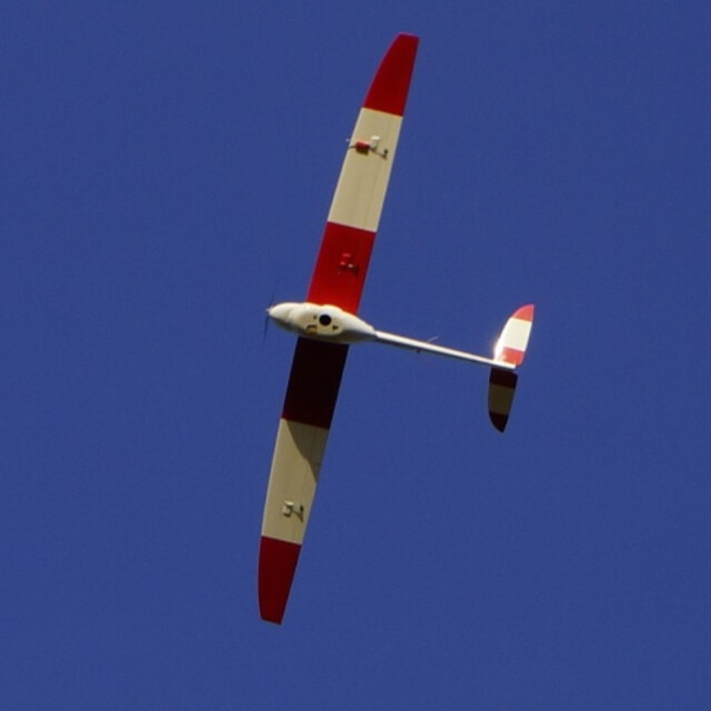
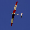


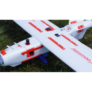
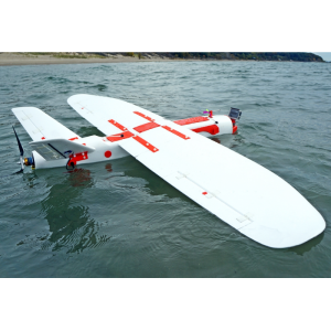
Aeromapper 300
A rugged working machine designed for long endurance and multi-mission payloads.
A rugged working machine designed for long endurance and multi-mission payloads. The Aeromapper 300 simply sets a new standard in the whole industry with the new optional GNSS PPK addition for centimeter accuracy, without sacrificing any of its standard capabilities and within an affordable package, offering users the highest level of productivity. There is just no match out there.
Aeromao Inc.
Mississauga, CA
Description
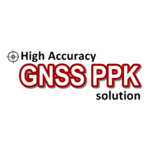
The Aeromapper 300 is now available with an optional Post Processing Kinematic (PPK) GNSS receiver for the highest level of accuracy on your deliverables. You can now achieve up to 3cm accuracy with no Ground Control Points.
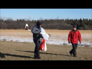
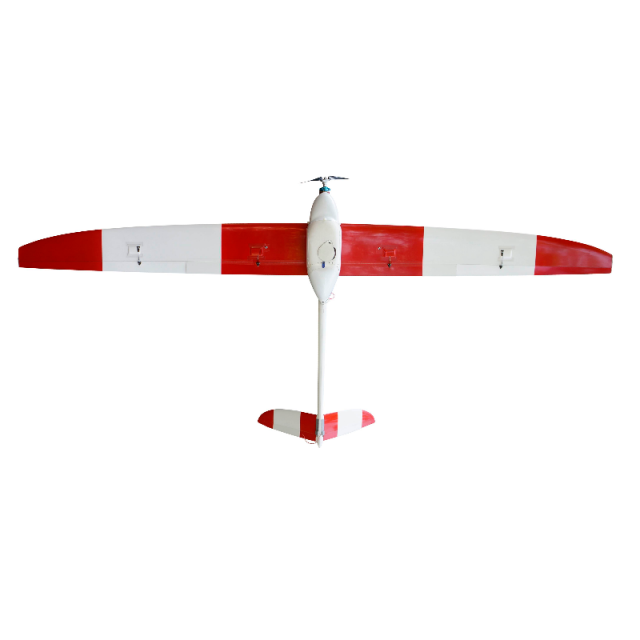
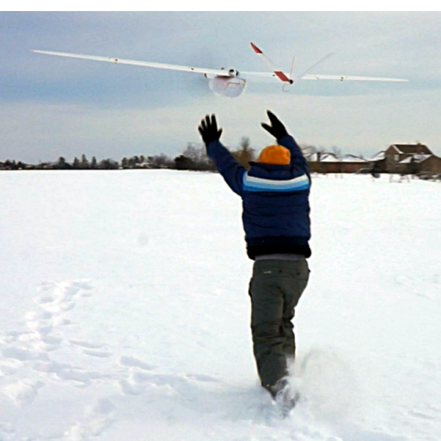
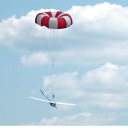
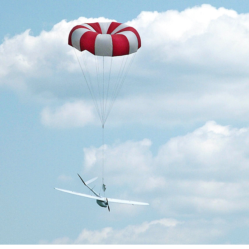
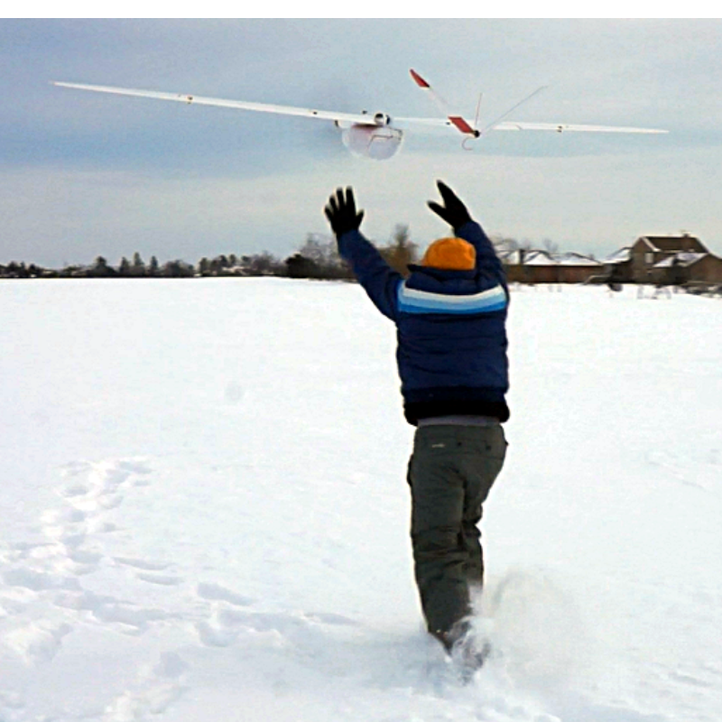
This is the most complete UAV package for survey and mapping at the most competitive price on the market. A powerful UAV yet very easy and friendly to use, 1.5 hour endurance, multi-sensor capabilities, easy parachute landing, hand launch, 30 km communications link, modular design and of course, fully autonomous flight. The Aeromapper 300 is ideal for those large projects or when two cameras need to be flown at the same time, cutting on acquisition time and costs.
The Aeromapper 300 can survey up to 6.6 Km2 at 2.4 cm/pixel in a single flight.
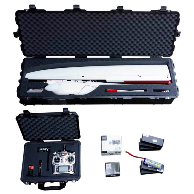
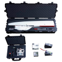
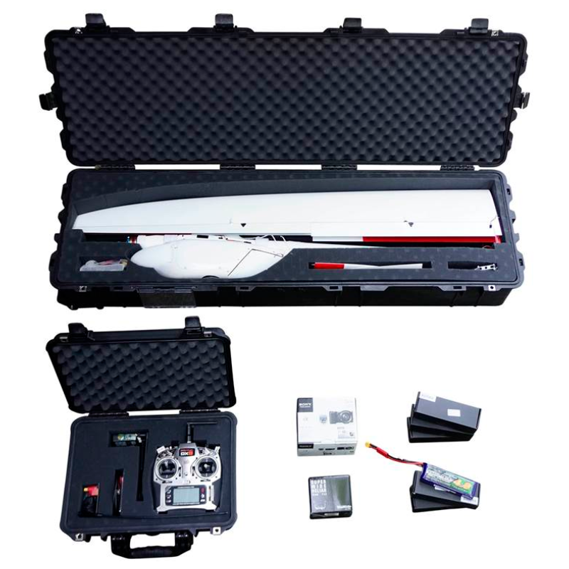
The UAV systems are delivered fully flight tested prior to delivery and with all the accessories the user will require.
We can also customize the UAV with other choices of payloads or devices, delivering exactly what the customer needs.
Cameras are installed in panoramic orientation for most optimal area coverage with maximum side overlap. The complete system can be ready for takeoff in approximately15 minutes after arriving to the field by a single user.
Operators training is optionally available but not required. Online training or hands-on flight training are available.
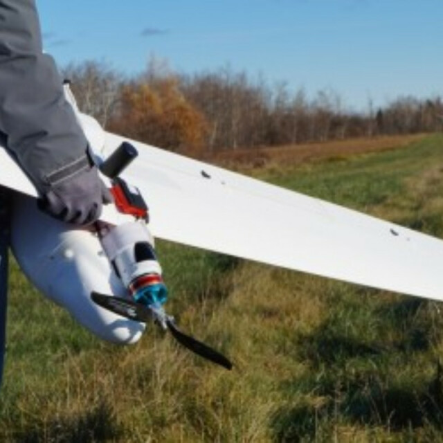
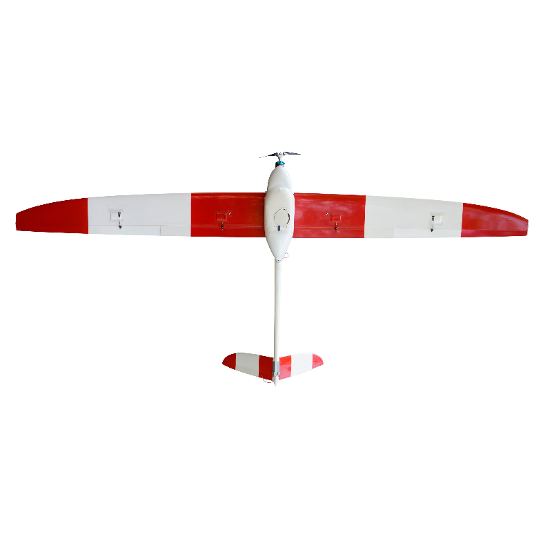
We can guarantee the toughest and most durable UAV you will use. It is entirely made of carbon fiber, with Kevlar reinforcements in key areas. It is a working horse that can take a beating and still give you years of use.
The Aeromapper 300 is a proven and mature UAV, tested over the course of countless flight hours and in many conditions. No catapult launcher is required.
Do you have questions about this product?
- Questions about price, availability, and/or retailers
- Questions about technical specifications and usage
- Questions about suitability for your project or application
Specifications
-
Environment
-
Min. operation temperature [°C]
-20
-
Imaging/scanning devices
-
Onboard imaging/scanning devices
RGB Camera
Type of Camera
24Mp standard. 36Mp camera available.
Additional Sensors and additional information
Multiespectral, thermal, Hyperespectral, Nadir HD video, High Res RGB
Build-in Stablilsation
N
Exchangeable
Y
Sensor tilting to allow oblique views
N
-
Platform
-
Platform
Aircraft
Brand
Aeromao
Max. stay in the air [min]
90
Max. speed [km/h]
90
Max. height above sea level [m]
4500
Propulsion
electric
-
Accessories
-
Transportation accessories
Heavy duty carrying case
Included batteries and charger
One set of batteries for 1.5hrs of flight time. Lipo Battery Charger.
More included products and spare parts
Sony 24 mp camera with 20mm lens. Mission Planner GCS software. 30 Km Link System. Unlimited after sales support
-
Operation Characteristics and Safety
-
Launching method
Hand-launch
Automatic launch and landing
Y
Autonomous emergency landing
Y
Training provided
Y
-
Dimensions
-
ø / wingspan [cm]
300
Weight [kg]
5.35
Number of rotors
1
Transport on human back
N
-
Base Station
-
Ground computer included
N
Sensor control
Y
Real time image and video download link
Y
-
Navigation Sensors
-
Correction services [PPK, RTK]
PPK upgrade optional
Type of GNSS receiver and captured signals
L1/L2 GNSS PPk, Glonass optional
Other sensors and additional information
Long range communications link +30Km (BVLOS capable)
-
General
-
Typical applications
Mapping, surveying, 3D modelling, photogrammetry, agriculture, mining, construction.
-
Included software and automatically generated
-
Type of software included
Flight planning, Photogrammetric software, Point cloud processing software
Automatically Generated Products
Flight planning software
Altitude, side and length- wise overlaps, orientation of the lines, start & end waypoints, flying speed and overshoots are user definable. Drone automatically calculates flight time, distance between images and triggers camera automatically. Distance between lines is calculated automatically according to desired side overlap.
Photogrammetric software
Agisoft, Pix4D
Additional information on software or automatically generated products
Optional image processing options (Agisfot, Pix4D)
Videos
