
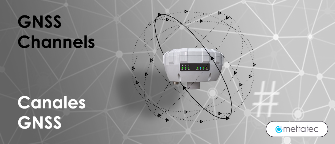
How many channels does a GNSS Receiver need? The 184 channels of the X5R are more than enough
GNSS Constellations
A Global Navigation Satellite System (GNSS) is a network or constellation of satellites that transmit ranges of signals that are used for positioning and localization anywhere on the globe. The following constellations currently exist: the Global Positioning System (GPS) of the United States, the Global Orbital Navigation Satellite System (GLONASS) of Russia, the Galileo Navigation Satellite System (Europe), the Beidou (China), the QZSS (Japan) and the IRNSS (India). The QZSS and IRNSS constellations are only effective on a part of the globe, so they are not effective in Latin America and other areas of the globe.
When a GNSS receiver, a permanent station or a CORS is up and running and receiving data, it will always have some satellites orbiting in the sky or celestial vault. In other words, GPS, GLONASS, GALILEO or BEIDOU satellites, which are orbiting over that area, will send data that will be received by the receiver’s GNSS antenna.
To manage all the information sent by the GNSS satellites and received through the antennas, the GNSS receiver uses several data channels. Each channel receives a signal from a specific satellite in a specific constellation. But in addition, each satellite sends not only one signal, but several signals, signals at different frequencies.
GNSS satellites then continuously transmit navigation signals on two or more frequencies in a band known as the “L” Band. These signals contain range codes and navigation data to allow receivers to calculate travel time from the satellite to the receiver and satellite coordinates at any time. The main components of this signal are described below:
Components of Navigation Signals:
Carrier:
A radio frequency sinusoidal signal at a given frequency.
Range Code:
Sequences of 0s and 1s (zeros and ones), which allow the receiver to determine the travel time of the radio signal from the satellite to the receiver. These are called pseudo-random noise sequences (PRNs) or PRN codes.
Navigational data:
A binary-encoded message that provides information about the satellite’s ephemeris (Keplerian elements or satellite position and velocity), clock polarization parameters, almanac (with a reduced-precision ephemeris dataset), satellite health status, and other supplementary information.
In the following table, we can see an example of the structure of the GPS constellation signals in the L1 band:

In the following table we can see the different frequencies sent by the main constellations in different bands.

The blocks in yellow represent the frequency bands used by satellites in the GPS constellation. We can see that GPS has the L1 band with a frequency of 1563 MHz to 1587 MHz approximately, L2 and L5. GLONASS has the G1, G2 and G3 bands. GALILEO has 4 bands: E1, E5a, E5b and E6. In the case of BEIDOU, it uses the B1, B2 and B3 bands.
Each GPS satellite sends signals in the L1, L2, L5 bands; each GLONASS satellite sends signals in the G1, G2, G3 bands, and this is also the case for satellites of other constellations with their respective bands.
Advantages of having several Frequencies
We know that GNSS satellites orbit the earth a little over 20,000 kilometers away. The signals emitted by the satellites will have to travel these long distances and pass through the Earth’s atmosphere before reaching the GNSS receiver. As they pass through the Earth’s atmosphere, the signals will be affected according to the different layers of the atmosphere (troposphere, stratosphere, mesosphere, thermosphere and exosphere) and the different temperatures in each of them (known as the Atmospheric Thermal Gradient). Therefore, the simultaneous use of several frequencies is essential to reduce atmospheric errors in geodetic measurements. We’ll explain how using multiple frequencies helps reduce atmospheric error:
Ionospheric error: The thermosphere or ionosphere is a layer of the Earth’s atmosphere that contains free electrons that can refract GNSS signals as they pass through this layer. The degree of refraction depends on the frequency of the signals. Multi-frequency GNSS receivers can measure the propagation rate of signals through the ionosphere at different frequencies and calculate ionospheric delay. By having multiple frequencies, it is possible to more accurately estimate ionospheric delay and correct measurements to reduce this error.
Tropospheric error: The troposphere is the lowest layer of the Earth’s atmosphere and is subject to constant changes in pressure, temperature, and humidity. These changes affect the propagation rate of GNSS signals through the troposphere. By using multiple frequencies, GNSS receivers can measure the difference in propagation rate between signals of different frequencies and estimate tropospheric delay more accurately. This allows for more accurate correction of measurements.
Multipath Effect Reduction: The Multipath Effect occurs when GNSS signals bounce off nearby objects, such as buildings or uneven terrain, before reaching the receiver. This can introduce errors into geodetic measurements. Multi-frequency GNSS receivers can use the phase information of signals at different frequencies to mitigate the multipath effect and obtain more accurate measurements.
Increased availability of GNSS satellites: By using multiple frequencies, GNSS receivers can track and use signals from more satellites. This increases the redundancy and robustness of the system, as if a signal is affected by obstruction or interference, the receiver can use signals from other frequencies or satellites to maintain measurement accuracy.
We can conclude that the greater the number of frequencies, the greater the accuracy. So, the fundamental question arises:
How many channels does a GNSS receiver need to have to take advantage of all the signals from all the satellites available in the sky at any given time?
How many channels does a GNSS receiver need to have to take advantage of all the signals from all the satellites available in the sky at any given time?

There are 102 satellites in orbit in total. Keep in mind that because the earth is an ellipsoid, we will never be able to have all the satellites available in orbit at the same time over a geographical point. In the following table we will perform an analysis of how many channels are required during a field session using a multi-frequency (multi-band) GNSS receiver, taking into account the maximum number of GNSS satellites available in the sky. Let’s assume that we have the best atmospheric conditions for reception, an unobstructed clear sky and an overestimation of the number of satellites orbiting the Earth’s geographical point where the GNSS receiver would be operating at any given time.
So, currently, with 160 channels we can broadly cover all frequencies of all satellites of all GNSS constellations currently operating in space. Currently, you don’t need to have 200, 400 or 600 channels.
It should be noted that some receivers may require some additional channels to receive signals from augmented systems such as SBAS and L-band, but even with these particular requirements, we can conclude that 160 channels are sufficient currently and also in the near future.
Accuracy Obtained vs. Number of GNSS Satellites
In terms of accuracy in receiving GNSS signals, it is essential to recognize that the relationship between the number of satellites and the improvement in accuracy does not follow a linear progression. It is important to stress that the addition of satellites does not result in a commensurate improvement in accuracy. Therefore, we cannot say that having a given number of satellites will automatically achieve a specific accuracy, as, for example, having six satellites will achieve an accuracy of five centimeters, or having 80 satellites will achieve an accuracy of one millimeter. This conception is incorrect and does not reflect the reality of the operation of GNSS systems.
In reality, the relationship between the number of satellites and the accuracy of measurements shows an improving trend, but this trend slows down as the number of satellites increases. In other words, if you increase the number of satellites used, you will get a significant improvement in accuracy to a point where the improvement becomes marginal and tends to stabilize. For example, if a large number of satellites are available, such as eighty, the accuracy achieved will not be significantly higher than that obtained with, say, twenty satellites. The relationship between the number of satellites and the accuracy of measurements is non-linear and is ultimately subject to practical constraints and additional factors influencing accuracy.
So, in short, you don’t need more than 160 to 180 channels to get the highest accuracy because at the moment you don’t need it due to the current availability of GNSS satellites in space.
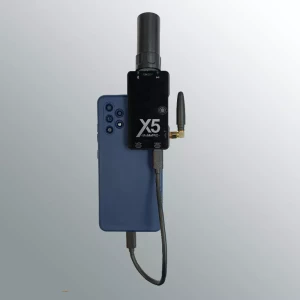
The 184 channels of Mettatec’s X5 GNSS Receivers are more than enough for high accuracy in satellite geopositioning, and reach an accuracy of up to 10 mm in PPK, RTK and NTRIP modes.
Do you have questions about this article?
Get in touch with METTATEC, and they would be happy to answer any questions you have about pricing, suitability, availability, specs, etc.
Related articles


