Evolving Multibeam Echosounders to Keep Up With Unmanned Surface Vehicle Developments
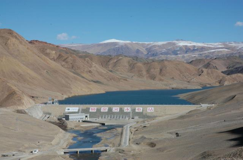
Along with the development of society, GIS data plays important role in economic operation. It was said that GIS data is the cornerstone of digital China. At present, GIS data on land is quite abundant, while underwater terrain data is much less. In some area, it is even blank. So the underwater bathymetry technology and application get more and more attention. Today, Hydro-Tech introduced a small size, high accuracy and low power consumpation multibeam echo sounder suitable for unmanned surface vehicle, which could survey the area that manned hygrographic ship can not reach, especially shallow water area.
In the perception of surveyors, underwater terrain surveying and mapping work is cruising in large rivers and oceans by ships equipped with measurement sonar equipment such as Singlebeam echo sounders and multi-beam echo sounders. Therefore, where there is a boat, there is a way to obtain underwater geographic information data. However, there are still a lot of sparsely populated waters in the country that are almost devoid of ships.
Similarly, a large number of shallow water areas and waters with high environmental protection requirements are still difficult to reach by manned ships, which all leads to a large amount of underwater data in the waters being blank. With the development and maturity of technology, the previous problem is no longer a problem. Unmanned and automated unmanned surveying ships have emerged in this context. In just a few years, a large number of unmanned ships have emerged in China. enterprise.
People can't help but ask, what is the current status of the development of unmanned surveying ships? As the measurement technology of unmanned surveying ships, what is the development status?
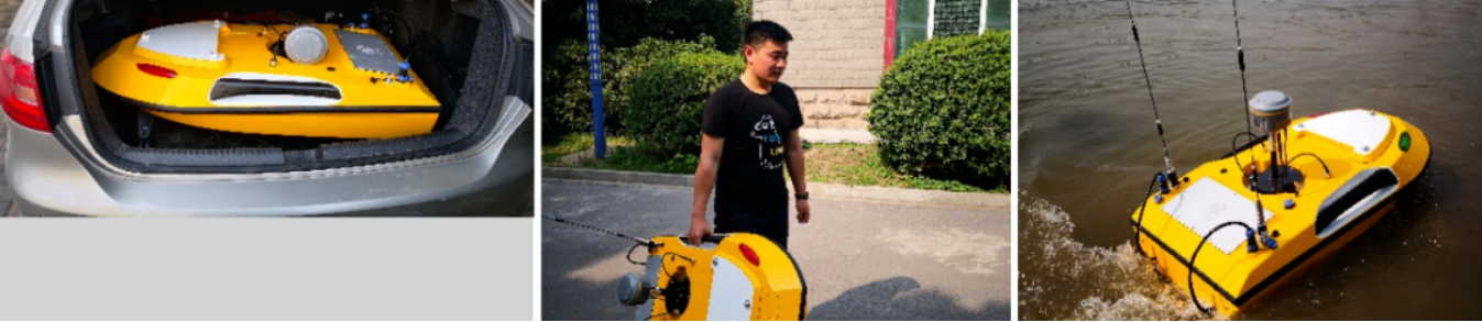
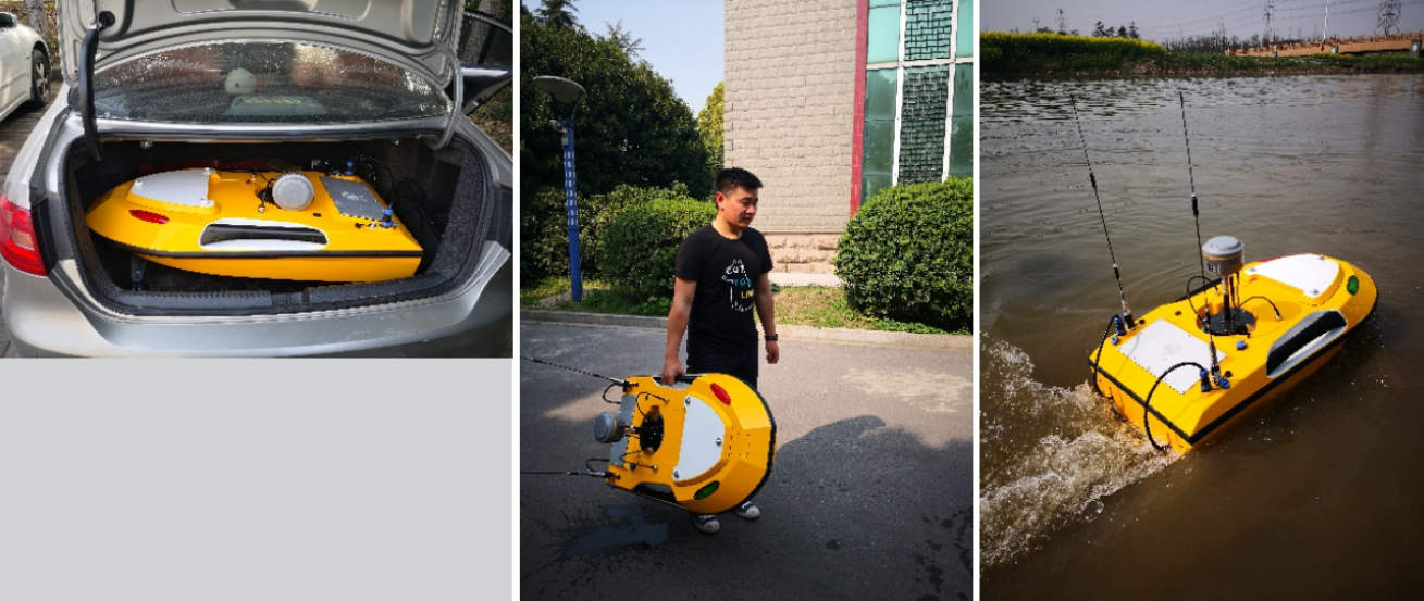
At present, there are two basic directions for the development of unmanned surveying ships. One is the replacement of manned ships with unmanned ships in the field of manned ships. Expansion of measurable waters. The application scenario we will focus on today: is the blind area of conventional measurement, the water area that cannot be reached or reached by manned ships. For the unmanned measurement ship in this water area, a series of problems such as decentralization, recovery, draft, and transportation must be solved. The miniaturization of human surveying ships has become an inevitable trend in the development trend.
The advantages of Unmanned Surface Vehicles in Shallow Water Surveying
The reason why the unmanned surveying ship can reach the so-called measurement blind spot is that it has the following characteristics:
1. A High Safety Factor
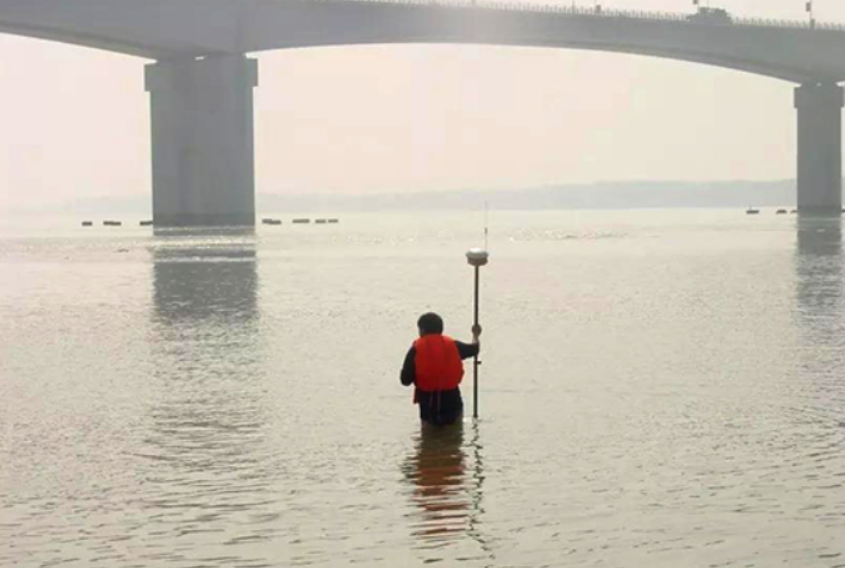
For many unknown waters or shallow waters, such as the use of manned vessels for manned operations or direct personnel launching measurements, due to the existence of a large number of uncertain factors, the safety of personnel is at great risk, and unmanned vessels are used to operate without personnel launching. After completing the work, the safety factor is greatly improved.
2. USVs are a Light-weight and Small Size Solution
There are many water areas to be measured, some are far away from people, and some mountain roads are difficult to travel, so it is impossible to transport traditional manned ships for measurement operations. Decentralization, recycling, etc., so as to achieve the purpose of water measurement.
3. USVs Have a Shallow Draft
For the measurement operation in shallow water, it is often difficult for underwater measurement. The water is shallow and cannot be reached by conventional ships, the manual measurement efficiency is low, and the safety hazard is great. The unmanned surveying ship perfectly solves the problem of shallow water surveying by virtue of its advantages of a lightweight, less load and shallow draft.
4. Automatically Controlled USVs offer a High Running Line Quality
Surveyors who are engaged in underwater surveying know that a major difficulty in underwater topographic surveying operations is the complex water environment. Ultimately, the efficiency of section measurement and other underwater measurements is reduced, and the quality of data is reduced. The program-based automatic control of the unmanned surveying vessel can accurately correct the direction and position of the vessel in real-time, which can ensure that the surveying vessel is online in real-time and the running line is straight, and the data quality is high.
Of course, in the traditional measurement methods, the cost is high, the terrain is complex, the installation bracket is inconvenient to process, the installation is inconvenient, and the operation is complicated.
Development of Underwater Measurement and Bathymetric Technology
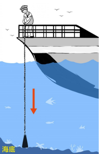
Bathymetry is the basic method of underwater topography measurement. By measuring the three-dimensional coordinates of each point on the bottom of the water, data users can conduct research, design, construction, and analysis underwater as if they were on land. With the development of technology, the technical means of bathymetry have also developed from the original sounding rod and water thallium sounding to the Hydro-Tech sonar technology such as Singlebeam Echosounder and multi-beam Echosounder.
In the fields of hydrographic survey, waterway engineering survey, construction survey, etc. that generally involve bathymetry, Singlebeam echo sounders and multi-beam echo sounders have become very common.
Compared with Singlebeam, multi-beam also has many advantages and more application fields Therefore, in the field of bathymetry, no matter in terms of technology or industry development trends, the replacement of Singlebeam bathymetry technology with multi-beam bathymetry technology has become a general trend, although unmanned survey ships are still mainly carrying single beams, with the development of technology and the needs of the market, the solution of multi-beam measurement on unmanned measurement ships will become the direction of future industry development.
So what exactly is a multi-beam, and what are the advantages of a multi-beam? Next, I will give you a brief introduction to the multi-beam bathymetry system.
Development of Singlebeam and Multibeam Echosounder Technologies
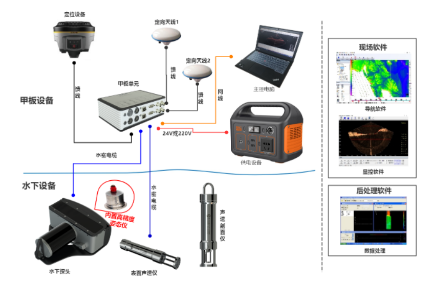
The technical requirements of multi-beam are also destined that the multi-beam bathymetry system is a set of measurement systems including a variety of auxiliary sensors, which are mainly composed of the following software and hardware products:
- Multibeam Echosounder
- GNSS positioning system
- Surface sound velocity meter
- Sound velocity profiler
- Attitude meter
- Compass
- Tide level meter
- Display control software (sonar work control software)
- Navigation acquisition software (recording sonar and auxiliary sensor data)
- Post-processing software
- Power supply, acquisition computer and other tool
Taking the Hydra MS400P multi-beam bathymetric system of Beijing Hydraulic Tongchuang Technology Co., Ltd. as an example, the typical system composition diagram is as follows:
The system has so many components and is so complicated. Is there any advantage to multi-beam? The answer is yes.
The Advantages of a Multibeam Echosounder
The emergence of multi-beam technology has brought great breakthroughs to underwater measurement. Compared with traditional bathymetry, multi-beam has the following obvious advantages:
1. Multibeam Echounders offer High Precision
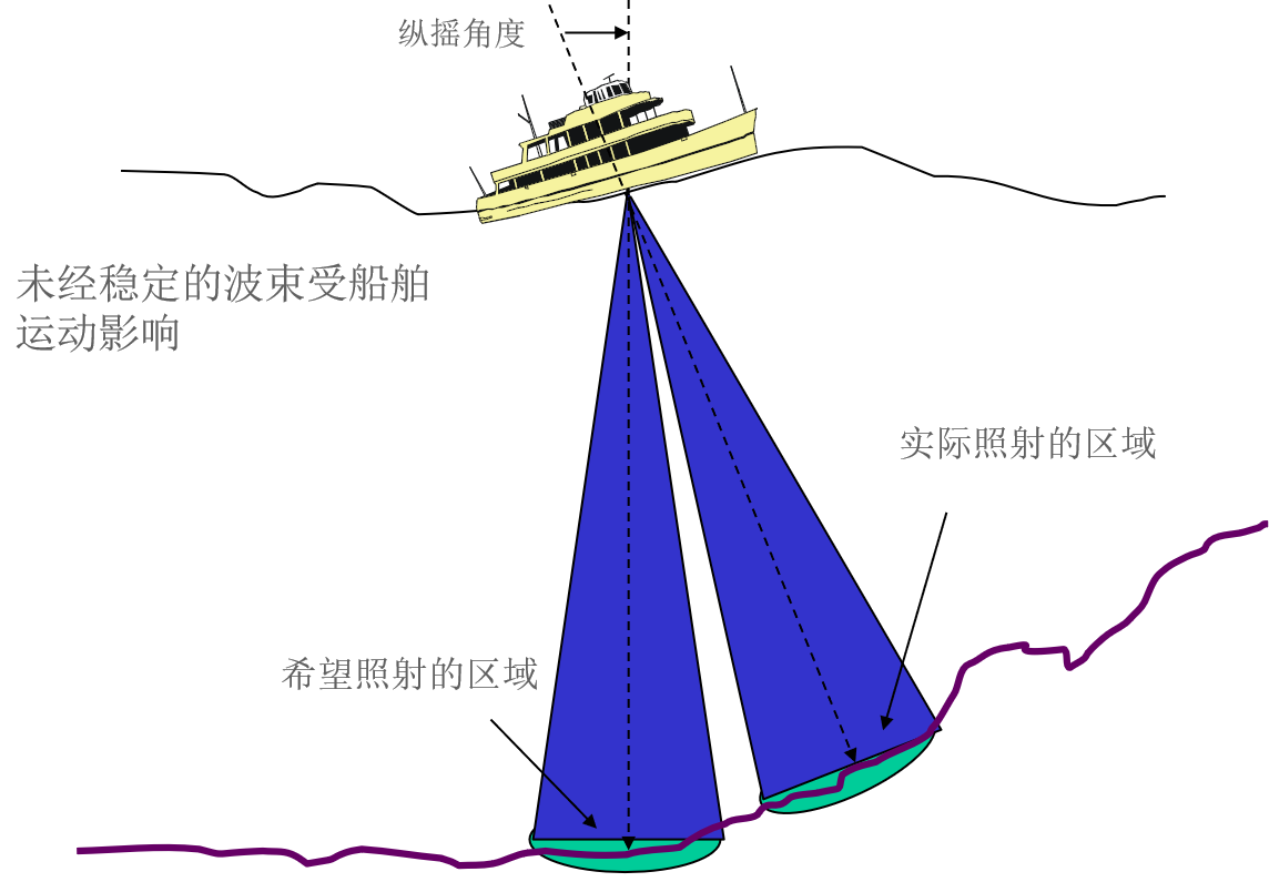
Compared with the Singlebeam sounding system, the multi-beam sounding system has more abundant and complete sensors and can measure more accurate underwater coordinate information with the cooperation of high-precision sensors such as sound velocity meters, attitude meters, and tide level meters. As shown in the figure below, the measurement error of a Singlebeam becomes larger under the swing of wind and waves, while the multi-beam is not affected by this.
Secondly, the Singlebeam beam angle is about 6-8 degrees, while the multi-beam angle is between 0.5-2 degrees. For example, the beam angles of the MS400P and MS8200 of Beijing Haizhuo Tongchuang are both 1 degree. Compared with the Singlebeam, the multi-beam angle is 1 degree. The smaller the beam angle is, the closer the returned water depth value is to the true value of the bottom, and the more accurate the reflection of the terrain trend.
2. Multibeam Echosounders Offer a Higher Resolution Compared to Singlebeam Echosounders
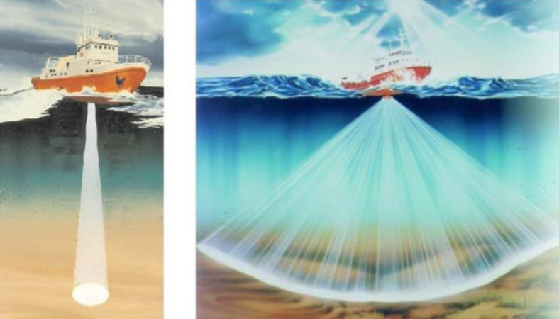
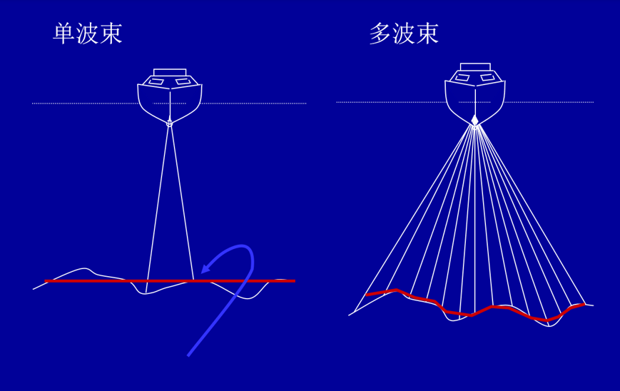
Anyone who has been in touch with bathymetry knows that a Singlebeam is a "point-to-line" measurement method. Each measurement can only measure one bathymetric point. With the navigation and movement of the carrier and equipment, a point-to-line measurement result is generated. ;
Multibeam is a "line-to-surface" measurement method. Hundreds or even thousands of water depth points perpendicular to the track direction can be obtained in one measurement. measurement results.
No matter how the measurement is encrypted with a Singlebeam, it cannot be compared with the full coverage measurement of multiple beams.
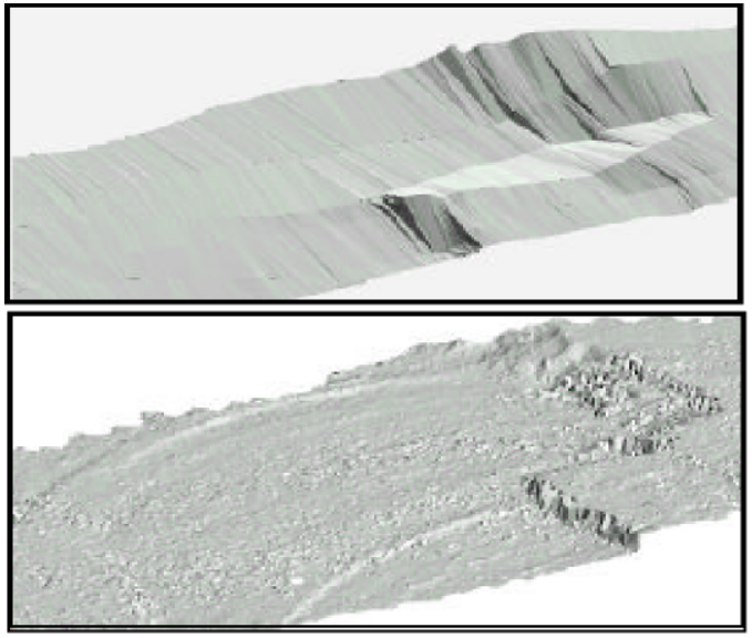
The above picture shows the same underwater terrain. Due to the difference in the density of underwater points collected by Singlebeam and multi-beam, the resulting resolution is different. It can be seen from the renderings that many details of the terrain cannot be reflected and expressed by a Singlebeam. As shown in the figure below, even the Singlebeam encrypted measurement still cannot achieve the multi-beam measurement effect in terms of resolution, and there are still a lot of terrain details that cannot be reflected:
In the above figure, the left side is the Singlebeam data, and the right side is the multi-beam data. It can be seen from this effect that there is a lot of loss of details in the Singlebeam measurement effect. When the resolution is incomparable, the generated topographic map has The loss of key information will inevitably lead to a decline in the "accuracy of results".
3. Multibeam Echosounders Offer High-Efficiency
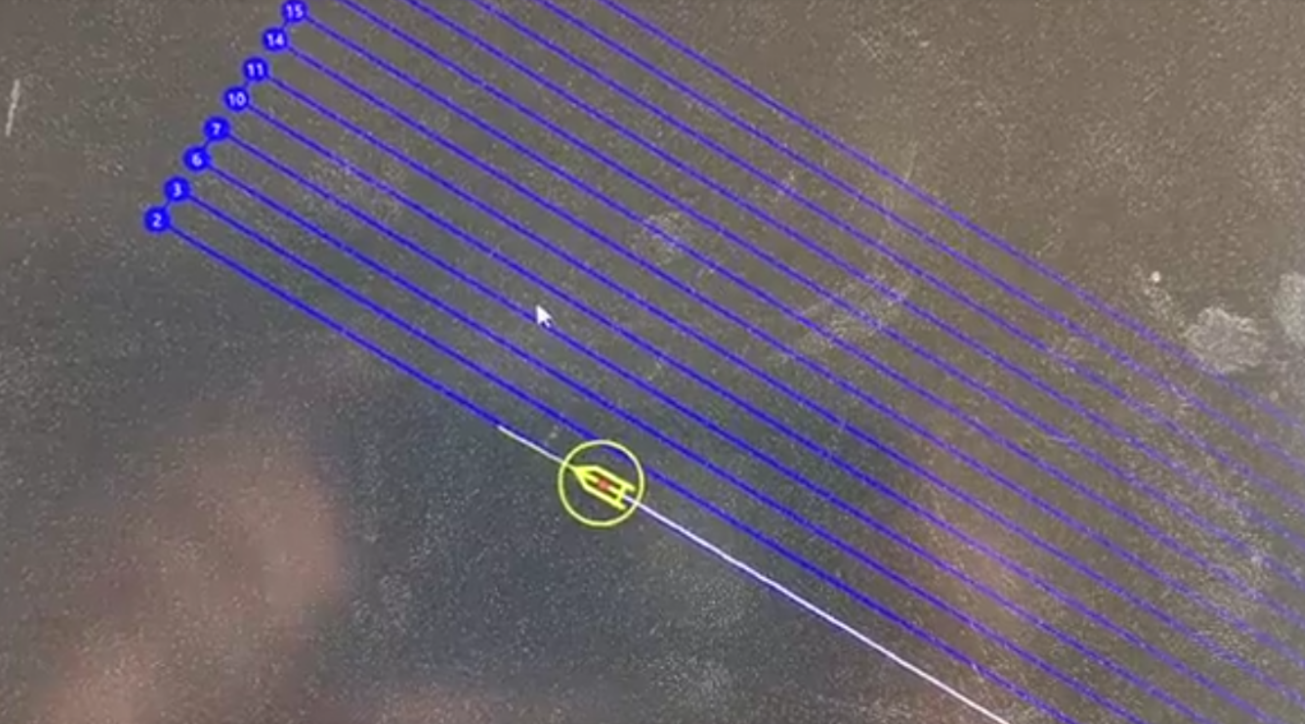
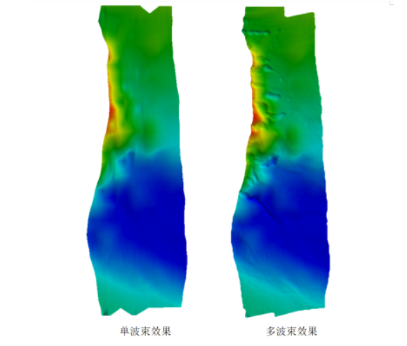
Singlebeam point-to-line measurement to multi-beam line-to-surface measurement not only improves resolution but also improves underwater measurement efficiency. 6-8 times larger than that, and even larger scanning coverage widths are used for scanning. The waters with a water depth of 10 meters are also subjected to 1:500 topographic map scanning. A Singlebeam of 5 meters is a survey line, and multiple beams are covered by a survey line. 60-80 meters, the efficiency is much higher than that of Singlebeam echo sounders. The working time is greatly reduced and the efficiency is greatly improved.
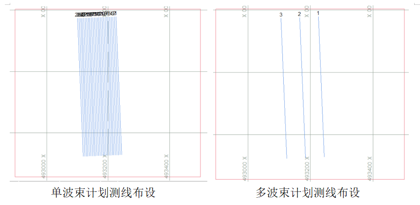
As can be seen from the above figure, for the same terrain scanning, the total length of the multi-beam survey line is much less than that of the Singlebeam, and the direct result is that the multi-beam terrain scanning efficiency is much higher.
Unmanned Surface Vehicles Require a Compact Multibeam Echosounder System
As mentioned above, if the miniaturized unmanned surveying vessel wants to solve the measurement problem in non-vessel waters and shallow waters, it must take advantage of its advantages of small size, lightweight and shallow draft. Human surveying ships are bound to develop in the direction of smaller size, lighter weight, and shallower draft. As the current advanced technology of underwater surveying, the multi-beam bathymetry system must solve the problem of unmanned surveying ships in shallow waters and shipless waters. Therefore, in order to adapt to the operation of such unmanned surveying ships, the multi-beam bathymetry system must have the following advantages to be easier to use.
1. The Features of a Multibeam Echosounder
- Small Size and Light Weight
The application of the unmanned surveying vessel requires that its draught should be shallow, and its load must be light. The unmanned surveying vessel is easy to transport but requires a small size, and its load capacity must be limited. Therefore, it is required that the sonar should be small in size and integrated It is equipped with a high-precision attitude meter and a sound velocity meter. Therefore, in order to be better used with lighter and smaller unmanned ships, the multi-beam bathymetry system must also be small in size and light in weight. - High Safety Factor
From the above-mentioned multi-beam system composition, it can be seen that the multi-beam bathymetric system is still very complex. It contains many auxiliary pieces of equipment, and many components are indispensable. However, the unmanned surveying ship itself is small in size and complex and diverse. Each part of the multi-beam must be small enough, otherwise, it cannot be installed, and the highly integrated product reduces the total equipment volume, wiring and other solutions, and successfully reduces the difficulty of carrying unmanned ships. - Calibration-free Installation
Anyone who uses too many beams knows that the multi-beam bathymetry system must perform installation deviation calibration measurement during use due to its large number of sensors, and the calibration measurement must be carried out in a specific direction under specific terrain conditions. In unknown waters, even extremely shallow waters, it is difficult to find the terrain that meets the calibration conditions, and even there is no ideal calibration terrain. Calibrated functions and features. - Very Shallow Water Measurement Technology
The general effective measurement range of conventional multi-beam bathymetry systems is more than 0.5 meters, and individual products can only be used at the meter level or above. For extremely shallow waters, this measurement range is obviously not usable. Therefore, multi-beam measurement is used in extremely shallow waters. A deep instrument must solve the near field problem.
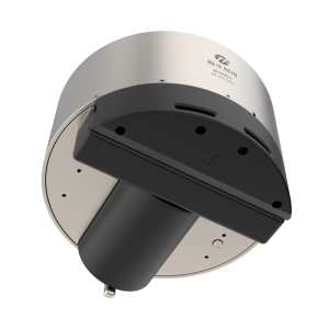
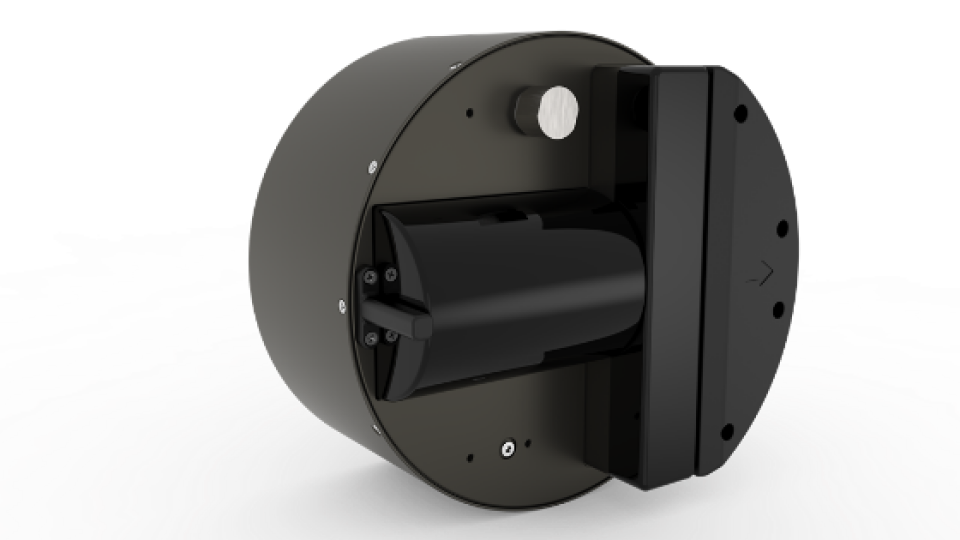
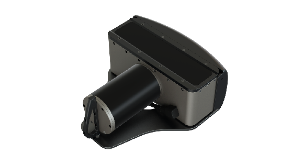
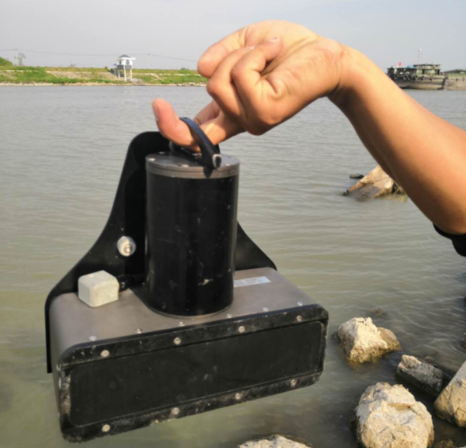
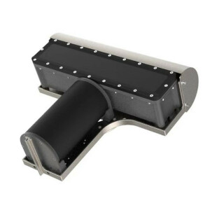
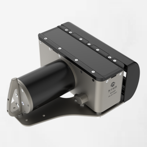
2. The MS400P Multibeam Echosounder
As mentioned above, the requirements for multi-beam bathymetry systems in specific water environments are mentioned, but the mainstream imported brand products on the market are generally large in size and heavy in weight, which is not suitable for miniaturized unmanned surveying vessels. The MS400P multi-beam sounding system of Beijing Haizhuo Tongchuang Co., Ltd. came into being under the condition of an in-depth understanding of the development needs of the industry. This multi-beam sounding system completely subverts the traditional cognition, with excellent performance and index functions comparable to international mature products, but like a Singlebeam, it is small in size, light in weight, low in power consumption, and simple in operation, so that one person can easily complete complex underwater measurement tasks.
3. Features of the MS400P Multibeam Echosounder System
- Small Size
Small size, like a dictionary, a shoebox; lightweight, the probe is only 6 kg; low power consumption, as low as 40W; installation is as fast and convenient as Singlebeam.
-
Mainstream Indicators
400kHz working frequency, 512 electron beams, 1°×2° beam width, 143° beam opening angle, 0.2-150m measurement range, 0.75cm sounding resolution, 60Hz maximum ping rate, all of which are mainstream advanced shallow water multi-beam standard indicators. -
Advanced Functionality
Near-field dynamic focusing beamforming, installation-free calibration, real-time water imaging, real-time roll stabilization, Sidescan image output, with various advanced multi-beam functions; -
Highly Integratable
The integrated attitude measurement instrument and sound speed instrument can realize installation-free calibration and tilt measurement at any angle. Users can also choose Hydra POS or other external attitude instruments according to their needs to meet the application needs of various occasions. -
Calibration-free Installation
MS400P multi-beam bathymetry system, with its deep "inertial sound fusion" technology, realizes installation-free calibration and saves a lot of fieldwork through the characteristic installation structure. -
Very Shallow Water Measurement Technology
It adopts advanced dynamic focusing beamforming, adaptive sidelobe cancellation and other technologies to ensure a clear effect both far and near. Its effective measurement range is 0.2~150 meters, which is very suitable for extremely shallow water measurement.
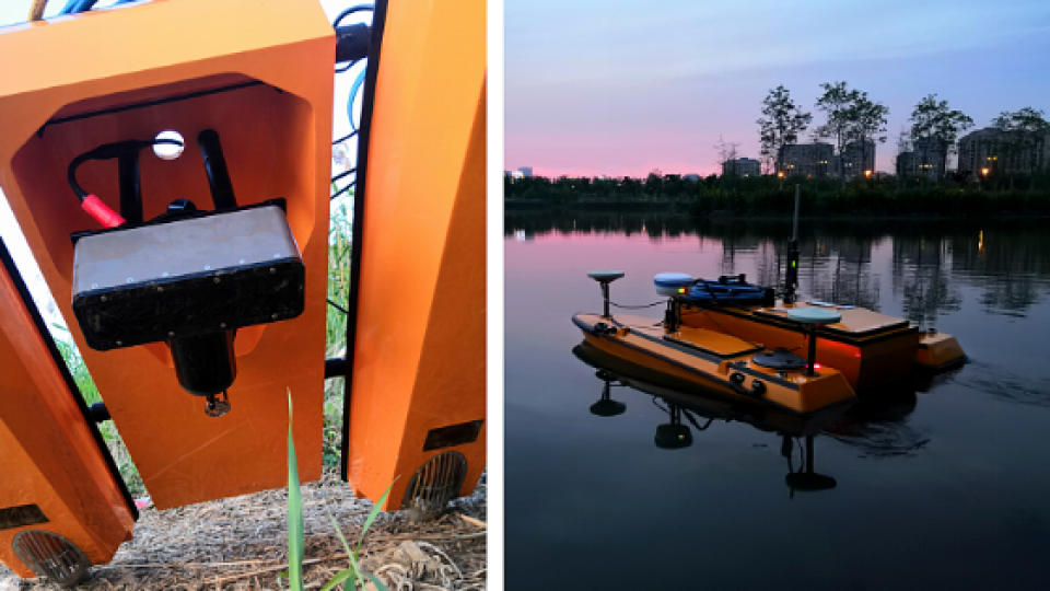
4. Application Example of the MS400P Multibeam Echosounder on a USV
MS400P multi-beam sounding system has excellent performance. Unmanned ship manufacturers usually choose MS400P for integration when selecting multi-beam sounding equipment for survey ships. At present, it has been tested for many unmanned ship manufacturers at home and abroad.
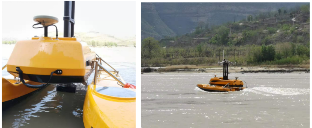
Yunzhou ME120 unmanned surface vehicle (2.5m in length)
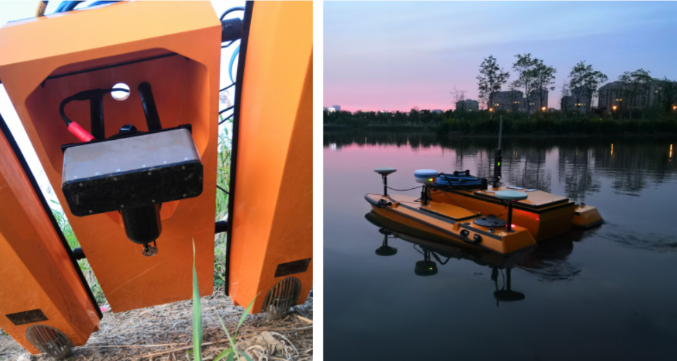
Usta U160 unmanned surface vehicle (1.6 meters in length)
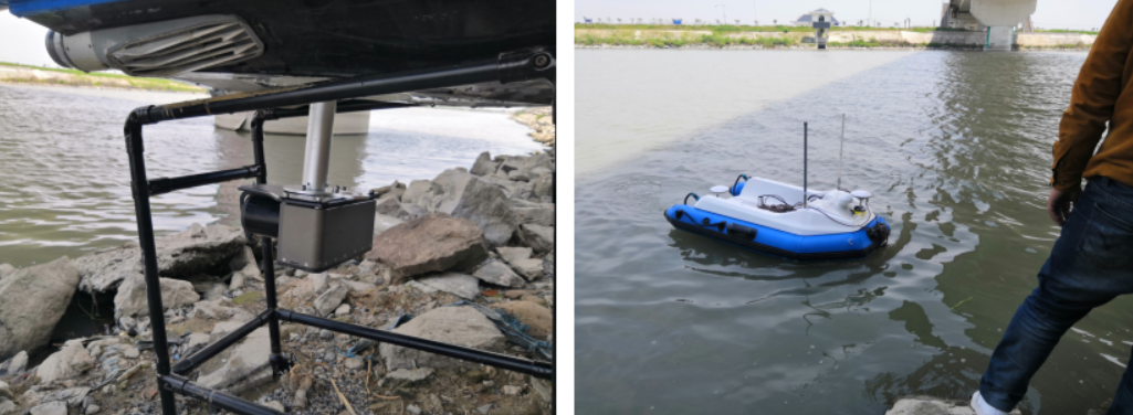
Kewei C170 unmanned surface vehicle (1.7 meters long)
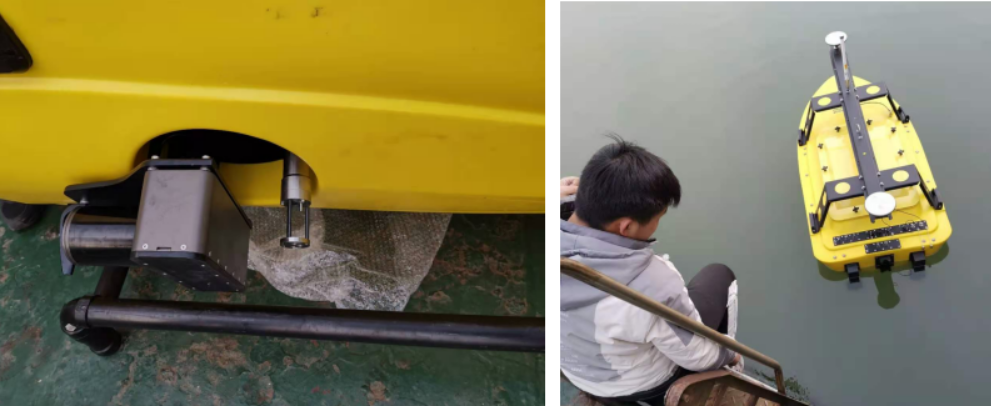
Seafloor unmanned surface vehicle (1.6 meters in length)
The Future of Unmanned Surface Vehicles and Multibeam Technology
With the development of unmanned ship technology, with the development of multi-beam technology, with people's desire for big data, people's needs will become more and more, underwater detection will require more and more accurate, and the detection frequency will become more and more The more, we can boldly guess that the future must be an era of big data that is efficient, can build data models, can do historical analysis, and can do evolutionary trend analysis. Whether it is for unmanned ships or sensors, there will be more and more demands. Whoever is at the forefront of technology will grasp the pulse of the future.

In the next ten years, the underwater era must be a big explosion. Various unmanned platforms, surface type and underwater type are equipped with various detection sonars to complete various projects. We can even imagine such a scenario:
1. Surveying with Unmanned Surface Vehicles is Easier
Various unmanned carriers are equipped with multi-beams of various specifications, and network measurements are performed during the limited measurement window period. Unmanned and efficient, the operator is sitting on the mother ship drinking coffee.
2. One Echosounder Device for Multiple Purposes
In the future, one "multi-beam" can realize multi-beam mode sounding, Sidescan Sonar mode image analysis, and image sonar mode to achieve target dynamic monitoring and other functions. The multi-beam technology developed by Haizhuo Co., Ltd. has been at the forefront of technology.
3. Big Data Analysis
In this era when everyone is vying for data, having more data means having more possibilities, historical comparison, evolutionary deduction, and many things we dare not think about, Haizhuo Tongchuang Qingdao Branch is dedicated to solutions such as software development and data analysis, providing all possibilities for our future.
To sum it up in one sentence:
"The future can be expected! All we need to do is go a little faster than others''
Do you have questions about this case study?
Get in touch with Hydro-Tech, and they would be happy to answer any questions you have about pricing, suitability, availability, specs, etc.


![3月21日-封面[1].jpg](https://cdn.geo-matching.com/voeE1ywo.jpg?w=320&s=6b3b1a0215d770f8797653e9202a8f52)


