

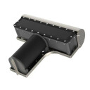
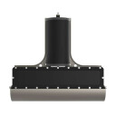


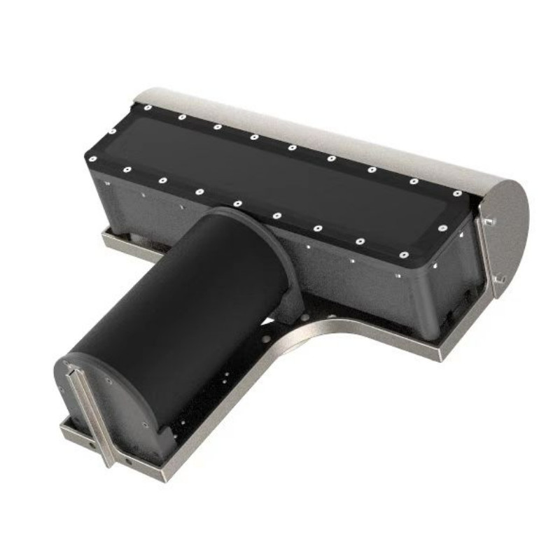
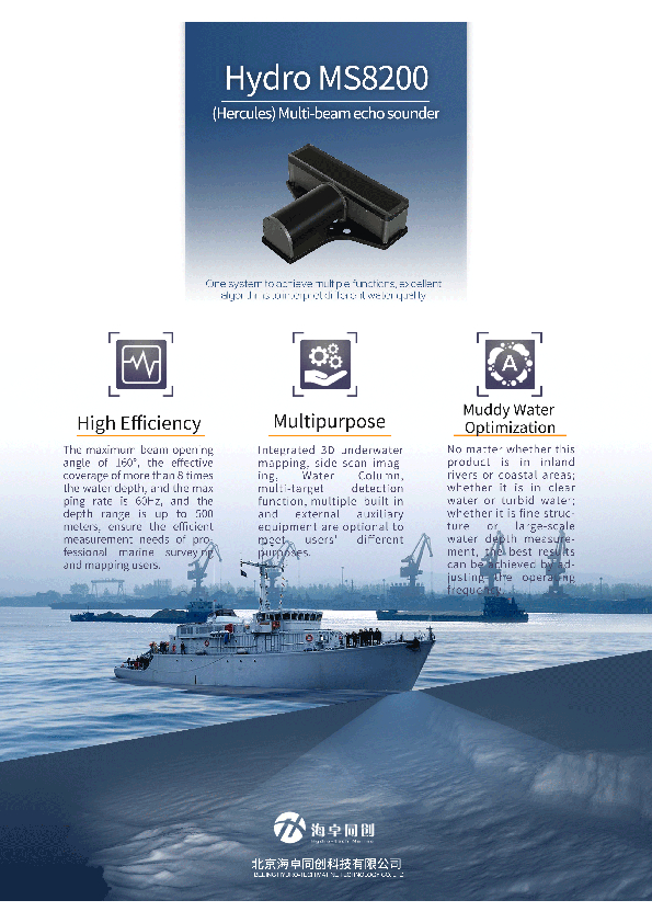
MS8200 MBES Multibeam Echosounder
Wide Swathing Coverage | Ultra-High Efficiency | Competent in Muddy Water
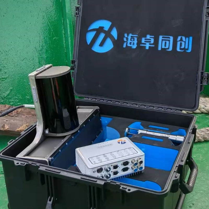
MS8200 is specially designed for professional oceangraphic mapping and deep channel surveying. It is based on the new product platform that our R & D team developed after so many year of sounding technology accumulation and studying the advantages & shortcoming of various models using under diversified environments. MS8200 is not only of reliable quality, but also with most advanced technologies. It can work well in harsh hydrology environment.

Hydro-Tech
Beijing, CN
Description
Main Features
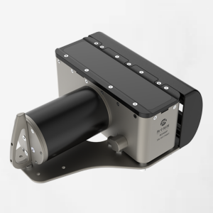
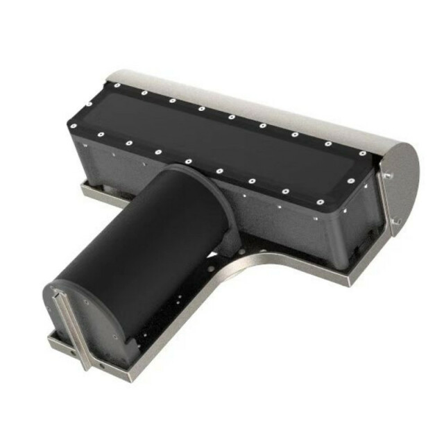
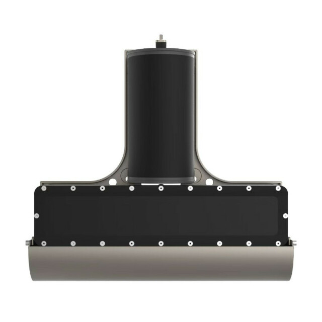
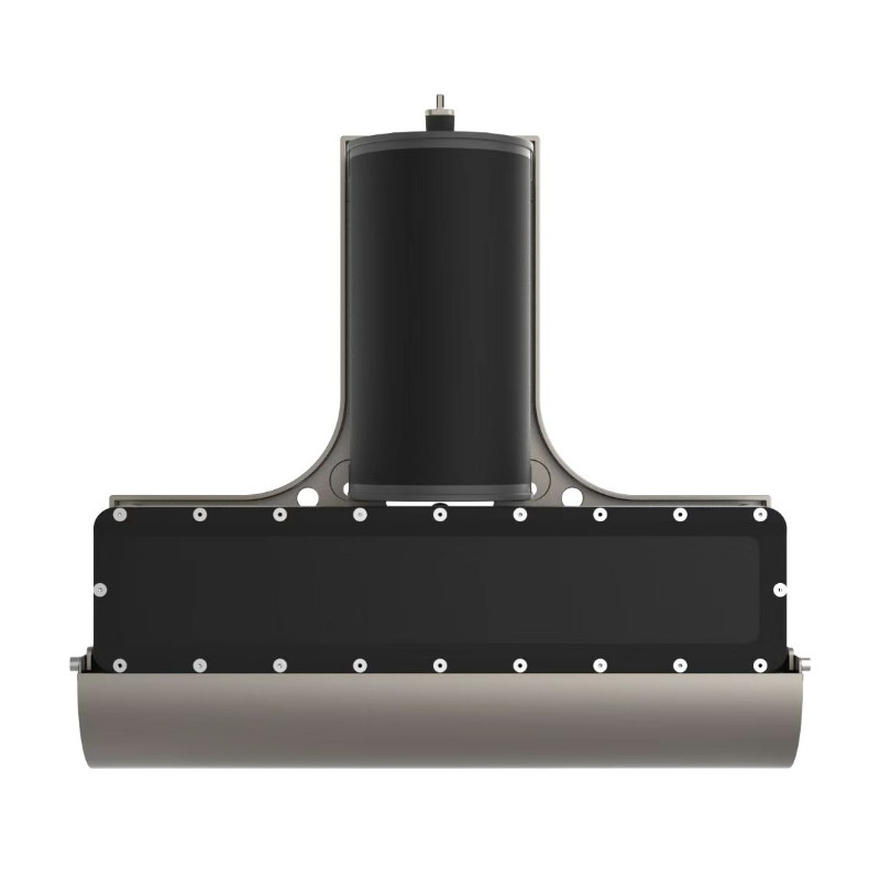
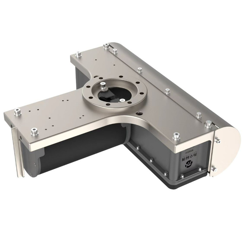
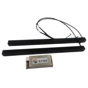
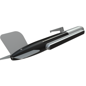
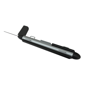
- Titanium Housing:Waterproof and Anti-Corrosion
- High Efficiency:160° Swath Coverage | Ping Rate 60Hz | Sounding Depth 400m
- One System Multi-functions:3D Underwater Terrain Survey | Water Imgaing | Scanning Imaging | Multi-Objects Detection
- Different Water Survey:River or coastline, clear or muddy water, fine structure or big range surveying, all can get the accurate result through adjusting working modes
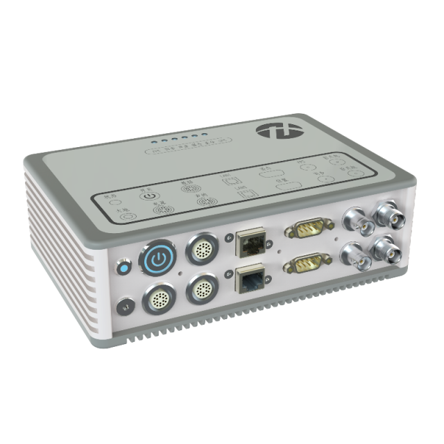
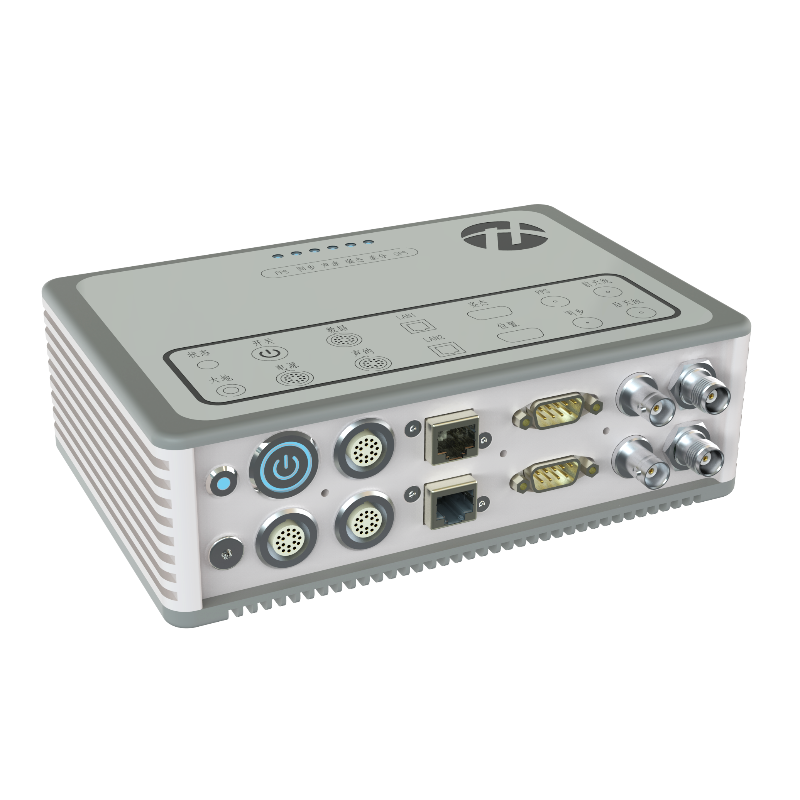
- Supply with Hydro Navi & Quest Software, which is easy operation and user friendly
- Suit for professional survey for big range shallow water oceanographic investigation | Channel surveying and dredging | Hydrographic surveying | Wind power Maintenance | Oil & Mine Exploration
Do you have questions about this product?
- Questions about price, availability, and/or retailers
- Questions about technical specifications and usage
- Questions about suitability for your project or application
Specifications
-
Physical properties of transducer head
-
Length [m]
0.5
Width [m]
0.457
Height [m]
0.147
Min. external power [V]
10
Max. external power [V]
240
Max. power consumption [W]
80
Weight in Air
22.6kg
Weight in Water
15.5kg
-
Speed of sound
-
Real-time correction of refraction at transducer head
Y
Real-time integration of SV-profile
Y
Explanation of SV-profile application process
Through acquistion software
-
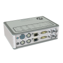
Interfaces
-
Compatible software
Many industry software support XTF data formats
Compatible hardware
Motion; Heading; SVS; SVP; GNSS
Real-time access procedure
Online Software; Gigabit Ethernet
-
Motion compensation
-
Motion sensors compatible to the system
Supports multiple industry standard sensors
-
Mounting and deployment
-
Mounting
Hull mounted & Portable
Retractable
N
-
Used Sonar Methods
-
Type of system
High resolution multibeam echosounder
Bottom Detection Method
EquiAngular or EquiDistant
Sonar type
Beam-forming
-
System Parameters
-
Min. frequency [kHz]
200
Max. frequency [kHz]
200
Number of selectable frequencies
1
Min. depth [m]
0.5
Max. depth [m]
400
Depth resolution [mm]
7.5
Max. swath as a function of depth
160
Max. pings / second
512
Ping frequency [Hz]
60
Min. beam width across track [deg]
1
Min. beam width along track [deg]
2
Number of beams
512
max Swath Update Rate
160
-
Bottom Coverage
-
Equi-angular/equi-distant mode
Backscatter
Y
Water column
Y
-
Uncertainty
-
Intended S44 order
Special
-
More information
-
Distinguishable features
Near Field Focus; Muddy Water Survey
-
General
-
Date of first release
2020
Documents
Brochure
hydro-tech-ms8200.pdf
3.66 MB

