
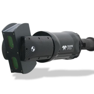
Titan ALTM
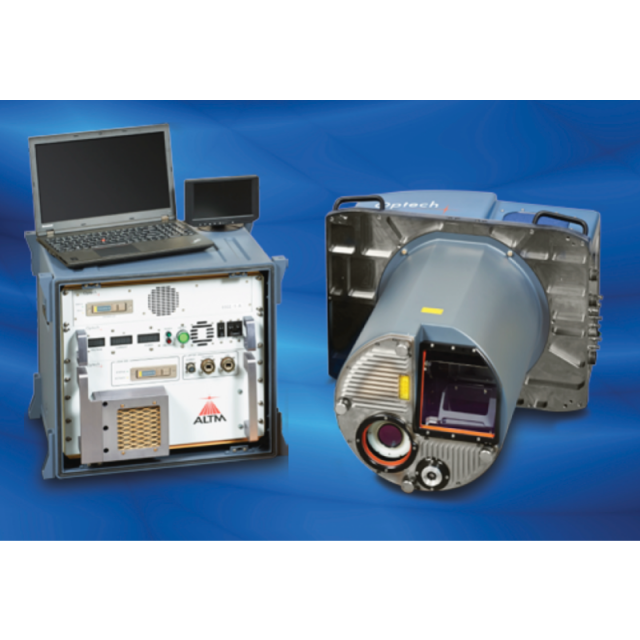
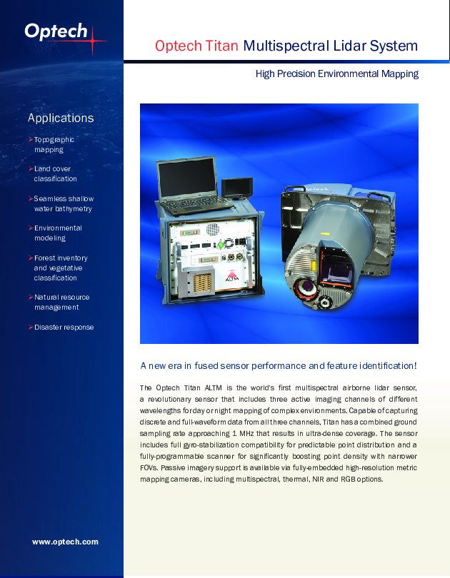
As the world’s first multispectral airborne lidar sensor, Optech Titan is opening up a new era in lidar survey and mapping. 3D surface spectral response information sensitive to the emitted wavelengths can now be derived day or night from complex environments using a single lidar sensor.

Teledyne Geospatial
Vaughan, CA
Description
As the world’s first multispectral airborne lidar sensor, Optech Titan is opening up a new era in lidar survey and mapping. 3D surface spectral response information sensitive to the emitted wavelengths can now be derived day or night from complex environments using a single lidar sensor.
Do you have questions about this product?
- Questions about price, availability, and/or retailers
- Questions about technical specifications and usage
- Questions about suitability for your project or application
Specifications
-
General
-
Year of introduction
2014
Year of last update
2014
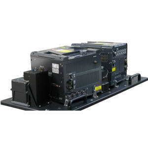
Total Weight [kg]
116
Power requirements
800 Watts
Type of GNSS/INS positioning system
Applanix AP50 OEM
Camera
80 MP orthometric RGB/CIR
Data storage facilities
ruggedized, removable SSD
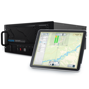
Mission planning software
Optech FMS (realtime XYZI point display)
Postprocessing software
Optech LMS (auto lidar/camera boresight/calibrati
-
Application
-
Main applications
Day/night multispectral data collection3D land surface classification Seamless shallow water bathymetryVegetation mappingEnvironmental modelingForest inventoryHigh resolution topographic mappingRapid response
-
Measurement Characteristics
-
Scanning method
Programmable scanner
Scan frequency [Hz]
210
Min. pulse frequency [Hz]
150000
Max. pulse frequency [Hz]
900000
Max. field of view [deg]
60
Max. number of recorded echoes per pulse
4
Full-wave form digitization
Y
Pulse sampling frequency [GHz]
1
Recording of intensity of return signal [bits]
12
multiple pulses in air
Y
-
Operation Characteristics
-
Platform
Fixed-wing
Min. flying height [m]
300
Max. flying height [m]
2000
Max. acquisition time [hr]
8
-
Laser Pulse Characteristics
-
Wavelength [nm]
53210641550
Standard pulse length [ns]
3
Beam divergence [mrad]
0.35
Type/class laser
IV
Eyesafe range [m]
300
Pulse length variation [ns]
0
-
More information
-
Distinguishable features
World's first multispectral lidar sensor with 3 independent, active wavelengths;full gyro-stabilization;optional full-waveform record;fully programmable scanner for superior point density;realtime in-air 3D XYZI in LAS format, choice of embedded; passive image support including 29MP NIR, 80MP RGB/CIR, multispectral, thermal
-
Uncertainty and resolution
-
Pitch and roll pointing precision [deg]
0.005
Heading pointing precision [deg]
0.008
Elevation precision at 1 km [m]
0.02
Planimetric precision at 1km [cm]
13
Across-track point spacing at 1km [m]
0.1
-
Application areas
-
Select an application area:
Documents
Brochure
migrationjkz5ct.PDF
12.5 MB


