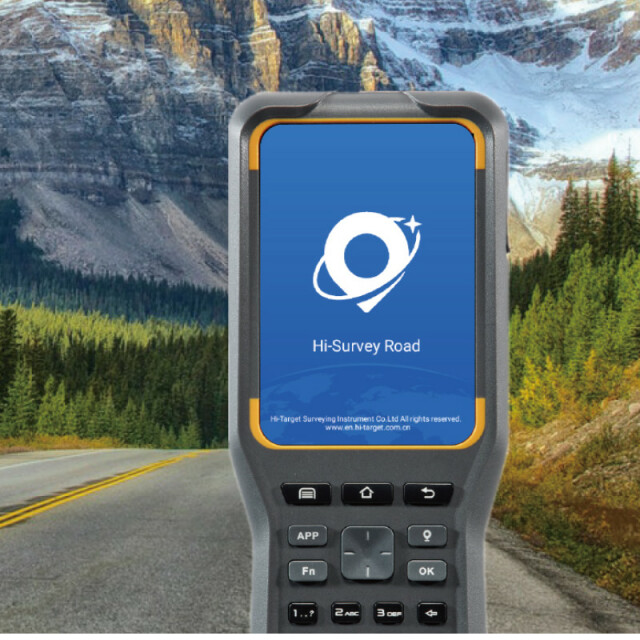
Hi-Survey Road Software
Surveying on the way
Hi-Survey Road is an Android software that is designed for all types of land survey and road engineering projects in the field. It is compatible with Hi-Target professional controllers, Android phones, tablets, and other third-party Android devices. It is a sleek and easy-to-use software that supports the operating of big data with built-in tools. With customized industrial application solutions, more possibilities are created for users.

Hi-Target
Guangzhou, CN
Description
Initialize your efficient work
An efficient measurement method. When it combined with a professional GNSS receiver and will make your measurement become simple.
Quasi-dynamic survey function
A measurement method independently developed by Hi-Target, surveying in some tough areas where there is strong multi-path interference, signal blocking like standing beside the big trees.
Road engineering survey
Using for staking complex roads, combining road lines, and has three road algorithms (intersection, element, coordinate) support all kinds of roads, common line, and multi-type complex lines.
For more information, please click HERE to visit our website.
Do you have questions about this product?
- Questions about price, availability, and/or retailers
- Questions about technical specifications and usage
- Questions about suitability for your project or application
Specifications
-
GNSS data and processing
-
GNSS static / RTK data collection
Y
GNSS setting out
Y
Input data formats supported
*.txt, *.csv, *.dxf, *.shp, *.dat, *.asc, *.kml, *.NCN, *.geojson
Base and rover RTK
Y
Post processed kinematic
Y
Network RTK
Yes
-
General
-
Software version
V2.0.5
Mobile (real time connected to instrument)
Y
-
Integrated environment for
-
GNSS data
Y
GNSS + dead reckoning data (Mobile Mapping)
N
TPS data
N
Point cloud data
N
Integrated least squares computation of control
Y
Transformation between map projections
Y
Compute grid DTM
Y
Compute TIN
Y
Computation of sections through surfaces
Y
Volume computation from sections
Y
Volume computation by substracting surfaces
N
-
More information
-
Distinguishable features
Android OS


