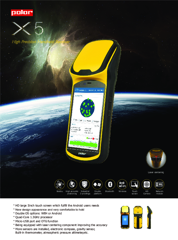
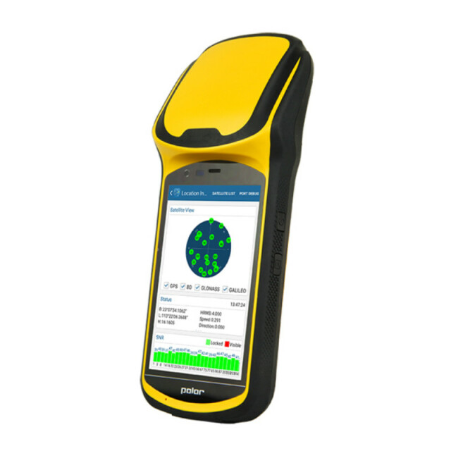
X5
High Precision Handheld Receiver
The South X5 adopts a professional GNSS module which receivers 220 channels, including GPS, GLONASS and BDS to ensure faster satellite tracking and more reliable positioning results.
SOUTH Surveying & Mapping
Guangzhou, CN
Description
The South X5 adopts a professional GNSS module which receivers 220 channels, including GPS, GLONASS and BDS to ensure faster satellite tracking and more reliable positioning results.
As one of the best sold products of South Group, the X5 can be widely used in a variety of applications in the GIS field.
For example, forestry investigation, agriculture management, land resource investigation, underground pipe and cable detection, geodetic control survey, etc.
Specifications
-
General
-
Height [m]
0.231
Depth [m]
0.057
Width [m]
0.092
Total Weight [kg]
0.56
Type
-
Performance
-
Max. simultaneous tracked channels
220
Tracked satellite signals
GPS L1. GLONASS L1. BDS B1.
SBAS differential signals
Yes
Reacqisition time [s]
1
RTK Network Compatibility
Yes
-
Environment
-
Operating temperature: min. [°C]
-30
Operating temperature: max. [°C]
60
Humidity resistance
IP67
Water sand and dust proof
IP67
Shock and vibration proof
Protected against 1.5 meter drop
-
Communication: Protocols
-
RTCM standards for differential data
RTCM2.3(1, 3, 9), RTCM31 etc.
NMEA output format
NMEA-0183
L-Band Compatible
Y
Configuration method
Android 5.1 Operating System
-
Communication: links
-
CDMA phone modems
3G WCDMA
-
Horizontal uncertainty
-
Initialization time on the fly [s]
30
-
Power
-
Internal power supply
Changeable 3.7V, 7200mAh Li-Ion, 2 batteries (standard)
Operating time with internal power supply [hr]
10
Rechargeable with (auto)battery
supports car-charger and charge pal
Direct car connection cable available
Yes
-
Recording
-
Memory medium
16GB ROM(32GB optional), extensible to 32GB
Data capacity [MB]
16384
Type of data (on board recording)
NMEA-0183
-
More information
-
Distinguishable features
Laser centerring, Electronic compass, gravity sensor, built-in thermometer, atmospheric pressure altimeter, light sensor and distance sensor (optional)


