


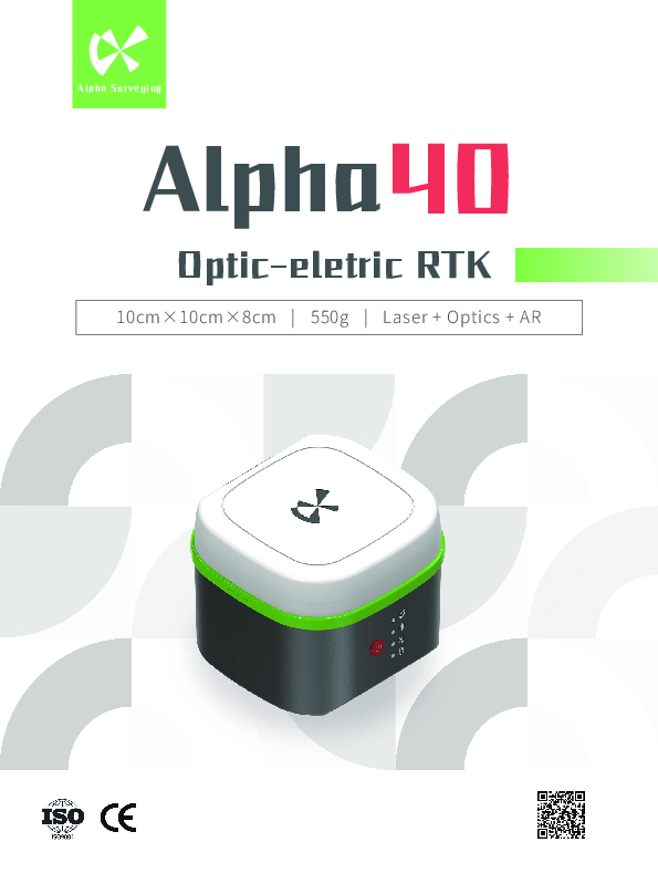
Alpha 40 Laser + AR Visual Stakeout GNSS
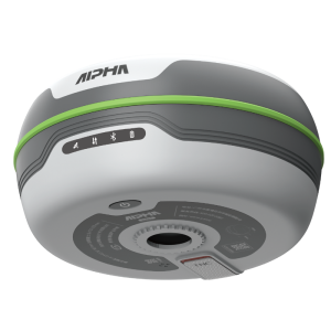
Alpha 40 optic-eletric RTK
Alpha 40 is a lightweight optic-electric RTK, an intelligent platform designed for the future, with rich communication modes and interfaces for collaboration with intelligent terminals, optoelectronic products, and unmanned systems.
Description
Alpha 40 Laser + AR Visual Stakeout GNSS
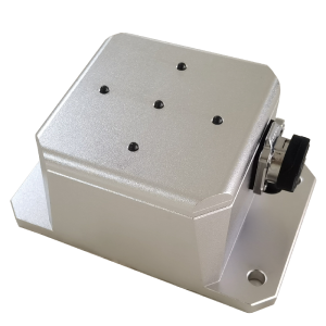
10cm×10cm×8cm | 550g | Laser + Optics + AR
Alpha 40 optic-eletric RTK
Excellent Performance
Anti-block
Instant fix
High precision
Long battery life
18h at CORS mode
15h at radio receiving mode
8h at radio transmitting mode
Calibration-free
Alpha 40 integrates GNSS, IMU, and magnetometer data, and adds temperature compensation and other algorithms to achieve real-time output of accurate tilt measurement data at high tilt angles and high dynamic postures, with a 60° tilt angle and an accuracy of 2cm. No initialization is required, just take a few steps to enter inertial navigation mode.
Optic-electric Measurement
With the advanced optic-electric technologies from Alpha Surveying, laser is combined with the RTK to provide 360° measurement without blind spots, 30 meters measuring radius with accuracy of millimeter. With high speed calibration-free IMU, unlike ordinary laser RTK, Alpha 40 can perform non-contact measurement of target points through optical system calibration when the laser point is invisible under strong light.
2 Watts Fully Compatible Transceiver Internal UHF Radio
supports external radio
AR Visual Stakeout
Professional camera; real-time clear display under outdoor bright light; real-scene stakeout navigation; combination of design data and images make efficient works.
Professional Surveying Instrument DiMap Pro
Besides point survey, detail survey, control point survey, point stakeout, CAD mapping, stake road, electric lines survey, DSM stakeout, also include polyline survey, polygon survey, spiral stakeout, electric towers stakeout, photovoltaic stakout.
Do you have questions about this product?
- Questions about price, availability, and/or retailers
- Questions about technical specifications and usage
- Questions about suitability for your project or application
Specifications
-
General
-
Depth [m]
0.1
Height [m]
0.08
Housing Material
alloy
Total Weight [kg]
0.55
Width [m]
0.1
Year of initial introduction
2024
Type
Land
-
Performance
-
No. channels
1408
Reacqisition time [s]
< 1
RTK Network Compatibility
TRIMTALK 450S 、TRIMMARKⅢ
SBAS differential signals
L1
Type of measurements
Land
-
Environment
-
Humidity resistance
Up to 100%
Operating temperature: min. [°C]
-30℃
Operating temperature: max. [°C]
70
Shock and vibration proof
Normal temperature resistance of 1.6 m drop (hard ground)
Water sand and dust proof
IP67
-
Communication: general
-
Communication ports
TRIMTALK 450S 、TRIMMARKⅢ
Bluetooth
Y
-
Horizontal uncertainty
-
Range on the fly [km]
5
-
Power
-
Certifications
CE,IOS
External power supply
power bank
Internal power supply
battery
Operating power: max. [V]
20
Operating power: min. [V]
9
Operating time with internal power supply [hr]
18
Connectors
type-c
-
More information
-
Distinguishable features
10cm×10cm×8cm | 550g | Laser + Optics + AR
Documents
Brochure
Alpha 40.pdf
3.13 MB
Videos


