

QBase 3D
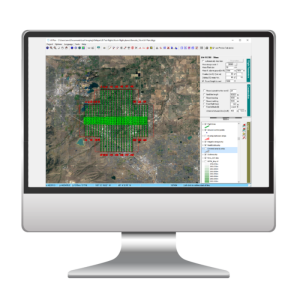
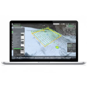
QBase 3D is a software solution for planning surveying tasks with Quantum-Systems UAVs. It is part of the overall Trinity F90+ package and can be operated intuitively and safely with no training required. It is simple and easy to use, with integrated imagery and digital terrain modelling (curated ESRI data), 3D mission viewing and planning, live monitoring of mission progress and aircraft status and integrated data post-processing.
Quantum-Systems GmbH
Gilching, DE
Description
QBase 3D automatically generates safe and precise flight paths after entering the mission parameters and no-fly-zones, including a detailed mission simulation, with wind forecast, battery consumption and flight time, automated verification of mission risks or errors and advanced terrain following to increase safety and data quality. Safe return paths ensure a risk-free return to home in any situation.
QBase 3D saves valuable time over the entire workflow to complete a surveying job through its efficient operation. Mission synchronization means that missions can be managed across several devices with just one license. Maps and terrain data can be downloaded for offline use. Advanced geotagging and data can be exported to common photogrammetry tools and the built-in PPK ensures high data accuracy.
Specifications
-
General
-
Desktop platform support
-
Flight Planning Characteristics
-
Flight modes