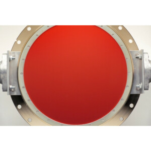

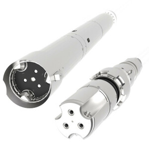
Ocean Surveyor ADCP
With Decades of Experience In Both ADCPs (Acoustic Doppler Current Profilers) And Specifically Phased Array (flat-faced) Transducer Technology.
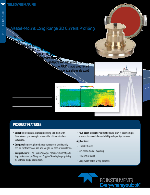
The world’s most prestigious research institutions, militaries, government agencies and private companies utilize the vessel-mounted Ocean Surveyor family of ADCPs which can collect detailed maps of the distribution of water currents and suspended materials through the water column at depths 1000m and beyond.

Teledyne Marine
Daytona Beach, US
Description
These depth and resolution capabilities were previously considered unattainable, and TRDI remains the only ADCP manufacturer backed by published research and applications at these depths and resolutions.
Beyond high-quality data and performance, OceanSurveyor is indispensable in practical, operational decision-making where safe and efficient field operations rely on the right environmental data.
Key Features:
- The deepest current profiling available to assist in production and rig safety
- Two forms of signal processing: patented BroadBand for high precision; standard NarrowBand for extended range
- Field-proven technology that operates in the high-noise environment of oil platform production
- A track record second to none; the Ocean Observer has been adopted by all the major oil companies on every type of platform
- Patented phased-array transducer for extended range in a powerful yet compact package.
|
38 kHz |
75 kHz |
150 kHz |
|
|
Max Profiling Range |
>1000m |
>700m |
>400m |
|
Max Bottom Tracking Range |
1700m |
950m |
540m |
|
Velocity Accuracy (typical) |
±1.0% of measured velocity ± 0.5 cm/s |
±1.0% of measured velocity ± 0.5 cm/s |
±1.0% of measured velocity ± 0.5 cm/s |
|
Velocity Range |
-5 to +9/ms |
-5 to +9/ms |
-5 to +9/ms |
|
Ping Rate |
0.4 Hz |
0.7 Hz |
1.5 Hz |
|
Beam Angle |
30° |
30° |
30° |
|
Depth Rating |
100m |
100m |
100m |
|
Standard Sensors |
Temperature, Gyrocompass interface board |
Temperature, Gyrocompass interface board |
Temperature, Gyrocompass interface board |
|
Communications |
Serial RS-422 or RS-232 Hex-ASCII or binary |
Serial RS-422 or RS-232 Hex-ASCII or binary |
Serial RS-422 or RS-232 Hex-ASCII or binary |
Applications
- Seismic, Cable and Pipe Laying Vessel Operations
- Renewable Energy
- Research Vessels
- Academic Coastal Oceanography
- Climate Research
Do you have questions about this product?
- Questions about price, availability, and/or retailers
- Questions about technical specifications and usage
- Questions about suitability for your project or application
Documents
Brochure
ocean-surveyor-datasheet-lr.pdf
275.46 KB