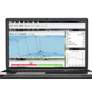
NavAQ
Easy Echosounder Data Acquisition!
BeamworX
utrecht, NL
Description
Easy Echosounder Data Acquisition!
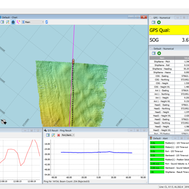
NavAQ is a user-friendly and versatile navigation and data acquisition program for Single Beam and Multi Beam Echosounders.
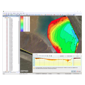
Positioning and Bathymetry results are computed in real-time, and visualized in various displays. All raw sensor data is logged for further processing. The raw and result files that are generated, seamlessly integrate into our other products AutoClean and AutoPatch. NavAQ includes flexible geodetic coordinate conversion routines for most existing Coordinate Reference Systems, including geoid models.
The Raw and result data are presented in various types of user-definable displays:
- Raw Single Beam Echosounder Echogram.
- Result for Multibeam Echosounder swaths.
- Chart View with grid and backgrounds (CAD, GeoTiff, Webmap).
- Graph and Numerical display.
- Alerts and I/O status.
- Left/Right Indicator for planned line.
A full range of equipment drivers is available (Serial, Network UDP, Network TCP):
- Multibeam: Kongsberg, Teledyne Reson , R2Sonic, Norbit, WASSP, PingDsp.
- Motion: Ixsea, SBG, Applanix, Kongsberg, NMEA.
- Single Beam: Kongsberg, Odom Teledyne, NMEA.
- NMEA position and Generic user defined data.
Specifications
-
General
-
Year of initial development
2017
Year of latest version
2019
Operating System
Windows
Area of Application
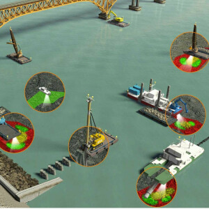
Hydrographic Survey Dredging Coastal Construction
-
Geodetic Functionality
-
Supported coordinate systems
Any Type (Proj4)
Supported datum transformations
Any Type (Proj4)
Geographical coordinates (Lat, Long)
Y
Ground coordinates (E,N)
Y
Seven Parameter shift supported
Y
Time-dependent Transformation Parameters (14param)
N
Supported vertical reference frames
Various
Ellipsoidal reference support (GRS80)
Y
Separation model for vertical datum shift support
Y
Local datum support
Y
Supported map projections
Any Type (Proj4)
-
Data / System Support
-
Recorded data storage formats
Proprietary Binary. Raw original incoming data is stored.
Supported Hydrographic Systems
SingleBeam, Multibeam, Motion sensors, GPS,Compasses
Supported multibeam systems
Kongsberg, Teledyne Reson , R2Sonic, Norbit, WASSP, PingDsp.
Supported surface positioning systems
Various
Supported singlebeam systems
Kongsberg, Teledyne, NMEA
Supported sidescan sonar systems
None
Supported magnetometer systems
None
Supported gyrocompass systems
Various
Supported motion sensor systems
iXBlue,Kongsberg, SBG, Applanix, NMEA,User Defined
Supported INS
Various
Time synchronization methods
GPS NMEA
-
Online capabilities
-
Helmsman display
Y
Max. number cloned displays
Unlimited
Supported background formats
Geotiff, TMS,WTMS,WMS
Max number of online displayed ROVs
Unlimited
Max number of online displayed surface vessels
Unlimited
Computed orientation solution
N
3D real time display
N
RTK GPS height correction
Y
Real time video integration
N
Real-time Pipe detection
N
Real time IHO / IMCA TPU support
N
SSS waterfall display
N
SSS target annotations
N
Backscatter display
Y
Online filtering options
Various
Status Views equipment
Various
Multibeam bathymetry coverage
Yes
Multibeam water column display
N
Remote control
N
Real-time DTM vizualization
Y
Online eventing
N
Real-time DTM comparison
Y
Supported 3D display data
N
-
Hardware requirements
-
RAM
8000
HD (GB)
128
Processor (CPU)
64-bit
Languages Supported
English

