
Description
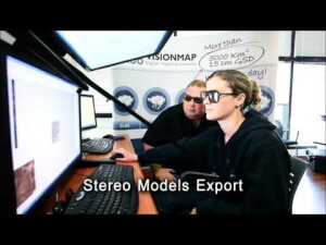
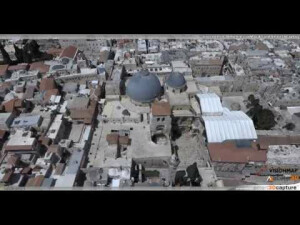
LightSpeed is a revolutionary photogrammetric processing system that automatically processes thousands of sq.km of VisionMap camera imagery per day for various mapping applications. LightSpeed’s end-to-end workflow produces accurate aerial triangulation, dense DSM, orthophoto-mosaic, stereo models, and photogrammetric solved imagery. LightSpeed is the only photogrammetric software that performs bundle adjustment of vertical and oblique images simultaneously, with sub-pixel accuracy. LightSpeed’s ability to provide accurate geospatial products within a short time-frame, without relying on a GPS base station or ground control points (GCPs), makes it ideal for rapid response applications.
Specifications
-
Feature Extraction and Mapping
-
Semi-automatic corner point extraction
N
Semi-automatic line feature extraction
N
Semi-automatic building extraction
N
-
Required Computer System
-
Operating system(s)
Windows 7, 8 or 10 Windows 2012 for the servers
CPU (min.)
8 cores
CPU (preferred)
20-60 cores
Min. data storage capacity [Gb]
10000
Preferred data storage capacity [Gb]
48000
64-bit version of software available
Y
Distributed processing capacity
Y
GPU based calculations
N
-
Images and data
-
Source data
VisionMap camera systems images
Input image formats
JPG2000
Export data formats
JPG2000, jpg, tif
Digital Aerial Nadir Frames
Y
Oblique Images
Y
-
DEMs & Orthoimages
-
Automatic matching
Feature base correlation
Mosaicing of orthoimages
Y
True orthoimage generation
Y
Dense DSM creating capability
Y
DSM to DTM filtering
Y
Automatic seam line creation
Y
Dense Image Matching
Y
-
Viewing System
-
Resolution
1280 x 1024
-
General
-
Year of introduction
2006
Year of last update
2016
Modular
Yes - Aerial triangulation, orthophoto, dense DSM
License configuration
Node-locked
Regional settings available
No
-
Orientation and triangulation
-
Automatic interior
Y
Relative
Y
Automatic aerotriangulation
Y
Automated blunder detection
Y
Self calibration
Y
Automatic Relative
Yes
images simultaneously processed
Y
-
Measurement tools
-
Length
N
Area
N
Volume
N
-
Image manipulation & processing
-
Automatic contrast manipulations
Y
Spatial convolution
Y
Radiometric corrections
Y
Radiometric adjustment for mosaicing
Y
-
More information
-
Main applications
Flight planning, Flight viewer, Data viewer, AT, Orthophoto, DSM, dense DSM
Distinguishable features
Very large areasVertical and oblique image simultaneous adjustment and processingVery high processing productivityFully automatic workflowSub-pixel photogrammetric accuracy

![ELCOVISION-10[1].jpg](https://cdn.geo-matching.com/wRWm7Gyp.jpg?w=300&h=300&crop=1&s=d9595e4eab382ce38f888d623cb550d7)


