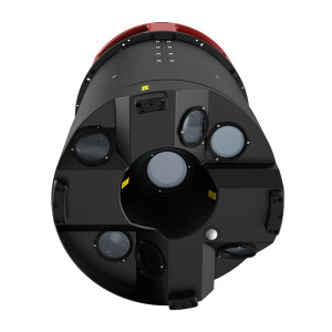
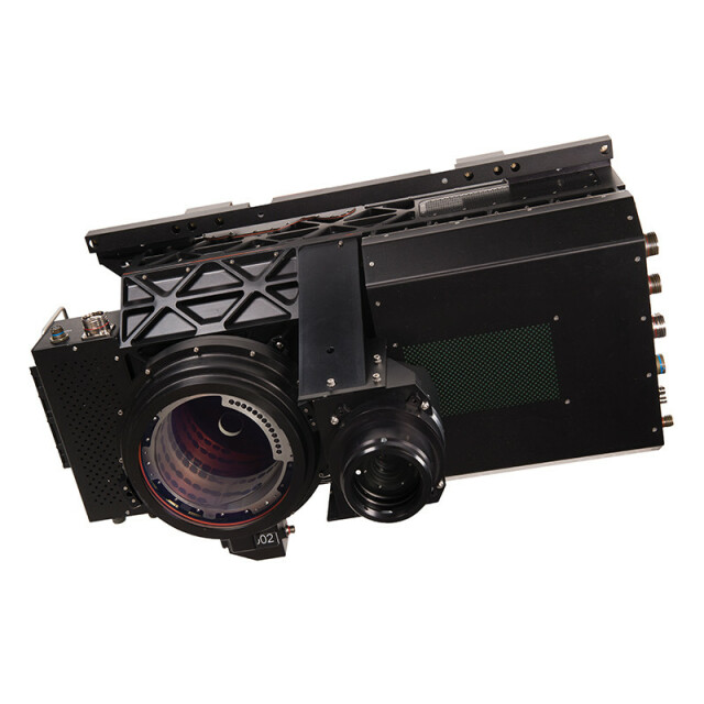
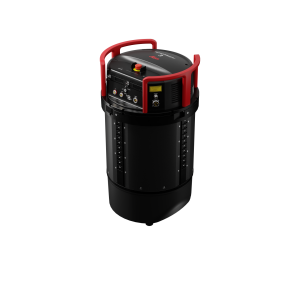
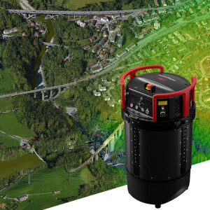
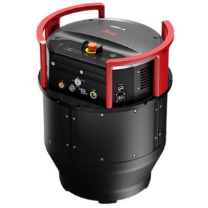
Leica SPL100 Single Photon LiDAR Sensor
Captures LiDAR data over large areas at the lowest cost per data point using 100 outlet beams
The Leica SPL100 is the single photon LiDAR airborne sensor ideal for large area terrain mapping projects. This system, which is accompanied by an 80 MP RGBN camera, captures 6 million measurements per second and delivers reliable results during day or night, leaf-on or leaf-off conditions and in dense vegetation. The SPL100 allows you to create the highest density point clouds by collecting 12 - 30 points per sqm - depending on flying height.

Leica Geosystems Airborne Solutions
Switzerland
Description
Leica SPL100 Single Photon LiDAR Sensor
Single photon LiDAR reaches highest efficiency over large areas
The Leica SPL100 is the single photon LiDAR airborne sensor ideal for large area terrain mapping projects. This system, which is accompanied by an 80 MP RGBN camera, captures 6 million measurements per second and delivers reliable results during day or night, leaf-on or leaf-off conditions and in dense vegetation.
The SPL100 allows you to create the highest density point clouds by collecting 12 - 30 points per sqm - depending on flying height - and penetrate semi-porous obscurations, such as:
- Vegetation
- Ground fog
- Thin clouds.
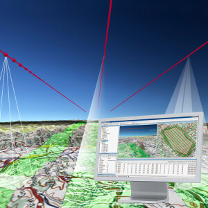
The information collected with the SPL100 single photon LiDAR is specifically useful for applications that require high point density over large areas, such as:
- Country and state-wide mapping
- Disaster risk planning
- Emergency management
- Forest inventory
- Flood mapping
- Control of soil erosion.
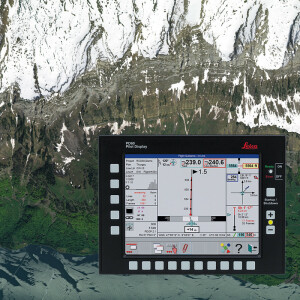
Leica SPL100 single photon LiDAR is part of Leica RealTerrain, the latest airborne reality capture solution by Leica Geosystems, combining innovative sensor technology with the intuitive, high-performance, multisensor, processing workflow HxMap.
Highest efficiency
The single photon LiDAR sensor reaches the highest efficiency for large area mapping and acquires data at the lowest cost per data point. Collecting 6 million points per second using 100 output beams makes the SPL100 10 times more efficient than any conventional LiDAR sensor.
Fastest processing
The SPL100 runs with the high-performance multisensor LiDAR and imaging post-processing workflow HxMap. This software:
- Features the highest data throughput
- Eliminates the limitations of single workstation processing
- Accelerates data delivery
- Reduces training costs.
Combining the SPL100 and HxMap, Leica RealTerrain offers the technical foundation for even the largest LiDAR mapping projects. In an increasingly connected world where interactions occur beyond borders, it is important to base decisions on reliable and inclusive information that is not being looked at in isolation. The success of making informed decisions starts with the provision of readily available terrain and elevation data. Hence, this is the sensor that seamlessly captures and visualises large terrain areas and ecosystems.
Do you have questions about this product?
- Questions about price, availability, and/or retailers
- Questions about technical specifications and usage
- Questions about suitability for your project or application
Specifications
-
General
-
Year of introduction
2016
Year of last update
2016
Total Weight [kg]
Under construction
-
Operation Characteristics
-
Platform
Documents
Brochure
leica-spl100-ds-853389-0918-en-lr.pdf
532.14 KB

