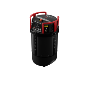
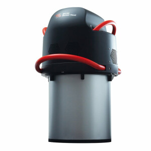
Leica HawkEye-5 Bathymetric LiDAR Sensor
Highest efficiency for deep bathymetric surveys
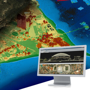
Leica HawkEye-5 is the world’s only stabilised bathymetric LiDAR sensor providing a high-performance solution for detailed data capture in deep waters. The system expands the capabilities of the Leica Chiroptera-5 bathymetric LiDAR sensor, enhancing the productivity of the most diverse application requirements from shore to deep waters.

Leica Geosystems Airborne Solutions
Switzerland
Description
Maximum survey efficiency and data quality
The HawkEye-5 increases survey efficiency by up to 25% compared to previous generations. The system fits the Leica PAV100 gyro-stabilised mount, which isolates the sensor from unwanted aircraft movements, providing consistent data density and more efficient area coverage. Users can reduce the operational costs and the carbon footprint of each mission and complete more projects in a shorter time frame, maximising their revenues and return on investment.
Purpose-built Modules
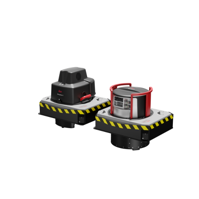
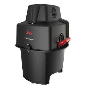
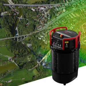
Combined with the Chiroptera-5, the HawkEye-5 features three LiDAR sensors, one 4-band camera and a QC camera. Each module is optimised for a specific task, allowing seamless acquisition of the highest quality data from land to deep ocean seafloor.
Integrated Workflow
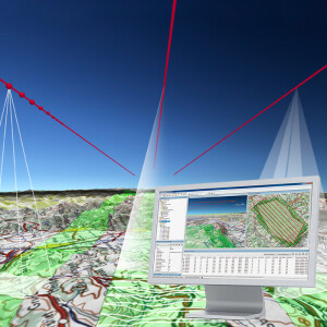
Leica LiDAR Survey Studio enables full waveform analysis, automatic data classification and advanced turbid water enhancement. Manage projects, analyse data, detect water and land interfaces with maximum efficiency and viewpoint cloud data in any standard format.
Versatile Applications
Together with the Chiroptera-5, the HawkEye-5 provides a comprehensive solution to support multiple applications, such as nautical charting, environmental monitoring, and maritime surveillance in coastal and deep waters.
Easy upgrade path
Leica Geosystems' modular design enables the owners of previous HawkEye systems to easily upgrade their sensor capabilities for deep waters bathymetric surveys while leveraging their initial investment.
Do you have questions about this product?
- Questions about price, availability, and/or retailers
- Questions about technical specifications and usage
- Questions about suitability for your project or application
Specifications
-
General
-
Year of introduction
2023
-
Operation Characteristics
-
Platform
-
Application areas
-
Select an application area:
Documents
Brochure
leica-hawkeye-5-data-sheet-0223.pdf
1.22 MB

