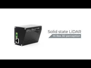
Cube 1
3D LiDAR sensor
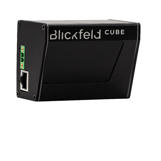
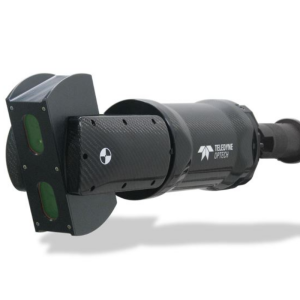
Cube 1 is a versatile 3D-LiDAR sensor that features an adaptable field of view, unique scan patterns, and a long-range while maintaining small dimensions and light weight. The proprietary solid-state technology based on MEMS is maintenance-free and durable. The associated recognition software makes Cube 1 a smart solution for numerous applications.
Blickfeld
Munich, DE
Description
Compact solid-state LiDAR
The Cube 1 is a fully integrated scanning LiDAR sensor in a small form factor. It comes with a point cloud interface and no additional adapter boxes are required for operation. Blickfeld‘s patented MEMS-based LiDAR technology enables a field of view of 70° x 30° and a maximum detection range of 250 meters. The sensor’s field of view, number of scan lines, and frame rate can be flexibly configured via software, enabling a variety of application scenarios.
Specifications
-
Power
-
Power connector
Phoenix Contact 1817615 Compatible power supply connector: Phoenix Contact 1845219, Alternatively Power over Ethernet
Operating voltage (V)
12
Power consumption
Typ. 8.5 W
-
Application
-
Main applications
Smart mobility, Autonomous driving, Robotics, Surveying, Security, Farming
-
General
-
Lidar type
Micro-electromechanical system (MEMS)
Year of initial introduction
2020
Height [m]
0.06
Depth [m]
0.05
Width [m]
0.082
Total Weight [kg]
0,275
Housing Material
The Cube’s housing consists of black anodized aluminum, and the window of the sensor is made of acrylic.
Certifications
IP40, IP67
-
Environment
-
Operating temperature: min. [°C]
-30
Operating temperature: max. [°C]
60
Water sand and dust proof (IP-classification)
IP67
-
Laser and operation
-
Frame rate (FPS)
2.5 - 50 Hz (dependent on configured scan lines and vertical field-of-view).
Laser/light wavelength [nm]
905
Eye-safe operation (Laser class)
1
Minimum detection range [m]
5
Maximum detection range [m]
250
Field of view (horizontal)
70
Field of view (vertical)
30
Scan patterns
Configurable
-
Data output of one point
-
Cartesian coordinate (X,Y,Z)
yes
Azimuth and elevation angle
yes
Intensity
yes
Timestamp
yes
-
Software and data processing
-
Data processing
On-device pre-processing algorithms, perception software stack available
Available point classification algorithms
Perception software stack available
Available sensor fusion solutions
On-Device feature
Other available software
Perception software stack available
-
Interface
-
Ethernet
Ethernet, RJ45


