


Scanfly PRO
The brand new, easy-to-use technology to capture reality!
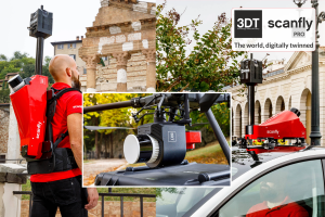
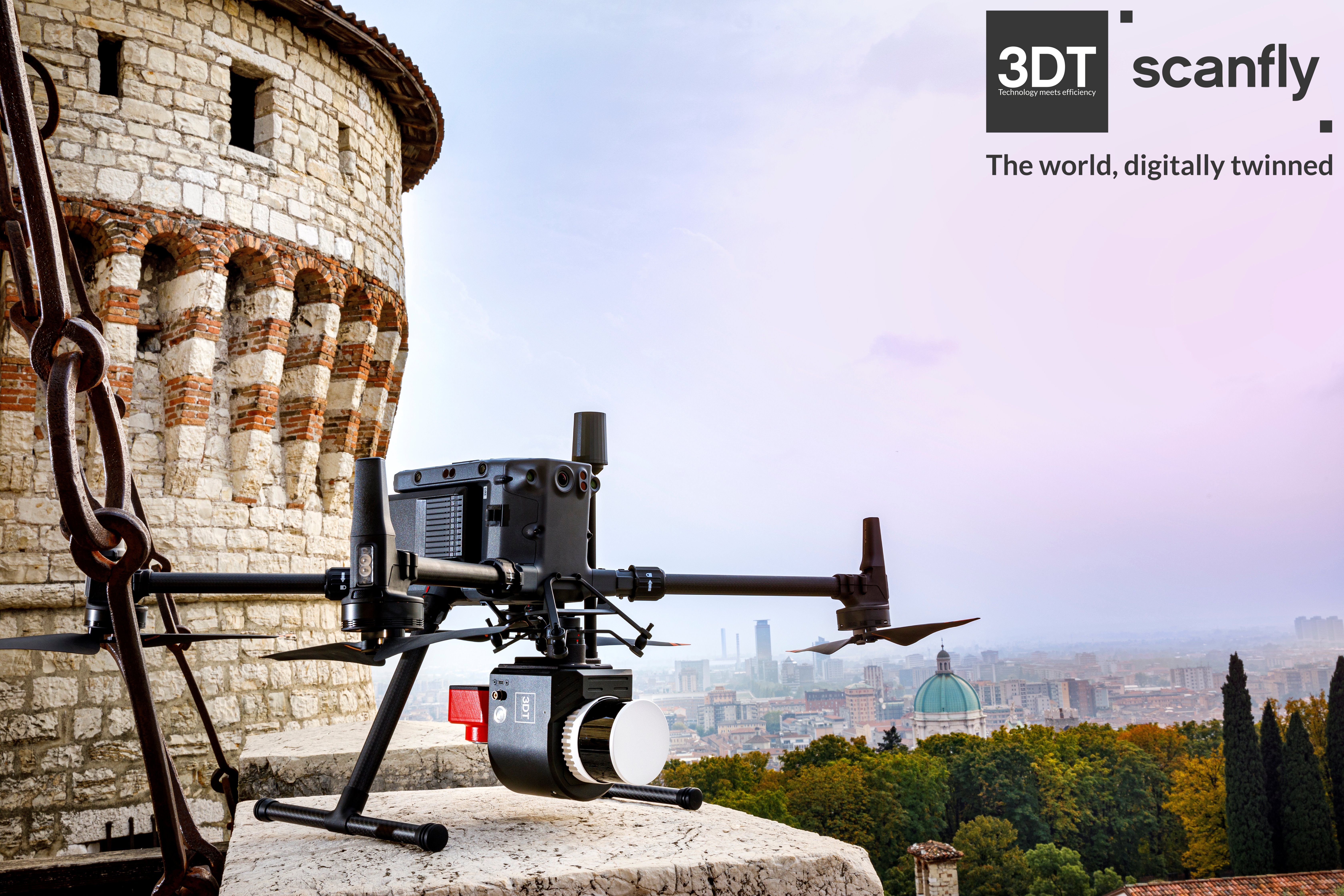
Introducing the Scanfly PRO, the 3DT‘s compact high-performance mapper. Engineered for excellence, this multi-platform LiDAR solution performs with no compromises even in the most challenging GNSS conditions, from tunnels to dense urban canyons. When unprecedented accuracy meets the unmatched versatility. Redefine mapping: anytime, anywhere with Scanfly PRO!

3D TARGET
Castenedolo, IT
Description
Scanfly | The world digitally twinned
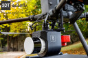
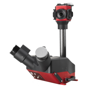
Triple return and up to 300 m range in the most accurate Scanfly evolution. Powered by the brand new Hesai PandarXT-32M2X
The Scanfly advantages:
- Accurate Applanix INS AP+ 20 (IMU/GNSS)
- Multi-platform, tool-less mounting accessorie, cable free design
- 24-62 MP Sony cameras, 60.5 MP NCTech iStar Pulsar panoramic camera
- Ground control points, strip alignment tool and SLAM enabled
- CE Marking Ingress, Protection IP55
Lidar integration
- Multirotor drone
- Backpack mount
- Car mount
Key features
- High resolution
- Calibrated reflectivity
- Triple return
SmartProcessing Lidar Software
Your point clouds, at their best!
- Intuitive Graphical User Interface
- Efficient direct geo-referencing engine
- Point clouds exported with intensity and RGB data
- 2D maps, 3D preview and quality diagrams
- Full support to geographic reference systems
- Ground control points and strip alignment tool
- SLAM tool to increase accuracy in bad GNSS conditions
- Blurring tool for faces and license plates
Do you have questions about this product?
- Questions about price, availability, and/or retailers
- Questions about technical specifications and usage
- Questions about suitability for your project or application
Specifications
-
Power
-
Power connector
56-pin Multi I/O Interface
Internal power supply (battery)
YES
Operating voltage (V)
24
Power consumption
30W (typical)
-
Application
-
Main users
THE MULTI-PLATFORM MAPPER
Main applications
Smart mobility, Surveying
-
General
-
Certifications
IP55 / CE
Depth [m]
1.42
Height [m]
1.33
Housing Material
Aluminium
Total Weight [kg]
1.4
Width [m]
1.80
Year of initial introduction
0
Lidar type
Mechanical rotation
-
Environment
-
Operating temperature: min. [°C]
-10
Operating temperature: max. [°C]
40
Water sand and dust proof (IP-classification)
IP55 / CE
-
Laser and operation
-
Points per second
1920000
Laser/light wavelength [nm]
905
Range resolution [mm]
10
-
Software and data processing
-
Data processing
SCANFLY SmartProcessing Lidar
Available SLAM algorithms
YES
Available point classification algorithms
YES
Available sensor fusion solutions
YES
Other available software
SCANFLY WebApp, SCANFLY SmartSurvey
-
Interface
-
Other data connectors
Embedded WiFi
Documents
Brochure
scanfly-pro
Videos


