
Agisoft Metashape
aka Agisoft PhotoScan
Stand-alone software product that performs photogrammetric processing of digital images and generates 3D spatial data to be used in GIS applications, cultural heritage documentation, and visual effects production as well as for indirect measurements of objects of various scales.
Description
Agisoft Metashape software allows to process images from RGB or multispectral cameras, including multi-camera systems, into the high-value spatial information in the form of dense point clouds, textured polygonal models, georeferenced true orthomosaics and DSMs/DTMs. Further post-processing enables to eliminate shadows and texture artifacts from the models, calculate vegetation indices and extract information for farming equipment action maps, automatically classify dense point clouds, etc.
Agisoft Metashape features satellite imagery processing in addition to central perspective cameras such as frame, fisheye, spherical and cylindrical ones. Panchromatic and multispectral satellite images are supported,provided that sufficiently accurate RPC data is available for each image. Laser scanning data can also be loaded into Metashape software and merged with photogrammetric point cloud; furthermore, LIDAR points can be colorized with the help of the imagery available for the same scene. In case project deals with archival data, Metashape is capable of scanned film images processing with support for automatic fiducial marks detection. If source data is video sequence, adaptive frame selection based on camera motion speed is particularly beneficial.
Mesh generation is possible directly from depth maps data — this allows to reconstruct exceptionally detailed geometry thanks to utilization of all the information available. The method is adaptive concerning resolution of the input imagery and, thus, guarantees efficient usage of the hardware resources while generating the most detailed model possible for the dataset.
Out-of-core implementation greatly reduces memory consumption, while GPU acceleration support for both mesh and texture generation steps significantly speeds up the processing. Distributed mesh generation over network allows for further cut of processing time.
Agisoft Metashape is cross-platform and runs on Windows, Mac OS X and Linux
Specifications
-
Feature Extraction and Mapping
-
Integration with point clouds
Y
Automatic texturing
Y
-
Required Computer System
-
System includes hardware
N
Operating system(s)
Windows (XP and higher) / Linux / Mac OS (10.6+)
CPU (min.)
4 - 8 core Intel or AMD processor, 2.0+ GHz
CPU (preferred)
6 - 24 core Intel or AMD processor, 3.0+ GHz
Min. RAM memory [Mb]
4096
Preferred RAM memory [Mb]
65536
64-bit version of software available
Y
Distributed processing capacity
Y
GPU based calculations
Y
Min. graphic card
Nvidia GeForce GTX 980 or GeForce GTX 1080 (optional)
Hardware handling of big data sets
GeForce RTX 2080 Ti or Radeon VII (or better)
Min. data storage capacity [Gb]
1
Preferred data storage capacity [Gb]
50
Supported special hardware
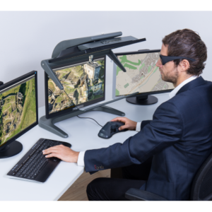
NVIDIA Quadro Stereo
User definable operations and extensions
Built-in Python API, Command-line, Java API
-
Images and data
-
Scanned analogue Aerial Photos
Y
Digital Aerial Nadir Frames
Y
Oblique Images
Y
Optical Satellite Images
Y
UAS Images
Y
Source data
Any digital camera (including Compact, DSLR, Multispectral, Tetracam, MicaSense) and any lens (including Fisheye). Spherical and cylindrical panoramas in equirectangular representation. Satellite imagery. Scanned analog images. Terrestrial Laser Scanner Data.
Input image formats
JPG / TIFF / OpenEXR / DNG/ PNG / BMP / SEQ / MPO, RGB / Single-channel / Multi-channel
Export data formats
Mesh model (TIN): Wavefront OBJ, 3DS models, COLLADA, Stanford PLY, STL models, Autodesk DXF, Autodesk FBX, Universal 3D models, VRML models, Adobe 3D PDF;Point cloud: Wavefront OBJ, Stanford PLY, XYZ Point Cloud, ASPRS LAS, LAZ, Autodesk DXF, ASTM E57, ASCII PTS, Universal 3D, potree (zip), Agisoft OC3, Topcon CL3, Adobe 3D PDFOrthomosaic: GeoTIFF, JPG, PNG, Google Earth KML/KMZ, Google Map Tiles, MBTiles, World Wind Tiles;Digital elevation model (DSM/DTM): GeoTIFF elevation, Arc/Info ASCII Grid, Band interleaved file format, XYZ, Sputnik KMZ;Tiled models: Agisoft Tiled Model (TLS), PhotoMesh Layer (zip), Agisoft Tile Archive (zip);Interior and exterior camera orientation parameters: Agisoft XML, Bundler, CHAN files, Boujou, Realviz RZML, Omega Phi Kappa, PATB Exterior Orientation, BINGO Exterior Orientation, AeroSys Exterior Orientation, INPHO Project File;for more see Appendix B in Agisoft PhotoScan User Manual.
Radar Images
N
-
DEMs & Orthoimages
-
Automatic matching
Dense image matching
Automatic breakline extraction
N
Checking facilities (DEM editing)
N
Automatic contour generation
Y
Mosaicing of orthoimages
Y
True orthoimage generation
Y
Dense DSM creating capability
Y
DSM to DTM filtering
Y
Automatic seam line creation
Y
Dense Image Matching
Y
-
Viewing System
-
Pref. display memory [Mb]
2048
Min. display memory [Mb]
1024
-
General
-
Year of introduction
2010
Year of last update
2022
License configuration
Node-locked/Floating, Free 30-day trial
Modular
Photogrammetry processing software product offered in two editions: Agisoft Metashape Standard and Agisoft Metashape Professional
Regional settings available
Yes
-
Orientation and triangulation
-
Self calibration
Y
Automatic interior
Y
Relative
Y
Automatic aerotriangulation
Y
Automated blunder detection
Y
images simultaneously processed
Y
-
Measurement tools
-
Length
Y
Area
Y
Volume
Y
-
More information
-
Main applications
Quarrying / Mining, Topography, Land Surveying, Cadastre, Construction, Urban Planning / Management; Precision Agriculture; Archaeology, Underwater Archaeology, Cultural Heritage, Architecture; Visual Effects, Game Design
Distinguishable features
Fully automatic workflow, Any OS, Any camera, Multi-core CPU / GPU, Aerial / Oblique / Close-range (terrestrial) imagery support; Built-in Python API, Distributed network processing support; Automatic dense point cloud classification, Orthomosaic seamline editing, Vegetation indices calculation and false color visualization
![ELCOVISION-10[1].jpg](https://cdn.geo-matching.com/wRWm7Gyp.jpg?w=300&h=300&crop=1&s=d9595e4eab382ce38f888d623cb550d7)
