
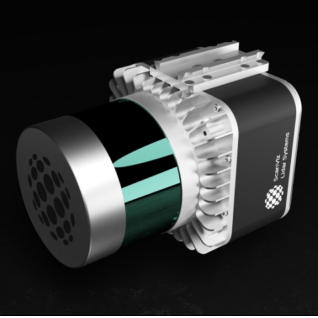
ScanViz Lidar Systems
SV-32.200
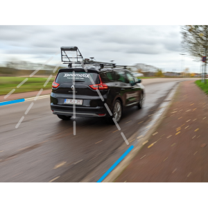
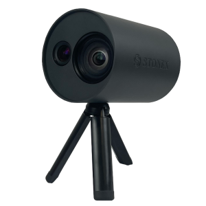
Meet ScanViz SV-32.200, a compact, lightweight, mobile mapping system. SV-32.200 - the latest mapping system for mobile devices, allowing you to capture the world in 3D from your point of view - WALK | DRIVE | FLY With versatile mounting options.
ScanViz Lidar Systems
Kaliningrad, RU
Description
Specifications
-
General
-
Year of initial introduction
2018
Year of last update
2019
Application
Outdoor
-
Positioning
-
GNSS receiver: Brand and model
Novatel OEM7720
Number of antennas
2
Update rate of GNSS receiver
20
IMU: Brand and model
IMU-3030(3050)
IMU update rate [kHz]
200
Wheel sensor: Brand and model
Optional
Number of wheel sensors
1
Ground control point integration supported
Y
-
Lidar Sensor
-
Range precision (1 σ)
1
Brand
Velodyne VLP-32C
Number of laser scanners
1
Wavelength [nm]
900
Laser safety classification
A
Min. Range [m]
1
Max Range [m]
200
Beam diameter at exit [mm]
0.01
Beam divergence [mrad]
2
Spot at 50m distance [mm]
0.1
Max. vertical field of view [deg]
2
Max. measurement rate [kHz]
1.2
Scans per second
700
Export formats
LAS
Measurements per laser pulse
1
Absolute accuracy (1 σ):
1
-
Operation
-
Max. speed [km/hr]
100
Operating time [hr]
10
Built-in Stabilisation
Y
Training provided
Y
-
Camera System
-
Brand and model
Sony QX-1
Number of cameras
1
Maximum frames/sec. per camera
4
Export formats
Raw
-
Dimensions & Environment
-
Size with case
116*124*185
Weight [kg]
1.8
Min. Operation temp. [°C]
-10
Max. Operation temp. [°C]
40
Max. humidity [%]
98
-
Included Processing Software
-
Photogrammetry Software
Pix4D
Laser Point Clouds Software
ScanViz ScanCore
Project Management Software
ScanViz Scada
Other Software
Inertion Exploirer
Recommended software (If no software included)
Vision Lidar
-
Control Unit
-
Computer
Computer
Processor
Atom
Size hard disk [GB]
500
WiFi
Y

